Ocean Solutions, Earth Solutions, Second Edition
Edited by Dawn J. Wright
The ocean covers more than 70 percent of the earth’s surface. What happens in our oceans affects land and vice versa. In the second edition of Ocean Solutions, Earth Solutions, more than 90 ocean and coastal science researchers express their insights by exploring the components of our oceans, as well as their relationships, patterns, and trends over time and space. The new edition includes the book’s original 16 chapters (four of which have been updated) plus seven new chapters that feature GIS best practices and additional online resources. Edited by oceanographer and Esri chief scientist Dawn J. Wright, Ocean Solutions, Earth Solutions, Second Edition, includes a new afterword by Jerry R. Schubel, president and CEO of the Aquarium of the Pacific. June 2016, 500 pp. Paperback ISBN: 9781589484603 and e-book ISBN: 9781589484658.

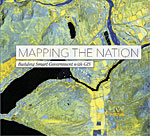
Mapping the Nation: Building Smart Government with GIS
By Esri
Mapping the Nation: Building Smart Government with GIS is a collection of maps that illustrates the many ways federal government agencies use GIS to build stronger, more resilient nations and help make the world a better place. Pulled from a broad range of departments, the maps included in the book demonstrate how GIS can be used to evaluate, plan, and respond to social, economic, and environmental concerns at the local, regional, national, and global levels. Examples on topics such as safe nations, public policy, health, and climate resiliency show how government agencies use GIS to facilitate initiatives, improve transparency, and deliver strong business models. February 2016, 154 pp. Paperback ISBN: 9781589484528.
