Abstract Machine: Humanities GIS
By Charles B. Travis
In Abstract Machine, author Charles Travis uses GIS technology to interpret, analyze, and visualize literary, historical, and philosophical texts. Travis’s study shows how mapping language patterns, fictional landscapes, geographic spaces, and philosophical concepts helps support critical analysis. Travis bases his interpretive model on the ancient Greek and Roman practice of geographia and applies it to works by authors including Samuel Beckett, Patrick Kavanagh, Flann O’Brien, and James Joyce. Travis illustrates how scholars in the humanities can experiment with GIS to create visualizations that support and illustrate their critical analysis of humanities texts and survey, navigate, and imagine various story paths through space and time. Esri Press, February 2015, 180 pp., paperback, ISBN: 9781589483682 and e-book ISBN: 9781589483989

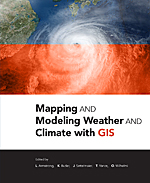
Mapping and Modeling Weather and Climate with GIS
Edited by Lori Armstrong, Kevin Butler, Jack Settelmaier, Tiffany. Vance, and Olga Wilhelmi
Mapping and Modeling Weather and Climate with GIS is a contributed volume from leading climatologists, meteorologists, and other experts about how geospatial cartography and analysis helps to advance atmospheric science research. Topics include data and software resources, data representation, observations, modeling, data model integration, web services, and the areas of current and potential cross-fertilization of atmospheric and geospatial sciences. Mapping and Modeling Weather and Climate with GIS includes concepts and practices of mapping and modeling projects, discussion of advances in GIS for atmospheric sciences, and lists of geospatial resources. Esri Press, February 2015, 370 pp., paperback, ISBN: 9781589483767 and e-book ISBN: 9781589484054

Building European Spatial Data Infrastructures
By Ian Masser and Joep Crompvoets
Building European Spatial Data Infrastructures, Third Edition, explores the efforts of the European Union (EU) to create a framework for a multinational infrastructure for spatial information in the European community. This framework will enable the EU to exploit the myriad opportunities created by modern GIS technologies. This edition presents an overview of the innovative activities being performed by both the public and private sectors to comply with the INSPIRE Directive and explains the rationale and the processes involved in spatial data infrastructure (SDI) development and implementation. Designed as a reference for GIS professionals and decision makers, the chapters promote a general understanding of SDI concepts and provide examples of practical applications. Esri Press, February 2015, 100 pp. paperback ISBN: 9781589483835 and e-book ISBN: 9781589484061

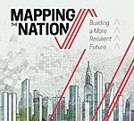
Mapping the Nation: Building a More Resilient Future
By Esri
Mapping the Nation: Building a More Resilient Future is a collection of GIS maps illustrating the many ways that federal government agencies rely on GIS analysis to build stronger, more resilient communities and help make the world a better place. Pulled from a broad range of departments, maps included in the book demonstrate how the technology can be used to evaluate, plan, and respond to social, economic, and environmental concerns at local, regional, national, and global levels. The topics covered, such as green government, economic recovery and sustainability, and climate protection, show how government agencies use GIS to facilitate initiatives, improve transparency, and deliver strong business models. Esri Press, February 2015, 108 pp., paperback, ISBN: 9781589483910
