
Educators Can Bring Geography to Life Right from Their Classrooms

From elementary schools through universities, students and educators alike are finding ArcGIS Earth to be a valuable and fun learning resource. Without leaving the classroom, they can zoom to anywhere in the world.
Students can look at different types of map data, sketch drawings or notes, and measure distances in an interactive, globe-based experience. Grade school teachers use ArcGIS Earth to display 2D and 3D map information and help their classes learn about and explore geospatial content and geography. At the university level, professors use ArcGIS Earth to introduce students to GIS visualization capabilities and spatial analysis. ArcGIS Earth is also a free gateway to the wealth of content in ArcGIS Online—basemaps, high-resolution imagery, and demographic data, plus curated maps and layers in the Living Atlas of the World that cover hundreds of topics.
Geography for Curious Kids
At Victoria Groves Elementary School in Rancho Cucamonga, California, Hollie Duran recently introduced her fifth-grade class to ArcGIS Earth.
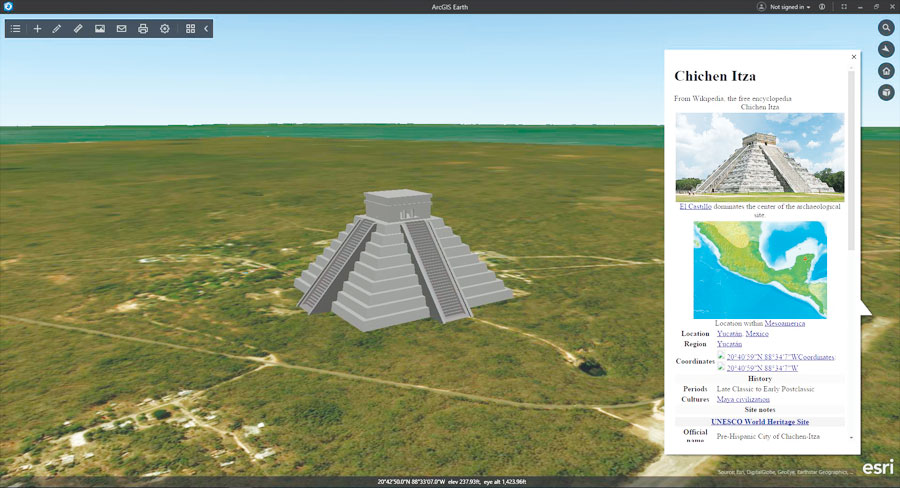
“The classroom applications for ArcGIS Earth are limitless,” said Duran. “It piques their interest in geography in a way that textbooks simply can’t. The students were thrilled to see global landmarks, such as the Sphinx and even Disney World, and excited to see 3D representations of mountain ranges and deserts.”
One of the key social studies standards for Duran’s class is to gain an understanding of US states and major landform regions. Using ArcGIS Earth, her students were able to zoom in and explore each state and region, rather than simply reading about them or pointing to them on a printed map. Students also learned how to search and add information from the Living Atlas of the World to ArcGIS Earth.
“We used ArcGIS Earth to travel around the world and had some fun with virtual reality,” said Sebrina Pustam, a student at Victoria Groves. “We learned that geography is also a science and great for kids like us who are curious and want to learn more about the world we live in. We can use ArcGIS Earth at home and in our class for our research and projects.”
Teaching Students from All Majors
Joseph Hupy, an associate professor in the Geography and Anthropology Department at the University of Wisconsin in Eau Claire also uses ArcGIS Earth in his classrooms.
“I like to tie ArcGIS Earth into applied examples in the business world,” said Hupy, who shows students how to use ArcGIS for drone mission planning. “What I like about ArcGIS Earth is that you can bring in tiled orthomosaics, KMLs such as a mission plan, and you can change your basemaps.”
As an example, Hupy introduced his students to a recent drone mission in Honduras that aimed to capture high-resolution imagery of a production gold mine. Geologists needed the aerial imagery to determine the best places to expand the mine. Drones made an ideal solution for working in rugged terrain to help the team create a digital surface model and digital elevation model.
“This project allowed students to see the true capabilities of GIS to engage in proper mission planning,” Hupy said. “I have students coming from all majors, not just geography, so I like using ArcGIS Earth because it’s not intimidating. It’s a way for students to view a lot of content and types of geospatial data.”
Working with ArcGIS Earth helps university students learn the fundamental concepts of map navigation and interaction, which enables them to move toward higher-level geospatial techniques such as setting up buffers or queries in ArcGIS Online, creating story maps, or editing and managing GIS content with ArcGIS Pro.
In recent releases, ArcGIS Earth gained the ability to create and exchange data using KML files. Students can now share KML files as email attachments with anyone, even those without access to ArcGIS technology. Sharing data and map images is a critical element of capturing research, saving work, and communicating with peers and professors.
“Perusing the students’ assignments, I can tell they like ArcGIS Earth for the hands-on component and interaction with the data,” Hupy said. “And ArcGIS Earth is free, so they can install it on their laptops.”
Accessing Learning Resources
ArcGIS Earth, which works with Windows 7 and above, is available to download for free. Additionally, Esri provides instructional activities similar to what Duran and Hupy have put together. For K–12 instruction, every public, private, home school, and youth-serving club can request an ArcGIS for Schools Bundle for free. And students and teachers of higher education can access more advanced ArcGIS learning resources.