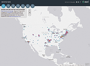
In 2013, President Obama launched the ConnectED Initiative to boost access to digital resources. He asked private industry to provide more devices, connectivity, learning resources, and teacher support for schools. On May 27, 2014, Esri made a billion dollar offer: Any K–12 school in the United States could acquire an ArcGIS Online organizational account for instructional purposes for free.
During the first year, more than a thousand ArcGIS Online accounts have been provisioned for K–12 schools. Where accounts have been implemented, much has happened. Educators are using apps, external groups are sharing content, leaders are crafting maps and scenes, and students are constructing data, designing presentations and story maps, and building knowledge and skills on all types of devices.
Uses range from quick demos for a single student to hour-long activities for multiple class sections to projects that last weeks and generate national attention. Here are just a few examples of the kinds of learning opportunities that access to Esri software has enabled.
- Seventh grade students of science teacher Erika Klose, at Winfield Middle School in West Virginia, tackled lessons from LearnGIS, an online course designed for adults. “We did [the volcano lessons] all on our Chromebooks and were very successful. This provided a great background for our next activities. They had fun!”
- A 12th grade student in Marcel Duhaime’s math modeling class at Bow High School in New Hampshire performed drive time analysis to demonstrate levels of coverage provided by current fire station locations.
- Students in Matthew Cowan’s ninth grade English class at Yucaipa High School, in California, are working on story maps that locate events in John Steinbeck’s novels.
Teachers find that students love working with maps. Some students are really quiet when they’re engaged, while others generate a buzz of excitement as they share what they find or help each other. The magic is engagement, intensity, and duration.
“I have found teaching with ArcGIS Online helps me differentiate my lessons and helps all my students learn,” said Dave Casey of Buffalo Central Middle School in Minnesota. “Students who have struggled in the regular classroom seem to grasp the lesson well using ArcGIS.”
Because it’s web based, students can use ArcGIS Online on computers, laptops, tablets, and smartphones of all shapes and sizes that run a variety of operating systems. Sometimes students all have the same type of device. Other times it’s a medley of student- and school-provided devices. Either way, it’s usually not a problem. A student can work on ArcGIS Online and move seamlessly from an Android phone to iPad to Chromebook to the teacher’s Mac or Windows laptop within a single class period.
This flexibility delights some teachers but can be a little trying for others. Many are hesitant to try resources if they cannot define precise bounds, strategies, and content areas. Vigorous learning by students may happen when students dive in neck deep, but not all teachers are comfortable with this.
To help educators get comfortable with this inquiry-based approach, Esri is constructing GeoInquiries. These are short, targeted activities that let educators dip a toe into ArcGIS Online. GeoInquiries cover core content in certain curricular areas and help teachers discover the power of interactive maps. The topic for the first GeoInquiries is earth science. The next topic will be US history, followed by advanced placement human geography.
Esri is also supporting the uptake of ArcGIS Online by sponsoring a set of workshops held by knowledgeable educators across the country. In June 2015, Esri hosted its seventh annual Teachers Teaching Teachers GIS (T3G) Institute to help another hundred education leaders expand their existing skills for sharing with their peers the power of ArcGIS Online as an educational tool.
GIS users can help teachers and students take advantage of the ConnectED program and access to ArcGIS Online by finding an interested teacher, librarian, or tech person at a local school and sharing the resources at connected.esri.com. They can also sign up to be a GeoMentor.