Become a user and a contributor
The Living Atlas of the World, available through ArcGIS Online, provides easy access to one of the largest, highest-quality collections of ready-to-use geographic information that has ever been assembled. This collection is available from any device, anywhere, at any time and is constantly growing and changing as maps, apps, and layers are added or updated by Esri and the ArcGIS user community. One of the primary goals of the Living Atlas is to make the best information easy to discover and use.
Over the past few years, Esri has been expanding the types of content that it makes available through the Living Atlas. Maps cover a wide range of topics related to people (human systems), the earth (physical systems), and life (natural systems). Human systems content includes demographic and lifestyle maps for the United States, Canada, and more than 120 other countries. A wide assortment of Esri Story Map apps, categorized by topic, can be accessed from the Living Atlas. Layer content includes multispectral imagery, elevation layers, and ecological land units.
What began as a way to build the best, freely available online basemaps is now a resource that extends far beyond basemap layers to encompass imagery, elevation, hydrology, 3D, and other content that can support a wide range of mapping and analysis activities.
The value of the Living Atlas has not only been recognized by the many users who have integrated Living Atlas content into their maps and apps but also by the larger mapping community. In late 2014, the International Map Industry Association (IMIA) honored the Living Atlas of the World with Best Digital Map Product, Best Overall, and the Global Award.
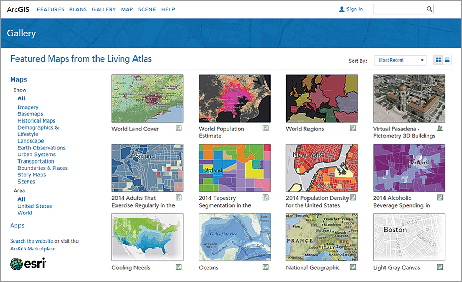
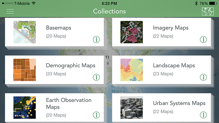
Exploring Content
Explore the Living Atlas by directly accessing its content through the ArcGIS Online Gallery featured content section. View the comprehensive set of maps, apps, and tools on a variety of themes available on ArcGIS Online or by using the Living Atlas of the World web app, available from ArcGIS.com.
Joining the Living Atlas Community
Content for the Living Atlas is constantly being improved through the efforts of contributors and curators. Members of the ArcGIS community can contribute to the Living Atlas directly by publishing content through ArcGIS Online or indirectly by participating in the Community Maps Program.
Initially, Esri provided ArcGIS Online users with a small set of basemaps and some foundational services such as geocoding and routing. This ready-to-use content was provided so users could easily publish and share maps and apps.
Subsequently, many ArcGIS users offered to share their geographic data with Esri to enhance the coverage and overall quality of the available content. This led to the Community Maps Program, which has significantly improved the quality and coverage of the Living Atlas over the last four years. Several hundred organizations have been sharing their authoritative content and making it accessible to the entire GIS community. By the end of 2014, more than 134 million features had been added through Community Maps contributions. [To learn more about contributing content to the Community Maps program, see ” Contributing to Community Maps Made Easy” in this issue.] In addition, many ArcGIS users began publicly sharing maps and layers created in ArcGIS Online for use by others, substantially expanding content for the Living Atlas.
Content submitted to the Living Atlas is reviewed by curators. These curators, who are Esri staff and other GIS professionals from around the world, review content to ensure that it is useful, reliable, and adds value. Each theme in the Living Atlas has its own curator. Content that meets the acceptance criteria is included in the Living Atlas and featured in ArcGIS Online for other users to discover and access.
Scoring Items
The new Living Atlas Contributor app allows Esri customers, partners, and staff to nominate their ArcGIS Online items (apps, maps, layers, and scenes) for the Living Atlas of the World and streamlines the review process.
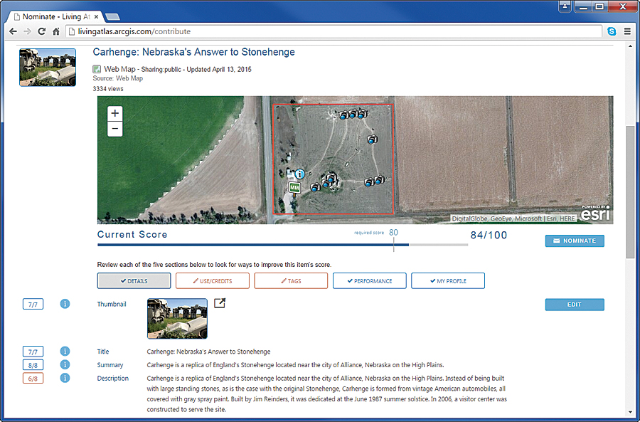
Each item being evaluated for nomination is given a score based on the presence of key elements, such as the summary, description, and custom thumbnail, and characteristics such as drawing performance, cartography, and other characteristics. An item must have a minimum score before it can be nominated for the Living Atlas. Scoring before nominating eliminates numerous emails and phone calls between the item’s owner and the Living Atlas curator.
Even if content is not going to be nominated for the Living Atlas, scoring can be a valuable tool for evaluating and improving content before sharing. Anyone can use the Contributor app to score content from a best practices perspective.
Once nominated, Living Atlas curators see the item, review it, and share comments with the item owner. Often these comments identify missing requirements or make pragmatic suggestions. After the contributor and curator agree the item is complete, it is accepted for immediate inclusion in the Living Atlas.
Take Advantage of These Resources
Improve the information products your organization produces with the Living Atlas. Using this resource will help you more quickly create apps; improve analyses and gain insights by using current, authoritative data; and enhance story maps and presentations. Start exploring it on ArcGIS Online.