The December 2017 update to ArcGIS Online includes many user experience and administration enhancements in addition to the release of the ArcGIS Online version of Insights for ArcGIS (see the accompanying article “New Version of Insights for ArcGIS Available for ArcGIS Online”) and updates to many apps.
As an ArcGIS Online user, you have more options for discovering and managing content. If you are an administrator, you have more granular control over members and content and can perform administrative tasks more quickly.
New features help you get to what you need quickly. You can specify the start page—the page you first see when you sign in to your account. Go to your Profile page and choose from the drop-down under Start page and click Save. The page you pick will now appear when you log in.
Manage Content
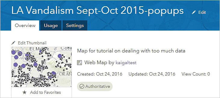
Administrators and content curators can mark items as authoritative or deprecated. This helps members of your organization manage content more intelligently by in identifying authoritative items and discouraging the use of items that are becoming out of date. Item status is indicated by a badge on the item page.
The Status filter can be used, in addition to the other filters, when searching or browsing for content. Searches can be restricted to authoritative layers when authoring maps using the Map Viewer. The authoritative status of items is currently only visible within your organization, while the deprecated status of an item is visible inside and outside your organization.
The new Item information status bar and interactive checklist on an item’s Overview page helps item owners and administrators improve item information by suggesting improvements so the item will be easier to find, understand, and use by others. It moves through the elements of the item page (summary, thumbnail, description, title, tags, and terms of use). As you complete item details, the status bar updates and offers suggestions for improvement.
You can also update the URL of layers in your map from HTTP to HTTPS or from staging versions of your ArcGIS service layers to production versions using the Settings tab for the map item. ArcGIS Online inspects each layer in the map. If any layers use HTTP, ArcGIS Online attempts to make a request to the same layer using HTTPS and then updates the map and any associated layer items you own or administer. If a layer does not support HTTPS, you are notified, and the layer URL is not updated.
Mapping and Visualization
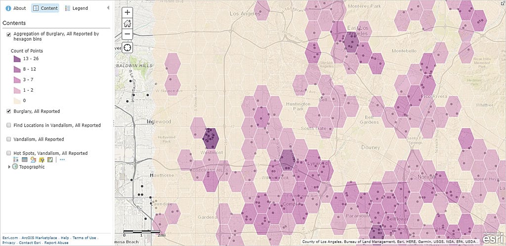
The Map Viewer, the built-in app for viewing, authoring, and editing maps and performing analysis, has an additional analysis tool—Find Centroids—and new capabilities for the Aggregate Points and Summarize Within tools. Use Find Centroids to find the geometric center of multipoint, line, or area features. You can use the Aggregate Points and a custom square or hexagon bins instead of summarizing data within an input area layer.
You can use geometric operations in Arcade expressions defined for smart mapping styles, labeling, and pop-ups. Use advanced functions to normalize by area, test spatial relationships, compute distances between defined areas, and more.
Add GeoJSON files to your map. GeoJSON is a widely used open standard format for encoding a variety of geographic data structures in JavaScript Object Notation (JSON) format.
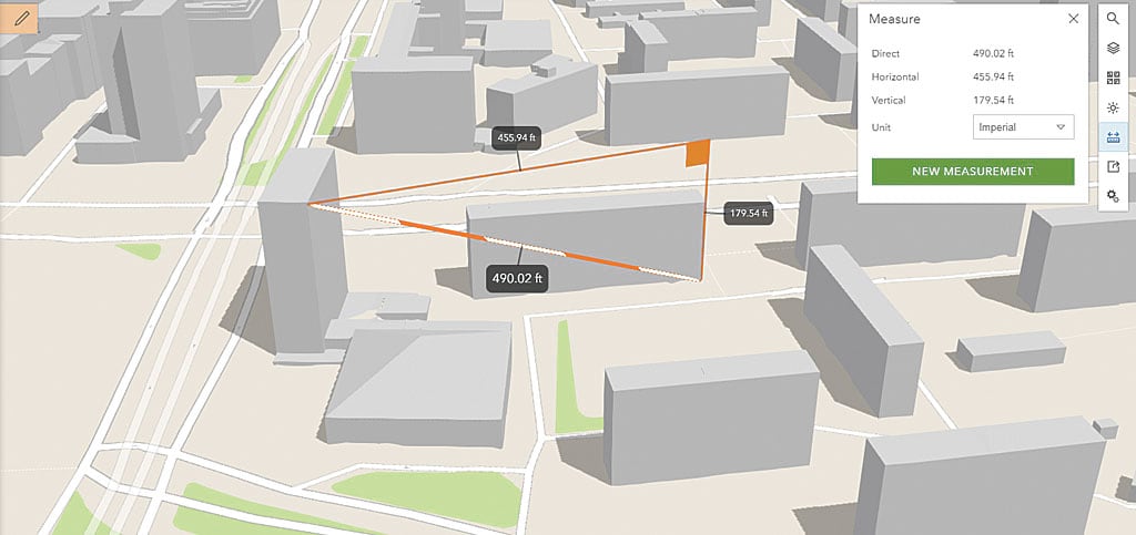
Scene Viewer has new capabilities and improved performance. You can measure distances in 3D between two points in Scene Viewer. Choose different measuring units and leverage interactive laser lines to calculate the direct and vertical distances in scenes. Buildings and integrated mesh scene layers load faster using the correct priority order. When zooming to scene layers, data is temporarily cached so layers redraw much faster. Use 3D symbols from ArcGIS Pro in scenes by using style files published from ArcGIS Pro. Administrators can also configure custom web styles for Scene Viewer.
Administration
Administrators can now make web apps available to organization members by adding apps to the app launcher. The app launcher appears in the upper right next to Search on all pages except Map and Scene once you are signed in. Members can personalize their view of the app launcher by dragging and dropping apps to change their display order. Administrators can prevent all ArcGIS Pro licenses in the organization from being taken offline.
The ability to link to enterprise groups can be granted by administrators to custom roles. To add this to existing custom roles, edit the role, add this new privilege, and save the role. Organizations can now create groups whose membership is controlled by Security Assertion Markup Language (SAML)-based enterprise groups.
Members with Level 1 accounts can now join external groups if assigned to a custom role granting this privilege. Members who can update member account information, as well as administrators, can also reset passwords for other members.
Inviting members to ArcGIS Online is easier. Administrators can enable Esri access when inviting and adding members, so a member whose account has Esri access enabled can use My Esri and the GeoNet community and forums, access e-Learning on the Training website, and manage email communications from Esri.
Data Management for Hosted Feature Layers
Publish hosted feature layers using CSV and Microsoft Excel files stored in Microsoft OneDrive and Dropbox. If you update the data in the file on the cloud drive, you can overwrite the data in the hosted feature layer using the updated cloud data. Google Drive, including Google Sheets, will be supported soon.
Administrators and owners can now append data to layers in existing hosted feature layers without needing to overwrite the entire hosted feature layer. You can now define an area of interest for hosted feature layer views to limit access to features within a particular area.
New editing options for hosted feature layers and hosted feature layer views provide more fine-grained control over what operations editors can perform.
For additional information, see the “What’s New” topic in ArcGIS Online Help.