
The history of County Donegal, like much of Ireland, is inextricably wedded to the geography of migration. Now county officials are using geography in the form of an Esri Story Maps app called Ireland’s Call—To Return Its Global Diaspora Home to try and woo émigrés back to the Emerald Isle.
Ireland's Call - to return its global diaspora home
This story map was created as a means of communicating with Irish citizens, who while living elsewhere, might consider returning home to start a business or work for a company.
At certain times over the last 150 years, the pursuit of a better life and even survival drove millions of Irish from their homeland. More than 1.5 million Irish left during the Great Famine of 1845–1850, when the potato crop failed. Emigrants from western parts of County Donegal would cross a small stone bridge on their way to the port of Derry where they would board ships bound for destinations throughout the world. Though accompanied by family and friends up to the bridge, the emigrants crossed it alone. This became known as the Bridge of Tears because few of the people who departed ever returned.

Subsequent large waves of emigration occurred in the early 1980s and between 2007 and 2013, during the last global recession. The Irish government views the loss of its citizens so seriously that a minister for diaspora affairs was appointed to the Irish cabinet in 2014.
Donegal County Council has joined the effort to encourage Irish citizens to return by highlighting the nation’s strengthening economy, rich culture, and diverse recreational opportunities.
For example, the county council hosts the Donegal Diaspora Project website, which offers information about visiting and investing in County Donegal. And to provide data that will be useful in helping returning émigrés decide where to work and live in Ireland, Donegal County Council created Ireland’s Call—To Return Its Global Diaspora Home.
The Esri Story Maps app, authored by Rosita Mahony, a GIS and research coordinator for Spatial Planning and Collaborative Exchange of Information and Learning North West (SPACEial North West) at Donegal County Council, maps data on topics such as local, globally based job prospects; home prices by county; self-reported health quality; and work commute times.
“The response to the [Donegal Diaspora Project] website has been very good, attracting queries from people living in 171 different countries,” Mahony said. “But the county council wanted to determine factors like where the Irish diaspora are living, what skill levels they have, what might entice them to return to Ireland, and so on. So I was asked to research this and present my findings in a more dynamic, data-driven way that would inspire our global Irish community to consider returning home. Our economy is now expanding, and there are emerging skills gaps in many sectors that our diaspora could potentially fill.”
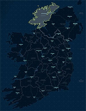
County Donegal in the Republic of Ireland borders three counties of Northern Ireland.
Mahony decided to use Story Map Series Tabbed, one of the Esri Story Maps apps, to present a collection of maps displaying economic and demographic information for Ireland’s Call—To Return Its Global Diaspora Home.
“I like the story map format because it has the necessary tools to create exactly the presentation we needed,” Mahony said. “We included maps, photos, descriptive text, and a response form, all in a very engaging way. From the outset, it was very important to ensure that it was as user-friendly as possible and to present complex data in a very visual and understandable manner. The story map format let me bring people along on a journey. In addition, it has helped demonstrate the potential of GIS to some of our national leaders.”
Among the many engaging sections in the Ireland’s Call story map is the interactive Global Irish Community map, which shows the population growth patterns throughout the world in places where Irish emigrants lived from 1990 to 2013. The population data came from a United Nations dataset.
The Global Job Prospects map provides information about the 800 overseas companies that are currently operating in Ireland, including their countries of origin. The Competitive House Prices map displays the average cost of homes by county and how the price has varied from 2014 to 2015.

The Ireland’s Call story map provides readers with information about home prices in Ireland.
Healthiest Towns makes use of a heat map to visualize how the Irish feel about their personal health throughout the country. Shortest Commute specifies the locations of hundreds of towns and villages in the country, with pop-up windows indicating the population and residents’ drive times to a job or school. “We added these specific pieces to the story map because they concern those issues that are important to people and may influence their decision to return to Ireland,” Mahony said. “Job opportunities, commute times, healthy living, and housing costs—these are all quality-of-life factors that can influence someone in their decision to come back home.”
To interact with readers, Mahony included in the story map the Global Skills Locator GeoForm template, an online registration form that lets Irish citizens living abroad register details about their education, skills, and past employment for potential work in Ireland. (Esri offers GeoForm as a configurable app template.) “This section provides a two-way flow of information,” Mahony said. “It not only lets potential Irish job seekers living outside the country register their qualifications, but it also allows our policy makers to target specific job sectors to entice foreign companies to relocate to Ireland based on the qualifications of our diaspora.”

This map shows how residents of Irish communities rated their own health.
The Ireland’s Call story map was first shown at the annual Tip O’Neill Irish Diaspora Award ceremony in 2015, where Jimmy Deenihan, former minister of state for diaspora and overseas aid, described it as “an exciting and innovative way of connecting and engaging with the Irish diaspora community globally.” As a result, Mahony was asked to discuss the project at a meeting at the Ireland Department of Foreign Affairs and Trade, where a national collaborative initiative is being developed to attract skilled Irish workers back to Ireland.
The story map has become an instant success with its wealth of information and the ease with which Ireland’s global community abroad can connect with it. It will be advertised in a variety of ways, including using marketing and social media campaigno attract the attention of Irish citizens currently living outside the country.

Commute times for residents in Irish towns and cities were mapped, too.
“A member of the Irish diaspora living in Australia recently contacted me about the story map and Global Skills Locator,” said Mahony. “She said that both were a great help to her in researching employment and housing opportunities for her planned return to Ireland. She says that the information makes the transition much easier and a lot less stressful so that she can return home with greater confidence.” (The woman returned to Ireland in June 2017.)
Ireland’s Call was the overall winning entry in Esri Ireland’s 2015 Maps Make Sense Challenge. When Esri technology evangelist Bern Szukalski invited Mahony onstage to make a presentation about Ireland’s Call at the Esri European User Conference in Salzburg, Austria, in 2015, he commented, “Rosita’s passion for her work was very evident, and many commented that it was among the best they had ever seen. I really appreciated her tradecraft behind the maps that she authored and her creativity in putting it all together.”

Rosita Mahony, a GIS and research coordinator, created the Ireland’s Call story map.
Mahony has worked for Donegal County Council for 14 years. In 2010, as part of the SPACEial North West team, she helped develop a comprehensive cross-border spatial dataset. County Donegal shares 93 percent of its land border with Northern Ireland, and as a result, there are issues of mutual interest.
With Ireland now bouncing back from the recession, the Ireland’s Call story map app illustrates the positive impact that this recovery has had on many key sectors in County Donegal, including investment, health, house prices, education services, and amenities. The story map provides the diaspora with the necessary information and incentives to consider relocating home.
To learn more about the diaspora project, follow Mahony on her LinkedIn page or on Twitter @RositaMahony.
