If you have a Twitter account, you can send out short posts called Tweets to your followers via this free social networking microblogging service. Twitter is often used by individuals and federal and local government agencies, organizations, and businesses. You can add location to your Tweets and place them on a map, providing an extra dimension of information.
Public Information, available in ArcGIS Online, is a fully configurable and responsive template that adapts to web browsers, tablets, or smartphones. You can use the template to map Tweets and other social content from Instagram, Flickr, YouTube, and Webcams.travel that have been linked to a location. The template can be configured to include a search string to retrieve Tweets with a geographic location. Other social media options can be similarly configured or can be removed. Here’s how to use Public Information for Twitter:
Configure the App
Step 1. Open an existing map in ArcGIS Online, click Share, then click CREATE A WEB APP.

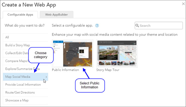
Step 2. Choose the Map Social Media category in the app gallery, then click to select the Public Information app.
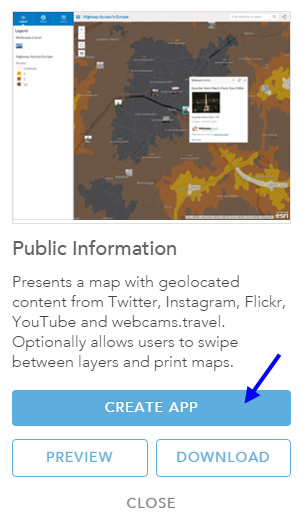
Step 3. You can download the app source, preview the app, or create the app. Click CREATE APP to configure it.
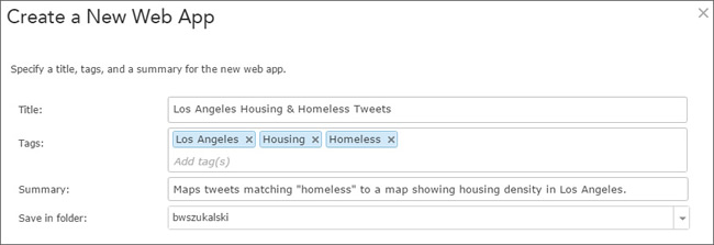
Step 4. Enter a title, tags, and a summary description for the app. Click Done when finished.
The app will display with the configuration panel open on the right.
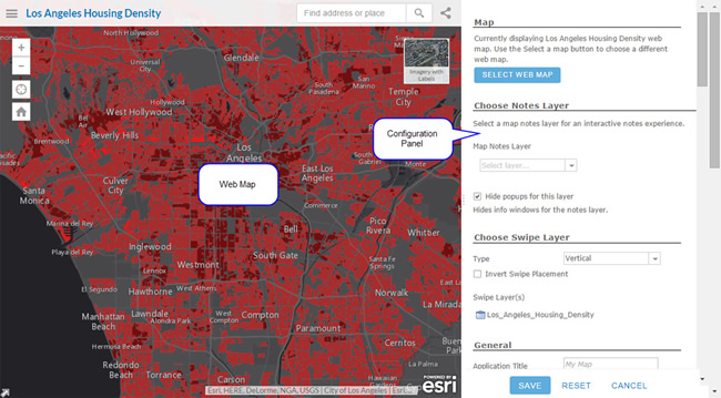
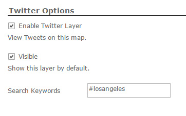
Step 5. Using the configuration panel, configure the application as desired. To display Tweets automatically, enable the Twitter layer, choose to make the Twitter layer visible by default, and set the search keyword as desired.
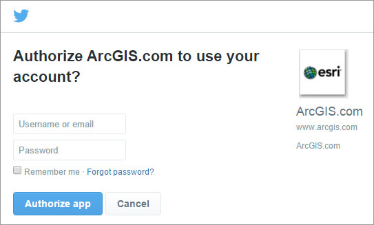
Click SAVE when you finish configuring the app. Note that when testing the app, you must log in to your Twitter account and authorize ArcGIS access if you’ve not done so previously.
Use the app
When the app is deployed, users will see the prompt, Sign in:
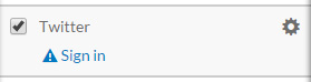
App users must sign in and authorize ArcGIS.com to connect to their Twitter account to enable Tweets to be shown.
There is a Remember me option that will save a cookie so logging in won’t be required again unless the cookie is cleared or a new user opens the application.
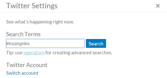
Once logged in, the user can click the settings gear:
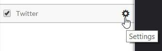
Change the search if desired.
The Public Information configurable app provides the easiest way to add tweets to your map.