
Examining two maps alongside each other can provide many valuable insights. You can detect changes, make comparisons, or study relationships.
There’s a very quick and easy way to compare two web maps side by side using the preview capabilities available in ArcGIS Online app templates.
First, choose two web maps that you want to compare. For this tip’s purposes, go to the ArcGIS Online Galleryand select the maps USA Median Household Income and USA Unemployment Rate.
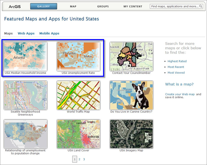
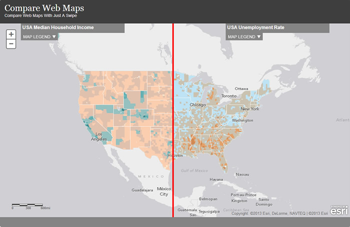
These maps can be placed side by side to explore how the unemployment rate in 2012 compared to the median household income in various parts of the country in that same year.
Here’s the easy way to make this type of map using the Swipe Tool.
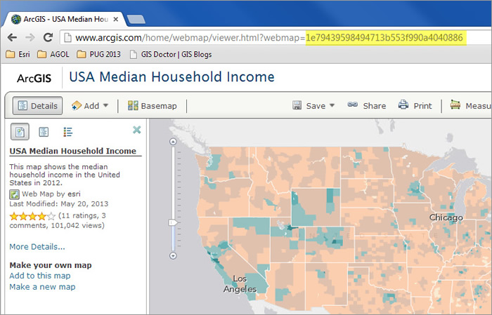
Step 1: Open the USA Median Household Income map. Each map has an ID. Like your social security number or driver license, this ID is unique and can be used to reference the map. You’ll find the ID in the URL for the map. Simply highlight it and copy it. Do not copy the complete URL.
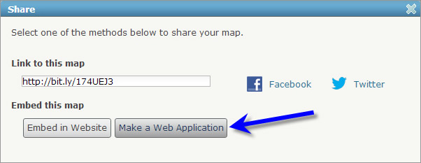
Step 2: Open the second map you want to compare, in this case it’s USA Unemployment Rate. Once opened, click Share and then choose Make a Web Application.
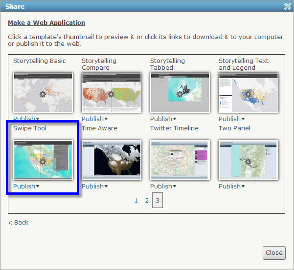
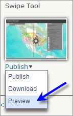
Step 3: Locate the Swipe Tool, currently found on page 3 of the template gallery.
Step 4: Click the arrow next to publish, and choose Preview as shown below:
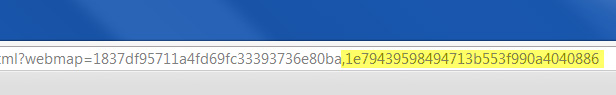
Step 5: After opening the Swipe Tool in preview mode, add a comma at the end of the URL (after the map ID) and paste the map ID you copied in the first step above after the comma (omitting any spaces).
Hit Enter, and you’ve got a quick visual comparison of two maps using the Swipe Tool template. Grab the red line with your mouse and move it back and forth to compare the two maps.
You can save and share the URL you’ve pasted together or, as an alternative, you can also host the Swipe Tool application and configure it to use both web maps.