Fall 2002
Fall 2002 |
|||||||
|
|
|||||||
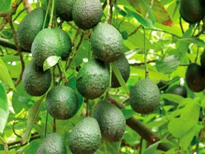
Automated Image Matching Technology Helps Get to the Guacamole
Avocado Harvest Predictions Streamlined With GIS |
|||||||||
|
By Marti Ebbert Kurth
Every three to five years the California Avocado Commission (CAC) requests an inventory of avocado groves. This inventory helps CAC predict crop yields and set market rates and focuses on four major areas of grove harvest indicators. Of primary interest to CAC is the number of healthy, producing trees in the groves. A second concern is the number of new trees a grower has planted. Typically those trees take from three to five years before they begin producing fruit and can be a key variable in predicting harvest yields. Next is the number of "topped" trees in a grove. Growers routinely chop older trees down to stumps to regenerate growth from the root and must wait for several years before they produce fruit. Finally the inventory looks for abandoned trees, those that are no longer in production. The territory that needs to be covered in the inventory is quite large, encompassing parts of five southern California counties from the northern edge of San Luis Obispo in the north to San Diego in the south. Assessing and predicting the yearly yield of the crop over that area has typically been a manual and highly labor-intensive task. Traditionally, data was compiled from hand-drawn overlays of aerial photo enlargements and verified by windshield field surveys and surveys mailed to 6,000 avocado growers. A typical inventory involves gathering approximately 200 nine-inch by nine-inch film aerial photos, covering an area of more than two million acres.
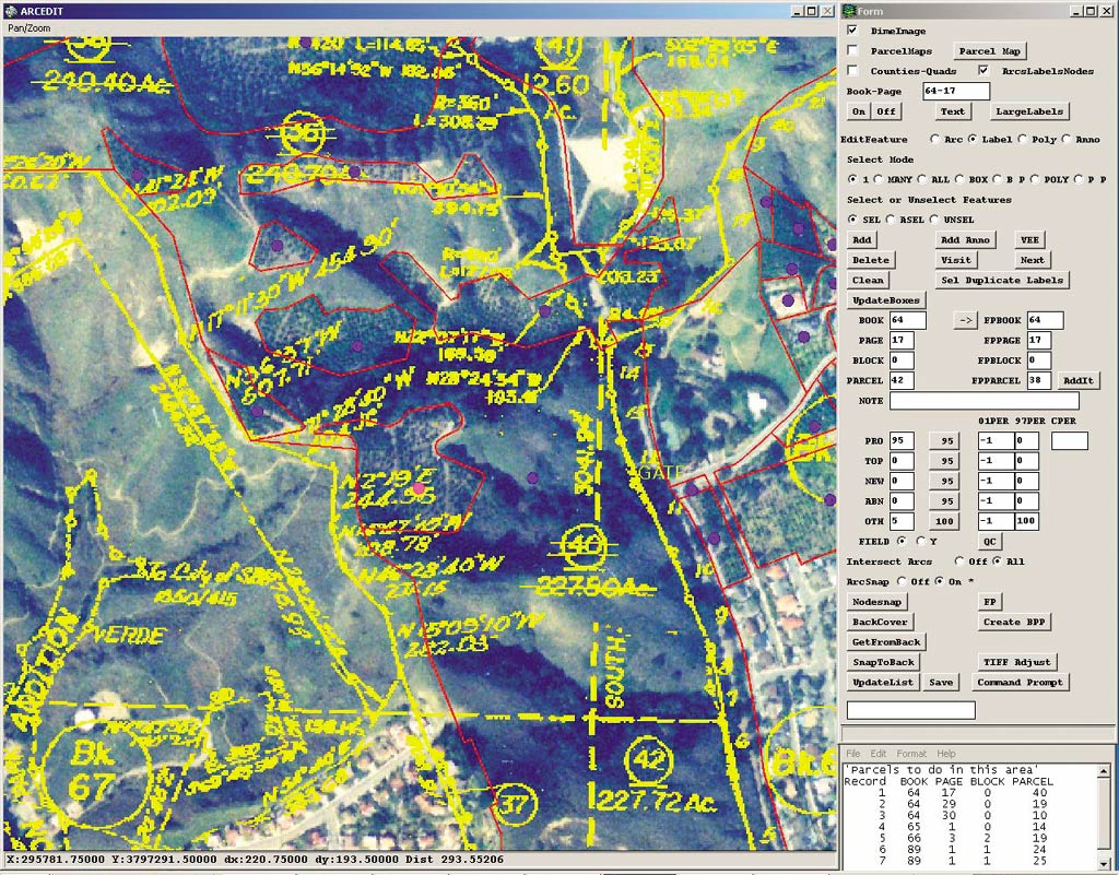
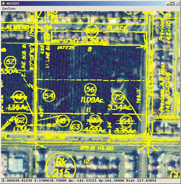
Aerial photographs of the avocado groves are used in part because avocado trees are prone to a root rot fungus (Phythophthora cinnamomi) that is spread via contaminated soil. Consequently, many growers have strict ground rules restricting entrance to the groves, especially for people who travel between neighboring parcels. This makes field assessment for the inventory somewhat difficult and aerial photography the best solution for gathering the needed information. According to Deborah Johnson, general manager of Aerial Information Systems (AIS), the company that has been doing the data acquisition since the 1980s, the photographs are used in the initial phase of the inventory to identify crop acreage and the number and stages of growth of the avocado trees. Each aerial photo is enlarged to 1:12,000 scale and overlaid with acetate to manually make hard-copy maps that delineate each grove using data from the Assessor's parcel information. AIS managers also rely on windshield surveys from vehicles driven outside the grove boundaries to verify the avocado interpretations. Johnson says that even though AIS' data gathering methodology has held steady over the years with a 90 percent accuracy rate, efficiency has been somewhat of a challenge. With each new inventory the time-consuming process of making hard-copy maps had to be repeated, and all of the existing information became obsolete as the groves changed. She began looking for a way to build upon the data gathered with each inventory and eliminate the re-creation process. AIS has been using ArcInfo software for more than 20 years and realized a decade ago that the avocado inventory project was well suited for implementation into a GIS. Johnson hoped that finding a cost-effective method to incorporate the aerial imagery and ArcInfo would allow AIS to identify change areas and simply update existing data rather than completely re-create the data each time. In addition, she looked for a method that could match and compare previous data.
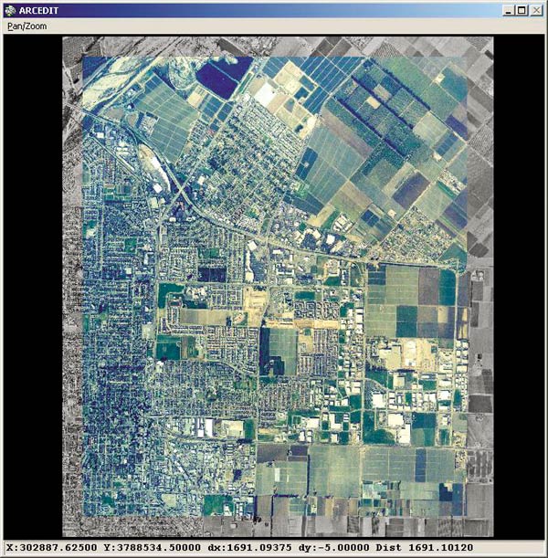
However, the biggest concern for converting completely over to GIS had been the cost of acquiring accurate digital imagery. AIS solved this problem by using a new image matching product called DIME from Esri Business Partner Positive Systems, Inc., of Whitefish, Montana, that, when combined with ArcInfo, creates relatively inexpensive current georeferenced imagery. AIS is using DIME to integrate newly acquired images with a United States Geological Survey digital orthophoto quarter quadrangle (DOQQ) basemap. The new images are first tied together to create a composite mosaic and then matched to the georeferenced DOQQ, allowing the new mosaic to take on the georeferencing characteristics of the basemap. The result is a seamless image of the project study area that can then be used as an image base layer to perform heads-up (on-screen) digitizing and create property parcel boundaries and grove delineations directly into the ArcInfo coverage. Tree characteristics within each grove (topped vs. new trees, for instance) and acreage estimates are then calculated and presented as tabular text with the corresponding maps to CAC for its market analysis. Lisa Cotterman, project manager for AIS, says, "For the last seven years we've been encouraging CAC to upgrade to ArcInfo and digital imagery. But the expense of acquiring digital imagery was always a limiting factor. With Positive Systems' software we can convert to a digital format using photography. Ultimately, this can provide a multifunctional product for our client." AIS' ArcInfo programmers developed a custom user interface that allows the photointerpreters to make the delineations of the avocado groves and add attributes to the new polygons. Once an entire DOQQ is photointerpreted, additional ArcInfo processing is performed (i.e., line cleanup and topology creation) followed by automated attribute quality control. After needed corrections are completed, the coverages are combined using ArcInfo software's Mapjoin command. ArcInfo software's statistical tools are used to break the data down by county, ZIP Code, and parcel number. A final report is then prepared using the outputs from ArcInfo.
Cotterman explains that because the aerial imagery of its project area is now georeferenced, it is more easily edited and updated. Thus, property parcel boundary data can be archived and digitally applied to newly acquired inventory imagery, eliminating the process of hand-drawn mapping. "It's a more versatile product, and we don't have to reinvent the wheel every time a survey is conducted," she notes. Johnson feels that the use of ArcInfo and DIME can potentially offer many digital solutions for the avocado inventory. Tracking data back in time to perform historical comparisons, improved planning and yield prediction, and improved classification and perhaps even incorporating the data into a visual display product for CAC's marketing and public relations activities are all possibilities for the product. Johnson concludes that DIME could be coupled with ArcInfo in multiple applications for the agriculture industry. "It's an inexpensive way to bring harvest and aerial photography data together in a digital environment. I can see many other crops where its use would be beneficial." For more information about AIS, contact Deborah Johnson (e-mail: djohnson@aisgis.com). For more information on DIME, contact Positive Systems (e-mail: positive@possys.com). Marti Ebbert Kurth writes about agriculture and technology. |