| |
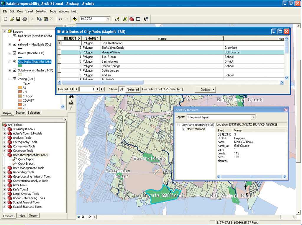
ArcGIS Data Interoperability allows you to use more than 70 data formats within the ArcGIS Desktop environment. |
ArcGIS Data Interoperability is an ArcGIS extension that eliminates barriers to data sharing by providing state-of-the-art direct data access, complex data transformation, and import/export capabilities. Jointly developed by Esri and Safe Software—an Esri Corporate Alliance Partner—this extension is built on Safe's industry-standard Feature Manipulation Engine technology.
ArcGIS Data Interoperability allows GIS professionals to use any standard GIS data within the ArcGIS Desktop environment, regardless of the format. This means that users can directly read, display, and analyze this data using all the tools available within ArcGIS Desktop.
ArcGIS Data Interoperability features
- Extensive Data Support—Directly read more than 70 spatial data formats and export to more than 50 spatial data formats. ArcGIS Data Interoperability adds support for a wide range of formats, including Autodesk DWG/DXF, Geography Markup Language (GML), Intergraph GeoMedia Warehouse, MapInfo MID/MIF and TAB, MicroStation Design, Oracle and Oracle Spatial, and XML.
- Conversion Tools—Perform automated conversion between source and destination formats. ArcGIS Data Interoperability provides a new toolbox with Quick Import and Quick Export tools that enable ArcGIS users to quickly translate between data formats with default format settings.
- Data Transformation—Further manipulate and translate default formats to create custom formats using the Workbench application. Workbench provides a rich set of more than 150 specialized transformers that can be used to transform both geographic and attribute information and lets users visually manipulate data translations.
- Full Integration With the Geoprocessing Framework—Enjoy full integration with the ArcGIS geoprocessing environment, including the ModelBuilder framework.
Availability
Visit www.esri.com/datainteroperability to download a 30-day evaluation copy of ArcGIS Data Interoperability or to purchase a registration code that converts an evaluation license of ArcGIS Data Interoperability into a full license.
|