Fall 2004
Fall 2004 |
|||||||
|
|
|||||||
Organizations Embrace ArcGIS Engine to Build Custom Applications |
|||||||
|
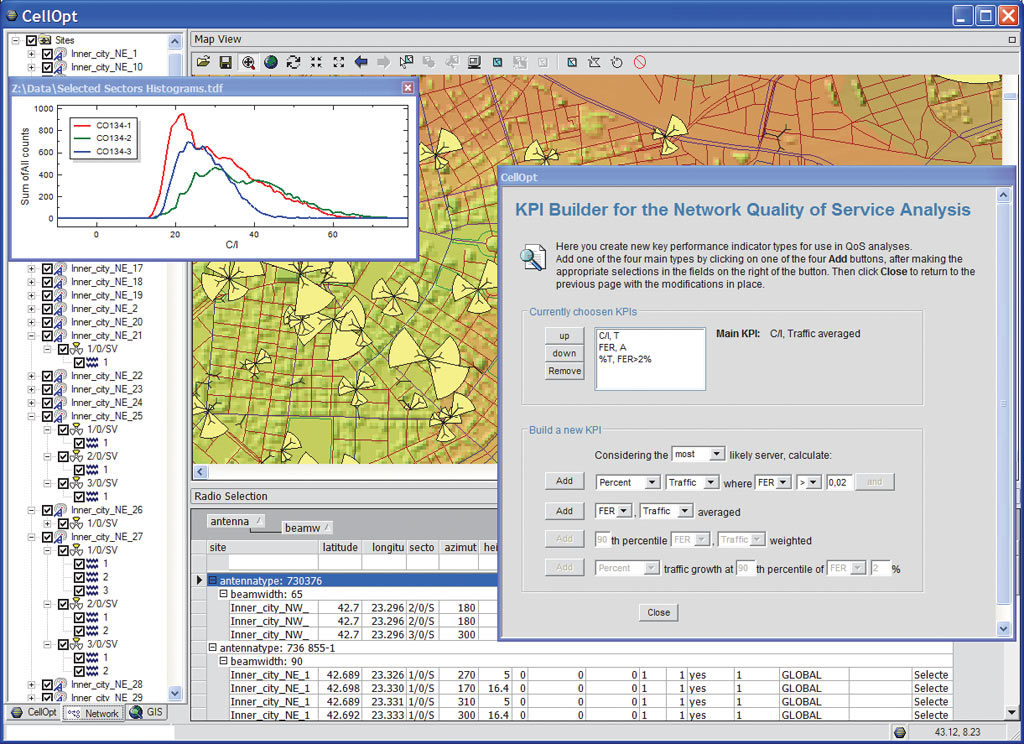
ArcGIS Engine is a GIS application framework, created in response to Esri users' requests that the rich technology of ArcGIS be productized to enable embedding spatial functionality in new or existing applications. Newly released, ArcGIS Engine comprises a set of embeddable cross platform ArcObjects, ArcGIS software's underlying components, used to build custom GIS and mapping desktop applications or add new functionality to existing applications. ArcGIS Engine consists of a software development kit and a redistributable run time required to run applications built on ArcGIS Engine. ArcGIS Engine applications can vary from simple map viewers to custom GIS editing and analysis programs. Early AdoptersAlthough this is a relatively new product, it was long anticipated and has been enthusiastically embraced by a number of organizations. This article highlights just a few of the early projects and products that are being built with ArcGIS Engine. ComOpt AGEsri (UK) Ltd. Business Partner ComOpt AG is a leader in automatic optimization applications for wireless operators. The software applications on which the company's notable success is built are called CellOpt. They allow wireless operators to optimize intelligently the performance of their radio networks automatically, enabling the best return on investment in radio spectrum, network infrastructure, and human resources.
CellOpt IQ is an automatic decision support application for wireless planning and optimization. It achieves this in a goal-oriented, user-friendly environment, embedding ArcGIS Engine. "We can provide a much higher degree of usability and more intuitive access to both the modeling of the problem and the understanding of the analysis results," says Craig Taverner, director of Research and Development at ComOpt AG. "The ArcGIS Engine library is very extensive, giving us the confidence that whatever future features we wish to add to our product, the library will have the capability to support us. The .NET and Java application program interfaces (APIs) are very useful to us since we have a mixed language product and can use ArcGIS Engine wherever we need it. Also, the fact that the APIs are very similar between the languages has made it easy to port code from one language to another." Woolpert LLP
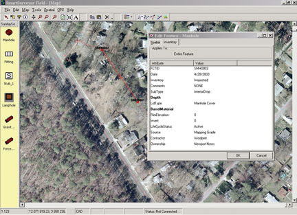
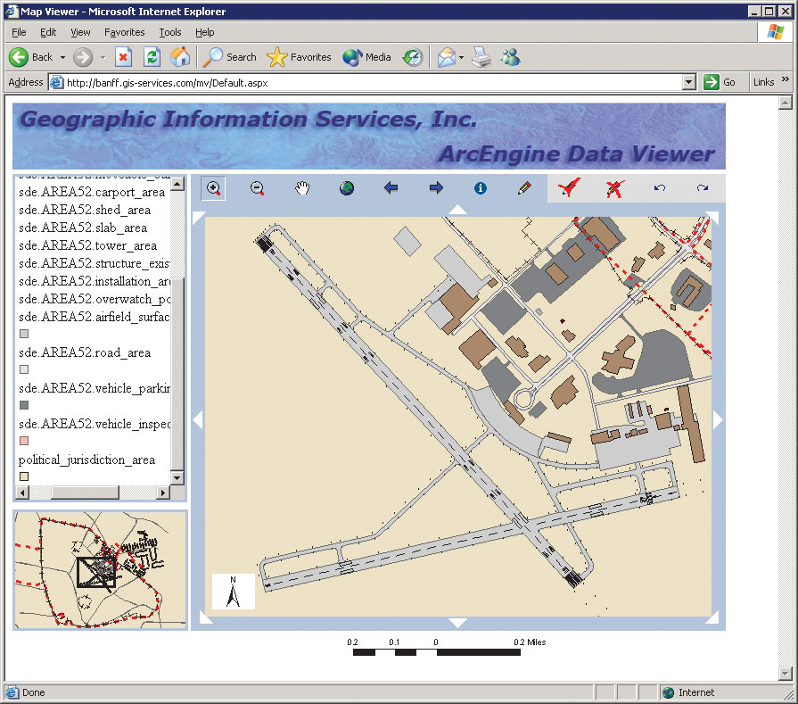
Woolpert LLP is a premier international consulting firm and Esri Business Partner that provides GIS and information technology services. The company designs processes and systems that make technology serve its clients' business needs and, in doing so, utilizes the full suite of ArcGIS software. Woolpert's SmartSurveyor software is a mobile mapping system that enables GPS crews to map utility systems and structure attributes on the fly, with complete network connectivity, and in a single sweep. Disconnected field editing streamlines the process of putting field data back into the central data repository. "We are using ArcGIS Engine to build field-based applications, providing disconnected geodatabase editing," says Bryan Dickerson, senior developer at Woolpert. "Our clients must produce high-quality data, and using these kinds of applications on tablet PCs with ink technology will help achieve our goals in a cost-effective manner. The user interfaces for these applications need to be simple, user friendly, and targeted to the job. ArcGIS Engine allows us to do that." Geographic Information Services, Inc.Geographic Information Services, Inc. (G/I/S), is an award winning Esri Business Partner, providing GIS system design, on-site support, training, and application development. It offers commercial off-the-shelf solutions, as well as custom application development.
Base Realignment and Closure (BRAC) is a Navy program to reorganize its installation infrastructure to more efficiently support its forces, increase operational readiness, and facilitate new ways of doing business. G/I/S is currently working on a project to provide a thin-client viewer application that allows data owners to review and approve their installation data from a central repository. The Installation Visualization Tool (IVT) data consists of seven data layers that are being loaded into ArcSDE and viewed on demand. Daniel A. Levine, Ph.D., G/I/S's Federal Program manager, says, "Flexibility is important to us and our clients. We have an open data storage architecture supporting files, personal geodatabases, and ArcSDE with a choice of commercial databases. The ability to run software in a configuration that makes the most sense and to distribute client and server functions as the situation warrants is a big deal in our business. The new Esri products, ArcGIS Engine and ArcGIS Server, allow us the flexibility to align computing resources with work flow. We believe these products will also let us deliver product at a lower cost and with better, customized user interfaces." Levine concludes by saying, "We are considering rewriting our Zoning Analyst and Buildout products in ArcGIS Engine to lower deployment costs and will use the new controls to save development time building the custom user interface. End users of these products run the gamut from GIS people to heavy to light use by non-GIS people, so interfaces must be tailored to the task." To learn more about how ArcGIS Engine can be useful in your GIS application development, visit www.esri.com/arcgisengine. For a general overview of Esri developer technology, visit www.esri.com/developers. |