Fall 2006
Fall 2006 |
|||||||
|
|
|||||||
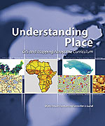
Upcoming Esri Press Book Shows GIS in College Classrooms
Students Learn Importance of "Understanding Place" |
|
|
Political science students at Virginia's Washington and Lee University use GIS to propose redistricting changes that reflect statewide demographic trends.
Whether it's classical archaeology students creating a database from archaeological survey projects in the Mediterranean basin or environmental chemistry students collaborating with GIS students to make watershed management recommendations, instructors and students in colleges and universities are using the powerful tool of GIS. Understanding Place: GIS and Mapping Across the Curriculum, edited by Diana Stuart Sinton and Jennifer J. Lund and is expected to be published by Esri Press in January 2007, illustrates these projects and others, showing how instructors have used GIS to help teach their students in such diverse areas as biology, geology, musicology, religion, foreign languages, and sociology. They educate students to perceive, evaluate, and analyze spatial information. These students are usually new to GIS, and by using it, they broaden and deepen their understanding of their own disciplines. The book's many contributors share their successes and candidly discuss the challenges of using GIS in their classwork. Sinton and Lund hope their book will encourage other teachers to bring GIS into the classroom. The experiences shared prove that instructors can convey complex and subtle meanings with a map as effectively as they can with a lecture or a chapter of text. How to OrderTo preorder Understanding Place: GIS and Mapping Across the Curriculum for January 2007 delivery (ISBN: 1-58948-149, 300 pages, $49.95), call 1-800-447-9778 or visit www.esri.com/esripress/up. |
 Students at Ohio Wesleyan University use GIS in tandem with GPS receivers to map and analyze bicycle paths to create a network of community trails and green spaces in Delaware, Ohio.