Fall 2007
Fall 2007 |
|||||||
|
|
|||||||
AEGIS Project Weds Geotechnology and Traditional Liberal Arts |
|||
|
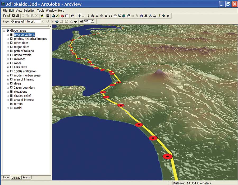
By Sean Flynt and Eric J. Fournier, Samford University, Birmingham, Alabama A grant from the National Science Foundation's Course, Curriculum, and Laboratory Improvement program is helping faculty at Samford University develop GIS modules suitable for use in introductory-level courses in a surprising variety of academic disciplines. Former Samford geography professor Max Baber (now at the University of Redlands, California) developed and directed the university's $195,000, three-year Academic Excellence and Geographic Information Systems (AEGIS) project, now entering its evaluation stage. According to Baber, the project's goal was to help faculty help students understand and integrate the technology into their studies and careers.
"The broader impacts of this project are far reaching," Baber says. "The integration of introductory GIS into a diverse array of arts and sciences courses is leading to further development of GIS modules for advanced courses and is enhancing student research skills by providing students with multiple opportunities to engage in spatial data acquisition and analysis activities." The AEGIS project graduated 14 faculty participants in two groups of seven. Participants spent two weeks learning the fundamentals of the ArcCatalog, ArcMap, and ArcGlobe applications in ArcGIS Desktop, then developed modules for use in their classes. The modules were then tested on other participants, fine-tuned, and used in a variety of classroom settings throughout the university. Participants, who received stipends for the work, were sometimes spotted wandering Samford's quad in clusters, hunched over handheld GPS receivers. Others gathered in the Geography Department's GIS lab (also an Esri regional training center) to process data and create student-friendly applications. When they returned to their own classrooms, they helped students use the technology in diverse undergraduate research projects and classroom exercises, from tracking wildlife to revealing the influence of ancient cultures to exploring political redistricting. The practical value in both career and classroom is apparent to the faculty who volunteered to participate in the AEGIS project. Professor Ron Jenkins and his colleagues in Samford's Biology Department were especially interested in the technology. "GIS and GPS can be big pluses in conducting environmental research," Jenkins says. "Being able to map distributions of animals can give the biologist a better understanding of the animals and their biological roles." Jenkins comments that Samford biology students used ArcMap in their study of the flora and fauna of Shades Creek, which runs alongside Samford's lush hilltop campus and has served as an outdoor biology lab for many years. Classics professors Shannon Flynt and Doug Clapp saw applications for GIS in even the most traditional of the liberal arts. "Those nebulous people of history, be they Greek, Roman, or your great-grandparents, did not live in a vacuum or on page 243 of a textbook but in a real place where it even rained sometimes," says Clapp. "The AEGIS project can help those of us who introduce students to their cultural roots through cultural perspectives courses or through Greek and Roman history by providing a geographical anchor for the printed page that is our primary teaching tool." Clapp's students used ArcGlobe to create a series of teaching maps of ancient Greece. Flynt, who specializes in Roman archaeology, led her students to create maps documenting the diffusion of distinctively Roman architecture in ancient Britain. For historian Jim Brown, knowing the roads is the key to understanding world history. Students in his introductory classes use ArcMap to construct a series of maps that show the routes of renowned roads in history, including Jordan's King's Road, Cortez's route from the sea to Mexico City, and roads of feudal Japan. The students brought no GIS skills to the class, but within a few class periods, they were following Brown's manual to open .mxd files, add layers, change symbology, and ultimately construct their own maps of these famous roads. While the students developed some GIS skills, Brown was more interested in using the technology as a tool to help them understand history. For students interested in taking GIS beyond the classroom modules, Samford's Geography Department offers a full range of GIS classes, including a GIS certificate program. The challenge now is to sustain Samford's interdisciplinary focus on geotechnology. A new cohort of professors from psychology, history, and biology plans to carry on the work of the project in a variety of classes without the use of the grant-related funds. Baber says the university's growing emphasis on mentored undergraduate research should help carry forward the aims of the AEGIS project, as should the project's proven utility. "Geotechnologies continue to grow in usefulness and applicability across a wide range of disciplines," Baber notes. And however unlikely this marriage of technology and traditional liberal arts might seem to some, Samford University is demonstrating that the match can be a happy one. More InformationFor more information, contact Eric Fournier, chair (e-mail: ejfourni@samford.edu), or visit Samford University's AEGIS project Web site (www.samford.edu/schools/artsci/geography/aegis). |