Fall 2007
Fall 2007 |
|||||||
|
|
|||||||
Additional Functionality Available Now with Free Download
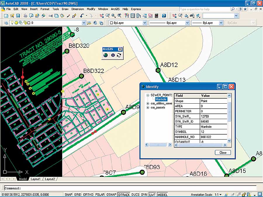
New ArcGIS for AutoCAD 2008 |
|||
ArcGIS for AutoCAD is a free, downloadable tool that provides access to ArcGIS Server map services and allows AutoCAD users to view and query GIS data inside AutoCAD. The new version of ArcGIS for AutoCAD is now available for use with AutoCAD 2008 and provides CAD users with a new and simple way to define and store coordinate system information inside their AutoCAD drawings, eliminating the complexities of maintaining external companion files. Beginning with ArcGIS 9.2 Service Pack 3, AutoCAD drawings with coordinate systems defined using ArcGIS for AutoCAD will recognize this new format and will not need the companion .prj file to define the coordinate system. When connecting to an ArcGIS Server map service in a different coordinate system, maps are automatically projected on the fly to display in the proper AutoCAD location. For CAD users, the ArcGIS Server map service yields additional value, as they are able to work in their chosen coordinate system without transforming their CAD drawings or converting the GIS data. By using ArcGIS for AutoCAD, CAD users benefit from quick and easy access to GIS basemap information inside AutoCAD without having to understand how GIS data is stored, how to generate quality maps, or how to convert or translate them. ArcGIS for AutoCAD allows users to approach design projects with a full understanding of the environment they are creating in. More InformationTo download this application and to learn more, visit www.esri.com/autocadapp. |