Fall 2009
Fall 2009 |
|||||||
|
|
|||||||
Locate, Segment, and Target Mailings to Raise Response Rates
Address Coder Reveals Valuable Marketing Information in Address Lists |
|
|
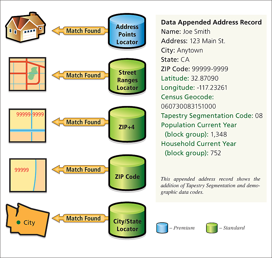
How can marketers learn more about the people behind the addresses in their mailing lists? Address Coder, Esri's affordable stand-alone U.S. geo-coding and data-appending software, appends latitude-longitude coordinates, Federal Information Processing Standards (FIPS) codes, Esri's Updated Demographics, and Tapestry Segmentation data to United States address records. To obtain higher response rates, marketers can use this information to craft specific messaging and promotions that will appeal to similar households in the mailing list.
Offered in two configurations, Address Coder matches addresses by the fallback locator concept. For example, if an address cannot be matched at a specific level, such as by street, the geocoder "falls back" to the next level. Address Coder includes four address match ranges, from the Street Ranges Locator to the City/State Locator level. Address Coder Premium begins five-level matches at the "rooftop" level, followed by the same four match levels that are included in Address Coder. The database maps street addresses to a physical location so that each address is a fixed point, not an interpolation from an address range. New features of Address Coder include the ability to append the name of the closest store from a list to each customer record. This is how profitable sales territories can be created that match customer lists with stores to conduct special promotions tailored to customers' shopping needs and behavior. This feature helps marketers target customers who are located within a desirable distance, thereby increasing the likelihood that they will respond to the promotion. Another feature enables users to append the distance from a point; for example, insurance companies can measure the distance from disaster sites to determine percentages of risk for area locations. Public safety agencies can use this information to define where to place services before, during, and after an evacuation. Data updates include Esri's 2009 Updated Demographics and Tapestry Segmentation data. The geocoding reference data includes Tele Atlas/TomTom Address Points and streets data and is current as of February 2009. The Tele Atlas/TomTom Address Points database now includes more than 51 million reference U.S. address points. With minimal training, users can quickly and easily geocode address lists by a single record or in batch mode for marketing, direct mail, and notification campaigns. Marketers in all industries can raise response rates by targeting only the most profitable audience, avoiding areas with low potential, then segmenting mailing lists and devising separate messages based on demographics, lifestyle information, physical locations, and spending habits. Address Coder is available for the United States, by six-state regions, or by individual state. Built with ArcGIS Engine and Esri's geocoding locator technology, Address Coder provides a proven address matching concept that is already part of ArcGIS. More InformationTo learn more about Address Coder, visit www.esri.com/coder. |