Fall 2009
Fall 2009 |
|||||||
|
|
|||||||
Census Is the Largest Peacetime Mobilization in the United States
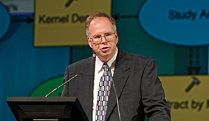
Bureau Chief Tim Trainor Says Geography Is Core of Census |
|
|
As a keynote speaker at the Esri International User Conference this year, Tim Trainor, chief of the Geography Division at the United States Census Bureau, addressed a crowd of thousands at the Plenary Session and delivered a clear message: "Geography is the core of the census."
Initially, the bureau divides the country into almost seven million census blocks with ArcGIS software. Those blocks are then aggregated into approximately 800,000 larger assignment areas for individual enumerators. Data from approximately 8,000 assignment areas is processed each day during address validation activities, which can exceed three million addresses per day. "The census is the largest peacetime mobilization in the United States," said Trainor. "It's a snapshot of the population. It tells us who we are within our borders, and it tells us where we live. The goal of the census is to count everyone once and only once in the right location." Using handheld computers, enumerators recently verified each address in the United States, which will supply the mailing list for the census questionnaires to be sent on April 1, 2010. Trainor described it as, "by far, the largest deployment of mobile GIS in the world." One hundred forty thousand temporary workers canvassed 145 million addresses and had 11 weeks to complete the task. "We're using GIS in the field to make things easier and faster," Trainor explained. He then announced, "Because of this technology, I'm pleased to tell you that on Friday, July 10, at 10:00 in the morning, the last assignment area was checked and verified. That ended our address canvassing field operations seven days ahead of schedule." After the census is taken next year, the bureau will limit the amount of material it disseminates with paper and will opt instead to deliver the majority electronically. Many users will access the data through American FactFinder, which is being redesigned to take advantage of Web 2.0 technology. Cached maps will load faster, and users will be able to make thematic maps with any data instead of predetermined sets of data. Census data will support general GIS applications, including planning efforts and determining where to locate schools, hospitals, and other public institutions. Trainor also noted it will help people answer questions about affordable housing, plan roads and bridges, and enhance businesses and other economic infrastructure, as well as develop social programs and improve community projects. Population totals will determine how many seats each state receives in the House of Representatives, and states will use the information to redraw congressional district boundaries. "The census," Trainor concluded, "is basic to our democracy." Then he strongly encouraged everyone to fill out their census forms. More InformationFor more information, contact Tim Trainor (e-mail: Timothy.F.Trainor@census.gov). |
 Trainor focused his talk on activities for the 2010 decennial census, some of which are already under way. Since geography is a key component of census activities, the bureau uses GIS throughout the process, from the first activities of address canvassing to final data delivery.