ArcNews Online
Fall 2010
[an error occurred while processing this directive]Measuring Super Cities
Thought Leaders Describe Their Vision of 19.20.21 at Esri UC
Most people in the world live in cities. Populations in urban areas are growing at a higher rate than the population as a whole. Cities need to plan for their futures, have a vision for the use of urban space that reduces poverty and promotes sustainability, protect the environment and manage ecosystems, and improve the nature and form of future urban expansion. To do this, people need good information that helps them ask the right questions for understanding urban situations and design solutions that support a sustainable future.
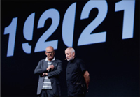
Jon Kamen and Richard Saul Wurman.
Cities flow over their political boundaries, land-use descriptors vary, and definitions of population density differ. Effectively measuring cities at a global level requires a common yardstick, a universal language, and standard methodologies that allow us to understand the city itself and to compare cities with each other. The initiative 19.20.21 is designed to help people better understand our world's urban environments.
Richard Saul Wurman, a prolific author and the founder of the Technology, Entertainment, and Design (TED) conferences, conceived the project 19.20.21 from the realization that there will be 19 cities in the world with populations of 20 million people in the 21st century. "Large urban hubs will radically redefine the world's future macroeconomic and cultural landscapes," said Wurman. "It is critical to gain a truer understanding of what is happening. The rise of super cities is the defining megatrend of the 21st century. Furthermore, the growth of cities has global challenges, such as shipping, food supply, and meteorological patterns."
One objective of 19.20.21 is to create methodologies for studying super cities. To do this, 19.20.21 partners want to drive the standardization of urban data and methodologies; design urban observation resources that help people learn about their city and how it compares to other cities; and disseminate information via communication media, such as printed publications, television, live presentations, and the World Wide Web. Wurman envisions a free Web site that would provide access to detailed, extensive, and standardized data, including graphics, maps, videos, and links. "People will be able to go to these resources to ask questions, do comparative analysis, and communicate with people around the globe," he said.
Wurman teamed up with project partner chairman and CEO of @radical.media Jon Kamen and president of Esri Jack Dangermond. These three thought leaders explained the vision of the 19.20.21 project to the audience at the 2010 Esri International User Conference. They presented a mocked-up version of an urban observatory, a place where people could immerse themselves with this information, interact with it, and see it in a new and different way. The presentation included five different ways of measuring and comparing cities:
- Population density and demographics—Education levels, immigrant communities, and age
- Modes of transportation—Cars, taxis, subways, and bicycles and percentage of usage by mode
- Health—Hospitals, trauma centers, epidemiology, accessibility, and proximity
- Crime—Police precincts, violent and nonviolent crime classifications, and social services
- Land use—Dwellings, parks, and industrial areas
"By comparing this data, people can see relationship patterns emerge," noted Kamen. "For example, in the Bronx neighborhood of New York City, you can see crime activity on the map. You can also see data about the area's dwelling types, population density demographics, and land use. This might cause a person to ask the question, Are these factors related to crime rates? The following question might be, If so, do other cities have a similar pattern?
Seeing these similarities helps analysts understand an urban problem and think about ways to solve it. They can compare their findings to other cities, look at the ways those cities have approached the problem, and consider how these solutions would fit into their own city's landscape.
The challenge to understanding mass urbanization is that no two cities currently measure themselves in the same way. Land-use patterns are different between cities because cities have different land-use classification systems. Even cartographers disagree on mapping methodologies. For instance, in an atlas of urban land use, the reader will note wide variations in legends and category definitions. Without standardization, it is difficult if not impossible to do legitimate comparisons.
To ensure the success of a worldwide mechanism for people to share urban information, people must use common measurements and methods for collecting and sharing information. Wurman believes that it will be easy to get people to adopt the standards if they have the means to do it.
Dangermond agreed. "If all cities harmonize environmental performance indicators, sustainability indicators, and other indicators, we will have a common metric for comparing progress," he said. Esri already makes it possible for people to create and share community maps and content using ArcGIS Online. Esri also works with users and partners to develop templates that help people harmonize data and classifications.
With harmonized databases, people can use GIS to study urban environments, do comparative analysis, and create designs that will improve life in the 21st century.
"I believe that public information should be made public," concluded Wurman. "Although this seems a benign statement, it is not benign. Rather, it is a very political statement. Making urban information available, accessible, and understandable pushes action. The urban observatory will offer people everywhere real-time information about where they live on this planet."
More Information
For more information, visit www.192021.org.