"Managing GIS"
A column from Members of the Urban and Regional Information Systems Association
Delivering GIS in a Period of Unsustainable Growth
By Corey Halford, Information Technology Team Leader, Data Services, City of Airdrie
Airdrie, Alberta, Canada, is a small city located just north of Calgary. The city covers an area of 33.1 km2 (12.8 square miles), is home to 43,155 residents, and employs 374 full-time staff. On staff are two GIS specialists and one GIS technician who provide the core support for the city's corporate GIS system.
History of Growth
The past 10 years have been dynamic and exciting for the City of Airdrie, as it has experienced high rates of growth through periods of both economic boom and collapse. For example, the lowest rate of population growth experienced over the past decade has been 4.54 percent (2010), while the highest rate has been 11.65 percent (2009), and the findings from the 2011 municipal census determined the city's population growth to be 8.37 percent year over year. To further illustrate the growth being experienced, the total population increase in Airdrie since 2001 is 22,747—a 111 percent increase. Similarly, the dwelling counts have increased by 10,768—a 156 percent increase since 2001. In contrast to these statistics, many growth planning professionals consider a population growth rate of approximately 2 percent to be a sustainable growth rate.
Dealing with the Challenges of Unsustainable Growth
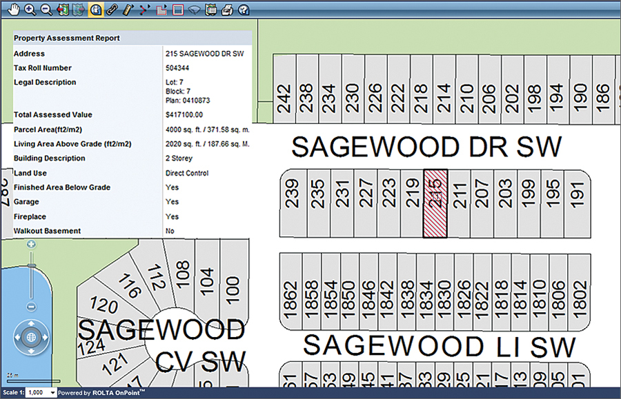
Example of public web mapping search for assessment values.
The current period of unsustainable growth in Airdrie began in 1997. Around that time, GIS became an acronym that city staff started to come across frequently, and by 2001, the city finally decided to invest in this new technology. This decision was made as it became increasingly obvious that GIS could enable the city to make more accurate business decisions and assist in dealing with the population and development growth that was being experienced.
The implementation phase of GIS at the city was initiated in 2001 and completed in 2003. Since 2002, the city has been using Esri technologies to support its GIS and is currently a subscriber to the Esri Small Municipal and County Government Enterprise License. At that time, however, GIS faced its first major operational concern—who would own it? There were many departments interested in GIS at the city, but finally, after much debate, corporate leadership determined that GIS would be a tool that could support the entire organization and therefore decided that GIS would sit in the information technology (IT) department. This wasn't a decision supported by everyone in the organization, but in light of the dependency of GIS on IT and its related infrastructure, this is, in actuality, the best place for it.
Following the implementation of GIS at the City of Airdrie, departments were able to justify new GIS-related positions based on Airdrie's increasing growth issues; however, this posed two major challenges to the GIS team. The first was that many of the individuals hired were ill equipped to offer the GIS support needed by their department, as they had only taken a GIS course or two and didn't fully understand the principles of GIS. The second was that some individuals began working alone in departmental silos without seeking support from the actual GIS team. Furthermore, these individuals began offering support to other departments, which resulted in significant confusion and conflicts with staff. To address this challenge, the GIS team, in collaboration with the rest of the organization, defined roles and responsibilities that all parties were able to agree on in an effort to properly support the city's GIS needs.
In recognition of the obstacles being faced by departments pursuing GIS initiatives, the GIS team developed a new method of customer engagement to be proactively involved, assigning a department to each GIS team member for which they would become the direct GIS support. Originally initiated as a pilot project with the parks department, this new approach started with four dedicated, on-site hours from a GIS specialist. At first, no one was sure how these visits would go, but after only a few weeks, it became apparent that the project could be considered a success, and it was soon rolled out to the rest of the organization. This model was so effective because it allowed the GIS specialist to witness the everyday operations of the parks department and find ways to use GIS as a tool to make those operations more efficient. Another benefit of this process is that it allows adaptability and customization per department. For example, while the parks department works well with four hours per week, the planning department prefers one, whereas public works requires even less time than that, and so on.
The implementation of the service model described above has also created a more organized and efficient environment for the GIS team. By having dedicated departments to support, there is less ambiguity over who is going to do what and when, which makes for a smoother response to requests. In addition, as demands for GIS resources increase and GIS staff reach their capacity, it is easier to justify the need for more staff and/or consulting dollars, as there is more tangible proof of the work being done. Lastly, all this has increased the team's customer satisfaction and engagement to a level better than experienced prior to the implementation of this service model.
Managing GIS during a time of growth has been very challenging. One would assume that, during a period of high population increase, obtaining funding would be easy; however, this has certainly not been the case in Airdrie. Since 2001, all aspects of the GIS program have been scrutinized on an annual basis, and the ability to secure adequate funding has relied directly on how effective budget justifications communicate the organizational need for GIS services. These needs are now being better demonstrated in the form of outcomes and deliverables so corporate leaders can clearly understand what they are investing in. Therefore, it is essential for GIS to deliver on its outcomes in order to justify additional resources and maintain corporate support.
An effective GIS program is built on the foundation of knowledgeable and skilled professionals, but it is the dynamics around people management that make staffing complicated. Staffing consists of more than just hiring and firing, as it involves discipline, recognition, rewards, and a strong organizational culture. In regard to the hiring processes, there have been challenges in the recruitment of skilled individuals. This has been mostly attributable to the economic boom in Alberta from 2002 to 2007, which reduced the pool of skilled GIS professionals that was available. Coupled with this, the financial benefits of working in the private sector have often placed the city at a disadvantage when recruiting staff. Unfortunately, this problem persists, but one method in which the city has attempted to overcome this disadvantage has been its commitment to an open and honest culture that fosters personal growth, development, and professional creativity. For the GIS team, this has resulted in only one cycle of significant staff turnover in the past 10 years. Ultimately, if you can make work a fun place to be and demonstrate that each person has the power to make valuable changes, people will want to work for you; at the City of Airdrie, this is where most success can be attributed.
Overall, it may not matter whether you are supporting a GIS in a municipality that is experiencing increasing or decreasing growth and budget pressures, as many of the difficulties facing GIS operations are the same. There remains a continuous need to justify how GIS adds value to the organization. This is a burden that every GIS professional has, and it is the knowledge, skills, experience, and creativity that each of us possess as GIS professionals that will help us meet the challenges of today and the future.
Recognitions
In 2009, the City of Airdrie was the recipient of the URISA Exemplary Systems in Government (ESIG) Award in the Single Process category for its development of the Online Census. In 2010, Airdrie's Tourist map, created by GIS specialist Jessica Letizia, won first place in the Best Cartographic Design in the Single Map Product category at the Esri International User Conference.
About the Author
Corey Halford, BSc, is the information technology team leader of Data Services at the City of Airdrie, where he is responsible for the management of the city's GIS program. In 2009, Halford was the recipient of the URISA Exemplary Systems in Government Award. He now sits on the ESIG Award review committee, and he is a graduate of URISA Leadership Academy. Halford is also president of the Prairies Chapter (Alberta, Saskatchewan, and Manitoba) of the Municipal Information Systems Association and chair of the Calgary Regional Partnership's GIS technical committee.
For more information, contact Corey Halford, information technology team leader, Data Services (e-mail: corey.halford@airdrie.ca).