Groundwater Resource Vulnerability Caught in Cedar Falls, Iowa
By Brian Gedlinske and David May
Highlights
- GIS work was performed to better characterize the hydrogeology of the Cedar Falls area.
- ArcGIS helped clearly illustrate that the aquifer is much more vulnerable to contamination than previously thought.
- A more accurate depth-to-bedrock representation relied on ArcGIS to compile information, interpolate data, and illustrate the findings.
The University of Northern Iowa (UNI) and the city of Cedar Falls, Iowa, rely heavily on groundwater from an aquifer underlying northeast Iowa. UNI extraction wells tap the aquifer largely as a source of once-through cooling water for its campus buildings, while Cedar Falls utilizes the aquifer as its municipal water source. Collectively, UNI and Cedar Falls withdraw over 4.5 billion gallons of groundwater from this aquifer each year.
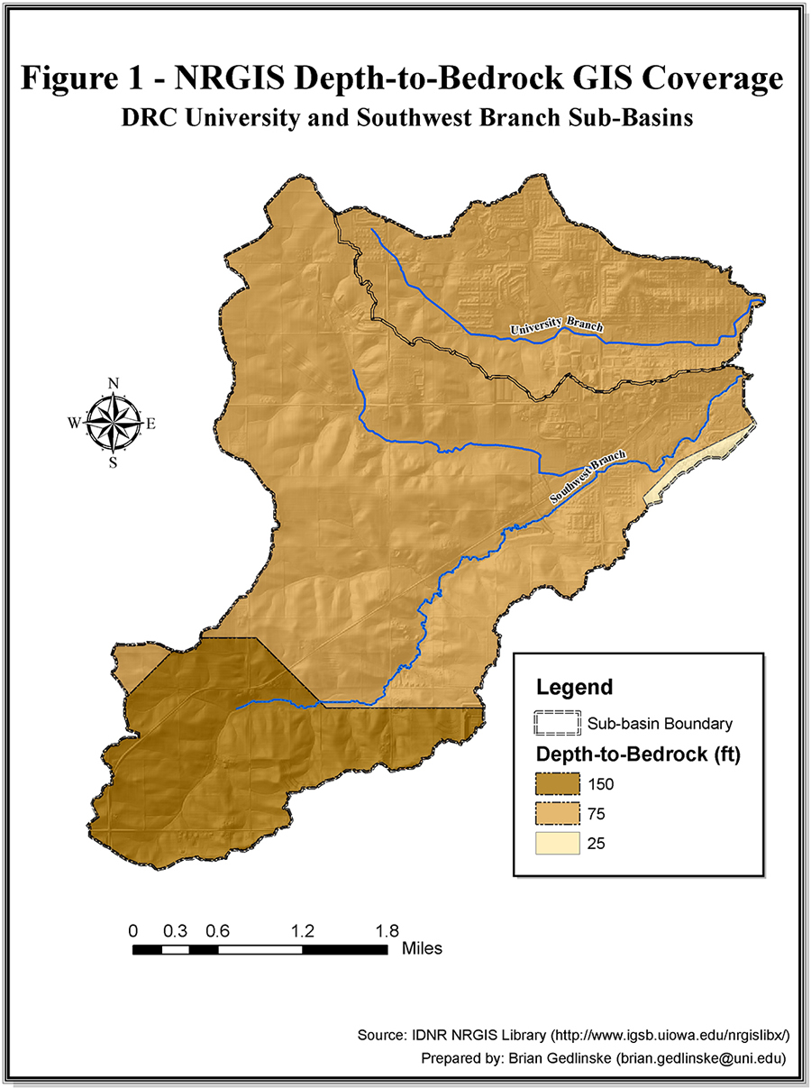
This generalized GIS data suggests bedrock depth ranges from 25 to 150 feet across the study site with 99 percent of the area overlain by at least 75 feet of Quaternary deposits.
The carbonate bedrock comprising the aquifer has typically been characterized as a highly productive groundwater resource protected or confined by overlying clay-rich till. This stratigraphic generality has led to an impression that the aquifer is not susceptible to most contaminant sources. Recent fieldwork, analyses of well logs, and representation of the new data in a GIS, however, clearly illustrate that the aquifer is much more vulnerable to contamination than previously thought.
The Study Area
Two adjacent subbasins within the Dry Run Creek (DRC) watershed (the University and Southwest Branch subbasins) constituted a study area in which detailed GIS work was performed to better characterize the hydrogeology of the area. Since its designation as an impaired water body in 2002, the DRC watershed has been the subject of numerous water quality studies. At best, these efforts provide only cursory descriptions of the area's hydrogeology. As a result, readily observable and significant aspects of that hydrogeology were omitted or misrepresented.
Data Collection, Analysis, and Interpretation Approach
As the thickness of an overlying confining layer (in this case, till) is often the most critical indicator of aquifer susceptibility to surface contamination, the GIS effort focused on developing a detailed depth-to-bedrock map of the study area. For comparison purposes in demonstrating how generalized data can be improved, a depth-to-bedrock map was also developed for the area using existing digital, geographically referenced data obtained from the Natural Resources Geographic Information Systems Library at Iowa Department of Natural Resources. This generalized GIS data suggests that the more ancient (Devonian) bedrock depth ranges from 25 to 150 feet across the study site, with 99 percent of the area overlain by at least 75 feet of more recent (Quaternary) deposits.
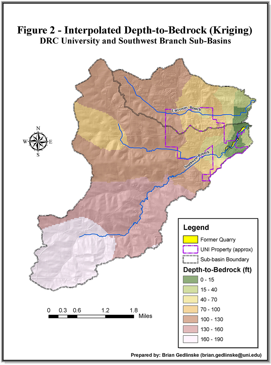
This illustrates the depth-to-bedrock map subsequently generated for the area. As shown, it conveys a dramatically different message in regard to aquifer susceptibility.
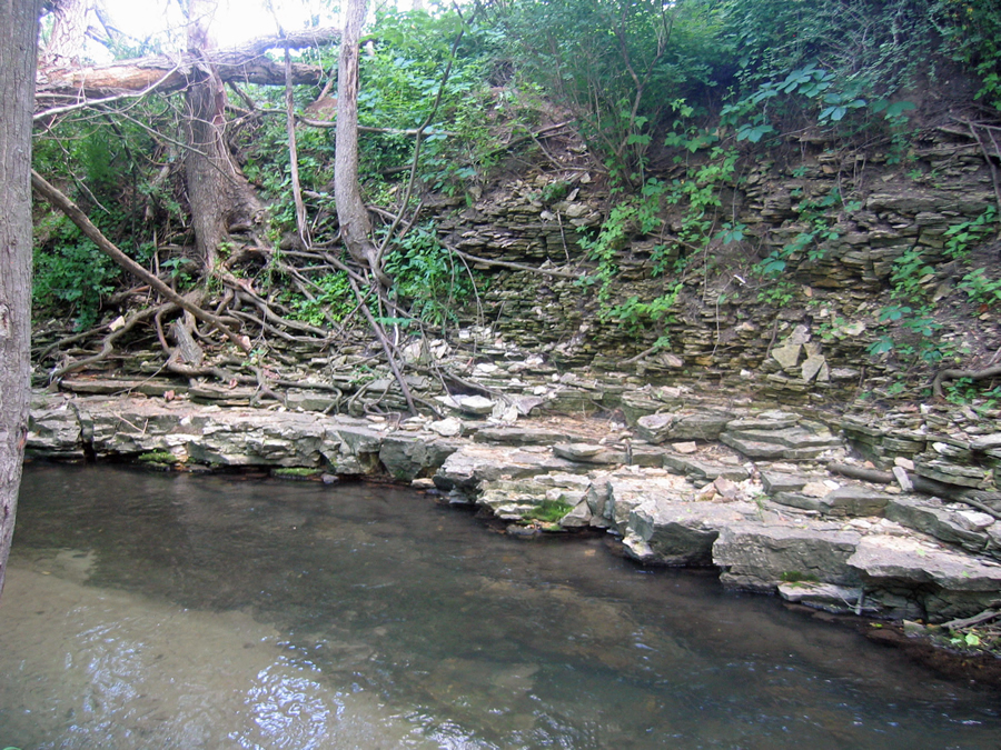
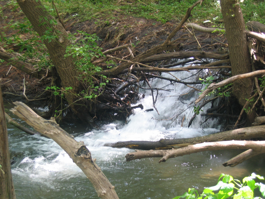
To develop an accurate depth-to-bedrock portrayal of the study area, a more detailed dataset was compiled for the area. Water-well drilling logs and boring logs associated with monitoring well installations that have been completed as part of environmental investigations were mined for pertinent data on the area's stratigraphy, hydrogeological characteristics, and specific yield information. Workers also performed a thorough review of historical literature. This review revealed significant but apparently forgotten or unrealized characteristics of the area including the presence of limestone (karst) swallow holes and bedrock quarry sites along the DRC channel. Finally, secondary data sources were complemented with GPS field mapping of significant features (i.e., well locations and bedrock exposures) found within the study area.
The effort to construct a more accurate depth-to-bedrock representation of the area relied extensively on ArcGIS to compile information, interpolate data, and illustrate the findings. This representation conveys a dramatically different message with regard to aquifer susceptibility. Data interpolation identifies a broad ridge of shallow bedrock along the DRC's Southwest Branch, a representation consistent with the bedrock exposures observed along the stream channel southeast of UNI's campus. Shallow bedrock, historical descriptions of the DRC as an ephemeral stream (caused by karst swallow holes), and groundwater-surface water elevation comparisons indicate a strong hydraulic connection between the DRC and the aquifer. Although a century of hydrologic alterations to the watershed (e.g., urban runoff, agricultural practices, cooling water discharge, and anthropogenic stream channel modifications) have transformed the DRC from a disappearing stream to a perennial tributary of the Cedar River, the aquifer undoubtedly remains more susceptible to surface contamination than typically alluded to in existing literature and generalized GIS datasets.
Implications and Conclusions
Dry Run Creek (DRC) watershed study area.
Results of this study clearly demonstrate why generalized depth-to-bedrock data and stratigraphic descriptions must be scrutinized and verified before being incorporated into local hydrogeological studies, aquifer vulnerability determinations, environmental sustainability assessments, or contemporary watershed-water quality work. Assumptions based on generalized descriptions or data may run the risk of causing and perpetuating mischaracterizations of specific sites. In turn, this may lead to false environmental conclusions, poor decision making and planning, and application of inappropriate water-quality regulations. The findings of this project demonstrate how readily available data resources may be used in a GIS to develop a more detailed and representative portrayal of the hydrogeology of an area and provide a more reliable basis for sound decision making and environmental planning, particularly with regard to source water protection, hydrogeology, and watershed assessment.
About the Authors
Brian Gedlinske is pursuing a master of arts degree in geography at the University of Northern Iowa. He is also an environmental specialist for the Iowa Waste Reduction Center, a small business environmental assistance branch of UNI's Business and Community Services division. Dave May is a professor of geography at UNI. He teaches physical geography, rivers, recent climate change, and a seminar on water resources.
For more information, contact Brian Gedlinske, environmental specialist (e-mail: brian.gedlinske@uni.edu), and David W. May, professor of geography, department of geography, University of Northern Iowa (e-mail: Dave.May@uni.edu).