Tailor ArcGIS Online to Your Organization
New Hosted Services Extend and Increase the Value of Your ArcGIS System
Maps published as a tile service include all the rich cartography that is part of the map.
Later this year, Esri will be enhancing the capabilities of ArcGIS Online to provide a managed infrastructure for organizing and sharing geographic information in the cloud. This infrastructure will give organizations the ability to store, manage, and host their mapping services, easily publish their geographic content, and off-load selected processing activities using cloud services. These new capabilities will not only help organizations share their knowledge and extend the use of their GIS but also enable them to meet the growing demand for their time and services by making geographic information available on demand and to self-serve customers through Esri's managed and secure cloud infrastructure.
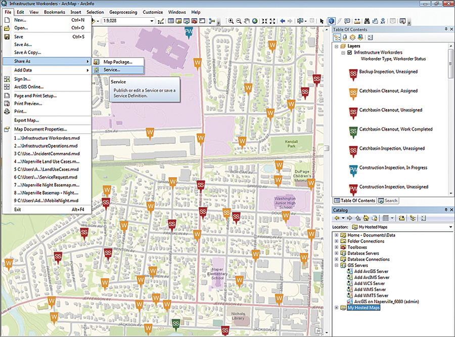
The managed infrastructure will be available through a fee-based ArcGIS Online subscription plan for organizations to publish their maps and data in the Esri cloud. It will give organizations the ability to provide web-accessible maps and data without the need for any server software or technical expertise. These web services, published as either feature or tile services, are managed and hosted in Esri's secure cloud environment. Access can be scaled elastically to meet demand without any effort on the organization's part. Organizations using this new infrastructure will significantly reduce content publishing obstacles and service management workloads. They will be able to focus on making maps, data, and GIS functionality available to anyone within the organization or the public.
An ArcGIS Online subscription will provide additional benefits not available to users who sign up for a free account. Organizations will be able to set up an account that is controlled and monitored by a designated administrator within the organization. The administrator manages and controls the content that belongs to the organization and can decide whether items are kept private, shared only with specific groups, or made public. The administrator also provisions user access and roles and can set up groups for collaboration and manage the groups' memberships and content. For example, an organization may wish to have 10 publishers as part of the account and 25 users. Publishers can author and publish hosted map services, whereas users can consume this content and use it to create and share new maps. Subscription management tools will be available to the administrator to monitor usage and storage of items that have been published to the cloud, such as the number of services and the storage capacity used. Organizations will also have the ability to personalize the look and feel of ArcGIS Online to fit their own brand. For example, an organization can set up a custom home page, add its logo, edit its name and description, decide what maps and apps should be featured in the galleries, and choose the default basemap that appears in the map viewer.
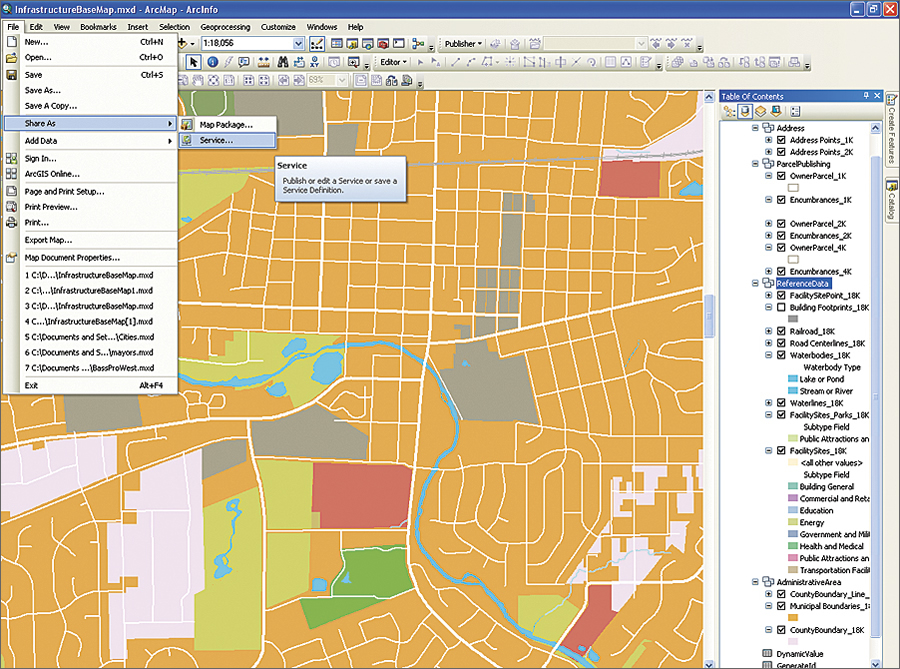
Publish maps created with ArcGIS 10.1 for Desktop as tile or feature services.
ArcGIS Online subscriptions will benefit organizations, especially those with limited resources, by simplifying access to maps and data and making it easy to publish and manage geographic content on the web. Subscribers will be able to quickly unlock their GIS data stored on local systems, enable its use and knowledge by anyone using cloud services, and expand their existing GIS into this new flexible and scalable environment.
The new functionality offered as part of the subscription will be accessible through ArcGIS 10.1 for Desktop and ArcGIS.com, on mobile devices, and with custom applications through the ArcGIS APIs. Once the product has been released, organizations will be able to purchase monthly or annual subscriptions based on the number of users, storage capacity, and page views.
ArcGIS Online subscriptions will be in beta this fall. Announcements of how to participate in the beta program will soon be available.