Amazonian States Map Threatened Borderlands
By David S. Salisbury, A. Willian Flores de Melo, Jorge Vela Alvarado, and Bertha Balb�n Ordaya
Highlights
- GIS provides a common language and shared framework regardless of national sovereignty or borders.
- Amazonian policy makers use ArcGIS to understand the geographic reality of remote borderlands.
- Scientists use ArcGIS to identify transboundary threats to Amazonian biologic and cultural diversity.
The 800 kilometers of boundary separating the Peruvian region of Ucayali from the Brazilian state of Acre crosses some of the wildest landscapes left on earth. The lush rain forests of this borderland region still resound with the low grunt of jaguar, while their canopy sways with acrobatic troops of woolly monkeys. Underneath the canopy roam hundred-strong herds of white-lipped peccary and the elusive and elegant ocelot.
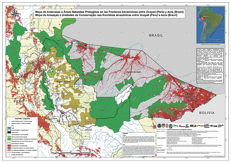
ArcGIS is used to create a thematic map showing threats to protected areas.
This biodiversity inspired parks such as the Sierra del Divisor, Alto Pur�s, and Chandless reserves, but these forests also hold humans. The "uncontacted" Mashco Piro, Murunahua, and Isconahua indigenous people still move stealthily through the trees, seeking no contact from outsiders or their goods other than the occasional machete. As these people migrate through their reserves and neighboring parks, other traditional peoples, such as the Ash�ninka, Yaminahua, and descendants of rubber tappers, live along neighboring rivers and adjacent lands. More recent arrivals include loggers, miners, and drug traffickers seeking to exploit these remote areas for high-value timber, minerals, and trafficking routes.
Improving Transboundary Planning
Recently, the Regional Initiative to Integrate South America has begun promoting a transboundary road that would bisect the forested borderlands and connect the two largest cities in the region, while the state governments seek to promote a direct ecological railroad alternative. Both transportation initiatives promise to alter forests and rivers and transform economies and cultures, but these projects also lack the base geographic information necessary to understand their potential transboundary impacts and benefits.
To improve transboundary planning, a grant from the Pan-American Institute of Geography and History was obtained to lead the Workshop to Integrate Data and Improve Technical Capacity to Mitigate Environmental Challenges in the Brazilian and Peruvian Amazon in June 2012.
The workshop used GIS as a common language and shared framework to bring together 16 GIS professionals from 13 institutions and two different countries to the National University of Ucayali (UNU) in Pucallpa, Peru. Each of the participants relied on ArcGIS in its home institution and brought work laptops to allow maximum flexibility for organic group work within UNU's Amazon Borderlands Research Center.
Bringing Diverse Areas Together
In the last decade, the Brazilian and Peruvian states have increasingly targeted the borderlands for conservation and development projects but with almost no knowledge of what lies on the other side of their respective boundaries. At the same time, the impacts of illegal logging and drug trafficking have spilled across borders, causing damage to the environment, local livelihoods, and diplomatic relations.
During this weeklong workshop, participants used ArcGIS to create a database and representative map integrating spatial data from both countries. However, before beginning the technical workshop, participants and invited speakers held a conference to educate the public and local policy makers on the importance of geographic information for conservation and sustainable development. Indigenous leaders, university professors, GIS technicians, nongovernmental organization directors, and government officials shared their insights:
- How ecological and cultural diversity permeate international boundaries
- How the environmental challenges on both sides of the boundary are similar
- How local and indigenous populations have been historically marginalized in the borderlands despite their local knowledge and leadership potential to reach transboundary sustainability goals
The conference ended with all participants empowered by the importance of the workshop in providing the information necessary to make informed decisions about natural resources management, development, and conservation along and across political boundaries.
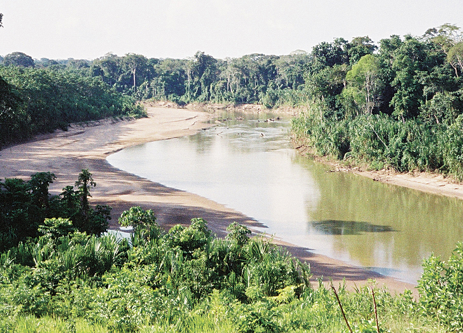
A river in the transboundary region.
A Common Platform to Standardize Management
Despite their enthusiasm, participants quickly faced numerous challenges, such as different spatial representations of their international boundaries; outdated national datasets; low-quality and missing geographic information; and data with variable scales, datums, and projections. Undaunted, the assembled GIS technicians utilized ArcGIS to standardize the best available data. The participants decided their efforts would focus on creating a capacity-building process and products for improved transboundary management rather than one flawless map. To this end, they divided into three mapmaking groups: threats, protected areas, and ethnogeography.
Each group contained representatives from both Brazil and Peru and used ArcGIS as a common language and arena to make the important decisions necessary for transboundary mapmaking. At the conclusion of the five-day workshop, the interdisciplinary team of participants named itself the Acre-Ucayali Transboundary Geography Working Group and held up three unique transboundary maps as examples of its craft and camaraderie. However, the greatest result of the workshop was the formation of a transboundary network of professionals taking the first step toward an integration based on geographic understanding rather than speculation and uncertainty.
To continue building on the workshop, the participants signed a document declaring their intention to meet annually to continue to build a transboundary network of geographic information interchange and improve the technical capacity to solve transboundary socioenvironmental challenges. A week following the declaration, the governor of Ucayali underscored the utility of the workshop by using the workshop maps in a presentation to Brazilian, Bolivian, and Peruvian delegates at a Pan-Amazonian seminar focused on tourism and commerce. A month later, the governor and his Brazilian counterpart in Acre signed the agreement of cooperation formalizing the interchange of geographic data across their shared border.
Sharing Data Across Boundaries
The ability to comprehensively share transboundary data across Amazonian boundaries at the state and local scales is unprecedented and marks a major advance not only for the governments, institutions, and universities involved but also—hopefully—for the indigenous peoples, landscapes, and species in the bioculturally diverse borderlands of Amazonia. Only with improved geographic data and transboundary GIS analysis can policy makers make the best decisions possible to mitigate transboundary threats to the Amazonian rain forest.
About the Authors
David Salisbury is an assistant professor of geography at the University of Richmond, Virginia; honorary professor at the National University of Ucayali in Peru; and member of the United States National Section of the Pan-American Institute of Geography and History. A. Willian Flores de Melo is an assistant professor in the Center for Natural and Biological Sciences at the Federal University of Acre in Brazil. Jorge Vela Alvarado is professor of agronomy and director of the Amazon Borderlands Research Center at the National University of Ucayali. Bertha Balb�n Ordaya is professor emeritus of geography at the National University of San Marcos in Peru and a member of the Peruvian National Section of the Pan-American Institute of Geography and History.
For more information, contact David Salisbury (e-mail: dsalisbu@richmond.edu, tel.: 804-289-8661).