More Exciting Than Ever, GIS Day Is Nearly Here
 Celebrated around the world, GIS Day is an annual salute to geospatial technology and its power to transform and improve our lives. It provides an international forum for users of GIS to demonstrate real-world applications that are making a difference in our society.
Less than a month from now, on Wednesday, November 14, thousands of users in more than 60 countries are expected to participate in about 600 events—either as hosts, attendees, supporters, or volunteers—demonstrating why GIS is so important to the world.
A new and improved GIS Day website is packed with features that will get you excited about GIS Day 2012 and make the tasks of finding, developing, and hosting events more fun than ever. The new features include the following:
- An interactive map showing GIS Day events around the globe. Register your event to promote it on the map. If you are interested in attending or volunteering at an event, you can easily find a GIS Day event near you.
- A resources page provides hosts with the items they need to promote events, including the GIS Day logo, customizable marketing files, and a PowerPoint template, as well as interactive map games, videos, and e-books.
- Our new, streamlined registration offers event hosts a quick and simple registration experience. Plus, all registered events will receive complimentary GIS Day giveaways, resources support, and a place on the Events Map.
- A downloadable video is available for hosts to use to demonstrate the many uses of GIS to a non-GIS audience.
- A Flickr photostream of successful past events submitted by hosts around the world can be viewed.
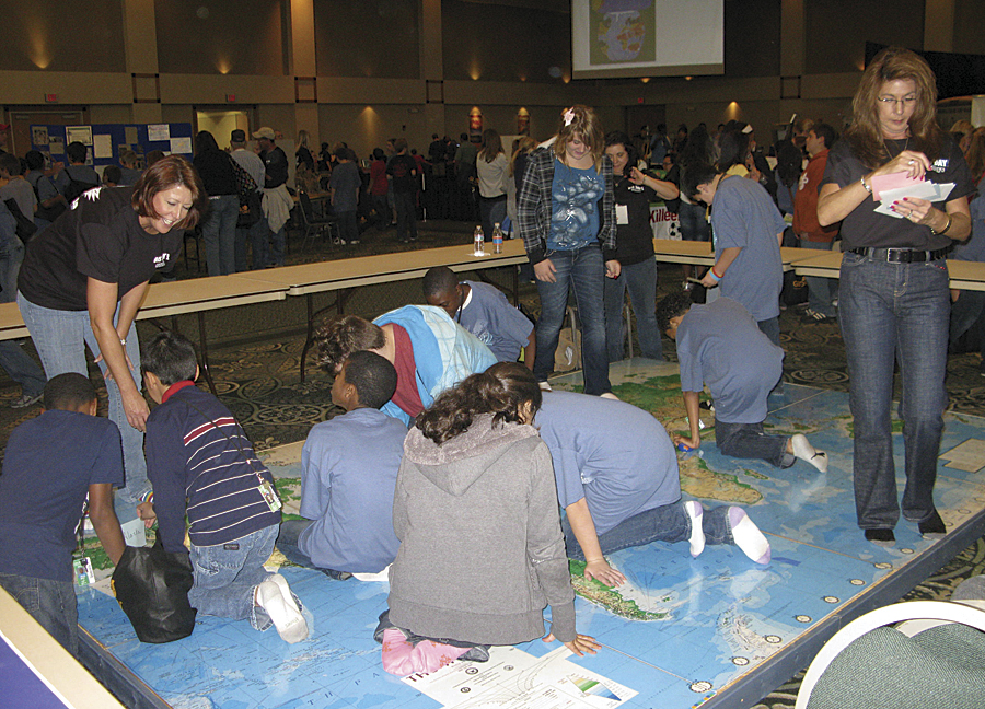
Students enjoy a challenging geography exercise as they explore a large floor map of the world on November 17, 2010, at the Killeen, Texas, Civic and Conference Center.
City of Killeen, Texas
"The new GIS Day website seems more intuitive and responsive and has a modern, easy-to-look-at appearance," observes Colen Wilson, GIS manager for the City of Killeen, Texas. "The content feels like it contains more in less space. It's arranged to provide a consolidated approach with commonsense access and a slick look and feel."
Wilson should know. Killeen has been hosting GIS Day events since 2006. The city's celebrations have grown into what he believes is "the largest single-day student-attended GIS Day event in the world" (based on attendance records of registered GIS Day events provided by Esri staff).
Students enjoyed a challenging geography exercise as they explored a large floor map of the world on November 17, 2010, at the Killeen, Texas, Civic and Conference Center.
Killeen's GIS Day 2012 will be big again, projecting 1,350 student attendees, 30 booths, and the Big Canyon Balloon Show from Trinity Science Solutions.
Wilson observes that the redesigned GIS Day website has really facilitated planning.
"The registration section provided a simple process and was a breeze to get through," he says. "The resources links are extremely valuable and available in one location."
Montserrat
The little Caribbean island nation of Montserrat hosted GIS Day events every year from 2006 to 2010.
"We missed last year for financial reasons," acknowledges Lavern Ryan, GIS manager for the Montserrat government. "But this year, we are hoping to put it on again because we've just launched our online mapping facility called Montserrat Land Info. Our GIS Day this year will promote that website."
As in the past, Ryan and her staff plan to interact with the general public, children, and users—this time employing the GIS Day event as a stepping stone that will lead to the government providing information in the cloud.
First, there will be a morning open house held within the government planning offices for people invited from various government departments; utility companies; and real estate, architecture, and other commercial groups.
Then Ryan and Rondell Meade, a GIS technician, will go into the schools to conduct GIS sessions with students. As before, they plan to work mainly with children from grade six who are leaving primary and entering secondary school, as well as those leaving secondary school to go into higher education.
Ryan expects a turnout similar to that in 2010, when GIS Day was well attended and a big success. Whether the audience is adults or children, she terms GIS Day useful "across the board because we can talk about what GIS can do and how it can benefit each person who uses it."
Canada
Thousands of miles north of the island of Montserrat, Canadians likewise have a passion for GIS Day.
"GIS Day gives us the opportunity to show our clients the numerous successful applications of GIS within our municipality," says Marianne Murphy, manager-GISS, Halifax Regional Municipality. "It allows us to engage them in our products and services and demonstrate what GIS can do for them."
At the University of Ottawa, Dr. Barry Wellar, professor emeritus of geography and environmental studies, terms GIS Day "a major event. It provides a fun and interactive setting for our students and the community to learn about GIS and facilitates insightful discussions about the role of GIS in our lives."
Missouri Geographic Alliance
The Missouri Geographic Alliance, led by coordinator Shannon White, plans GIS awareness events throughout the year to bring attention to geospatial technologies.
This year, it wants more professionals and the Missouri GIS Advisory Council to do GIS in their local communities, especially going out into schools. The council supports and helps guide Missouri's geospatial program statewide. Its members represent a cross section of organizations, including counties, cities, universities, businesses, nonprofit organizations, and federal and state agencies.
"We think that's where the next generation of users will come from because they're going to learn about it there," says White, a PhD geospatial extension specialist in the University of Missouri's Department of Geography in Columbia, Missouri.
Of the GIS Day website's new look and functionality, White says, "The best thing is the resources for hosts page—by far, hands down—for any GIS professional who is a little bit intimidated about presenting about GIS. You can take some of the PowerPoint slides and then customize them for your own purposes. I think that's a wonderful, wonderful resource."
White also likes the Events Map: "All of a sudden, you start to see yourself on the map, so that's a great thing—because as mapping professionals, we should be showing ourselves on the map."
For more information on GIS Day and how to host an event, visit gisday.com.