Origins of the Canada Geographic Information System
By Roger Tomlinson
This article has been paraphrased from Roger Tomlinson and M. A. G. Toomey, "GIS and LIS in Canada," chapter 15 in Mapping a Northern Land: The Survey of Canada 1947-1994, Gerald McGrath and Louis Sebert, eds. (McGill-Queen's University Press, 1999).
At the heart of the innovations that led to the Canada Geographic Information System was the fundamental idea of using computers to ask questions of maps and to render useful information from them. To do this, maps had to be in digital form. This led to the idea that many digital maps could be stitched together to represent the whole of Canada and that the maps could be linked intelligently to digital databases of statistics, such as the Census. Fifty years later, this brief article recalls the people, organizations, and circumstances that gave rise to these original ideas, and how the ideas played out.
In 1960, Spartan Air Services of Ottawa, Canada, was a large surveying and mapping company whose business included topographic mapping, geophysical surveys, land resources surveys, and other projects worldwide. Some projects required manual analysis of mapped data. However, since manual analysis was almost as costly as the surveys themselves, not infrequently the proposals for map analysis were rejected by both clients and Spartan's management because they were too costly.
George Brown, chief of Spartan's land resources division, permitted me to try digital methods as a potentially cost-effective alternative. I created two small test maps in numerical coordinate form—each 5 x 5 inches and containing five polygons. I found that these could be digitally overlaid and that I could measure the resulting areas from the digital record.
Efforts to interest Ottawa computer companies (Computing Devices of Canada, IBM, Sperry, and Univac) to partner with Spartan for future development were not successful. However, in 1962, at an ASPRS conference in Washington, DC, John Sharp, a consultant to IBM, introduced Spartan to the digital photogrammetric research being done at IBM in Poughkeepsie, New York, in the United States. That, along with subsequent contacts with the previously reluctant staff in the IBM office in Ottawa, was the beginning of a pivotal relationship that was to grow significantly over the years. IBM brought early experience with computers and programming to the table. I brought an understanding of the needs, as well as the geographical training needed to formulate the new concepts and to spell out the requirements for the system.
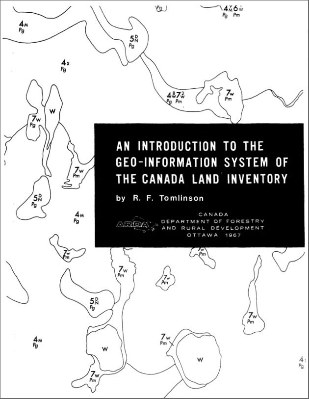
The term geo-information system or Geo-IS first appears in the 1967 paper shown here.
Another pivotal encounter was a chance meeting with Lee Pratt in 1962. Canada had recently passed into law the Agricultural Rehabilitation and Development Act. That legislation created a need for an inventory of land use and land capability across Canada. Thus was the Canada Land Inventory (CLI) established in 1962. Pratt was the new head of the CLI. The CLI planned to create about 1,500 maps of the commercially productive parts of Canada at scales of 1:50,000 and 1:250,000. These were to show the capability of land for agriculture, forestry, wildlife, and recreation, as well as present land use and the boundaries of census subdivisions. Like Spartan and me, Pratt and the CLI faced the problem of how to efficiently analyze a large number of maps. The idea of using computers to do this was very attractive.
Pratt urged me to write a paper entitled Computer Mapping: An Introduction to the Use of Electronic Computers in the Storage, Compilation and Assessment of Natural and Economic Data for the Evaluation of Marginal Lands. I presented the paper to the National Land Capability Inventory Seminar in Ottawa in November 1962. It was well received. The Department of Agriculture subsequently awarded a contract to Spartan to carry out a technical feasibility study for the CLI. The outcome of that study was the Feasibility Report of Computer Mapping System that I prepared and delivered to the Agricultural Rehabilitation and Development Administration (ARDA) in August 1963.
In retrospect, the feasibility report seems remarkably prescient about the functional requirements of a comprehensive GIS. The system's purpose was to enable analysis of geographic data over any part of a continent-wide area. Results were to be provided in tabular or map form, or both. Many different kinds of maps needed to be put into the system. The report specified a seamless, nationwide data structure. The recommended structure separated the descriptor data (attributes) from image data (points and polygon boundaries). The report addressed the task of converting many maps to digital form. The need for various data inputs optimized for different data types was anticipated, including automated scanning for polygon boundaries, digitizing for selected points as identifiers inside the polygons, and keypunching for descriptor and statistical data. These data types were to be input separately and linked logically later. The coordinate system requirements were examined, and the concepts of error in subsequent area calculation considered. Image data compaction requirements were identified to reduce data volumes to be stored on magnetic tape. The need to combine socioeconomic data with mapped data was also prescribed. Data analysis capabilities included area measurements and multiple topological overlays. The vision of a comprehensive GIS is clearly evident in this report.
The Department of Agriculture (Pratt and Al Davidson) accepted the proposal and awarded contracts to Spartan and IBM to develop the system. I was asked to join the ARDA team and direct system development. More than 40 people worked on the development teams throughout the rest of the decade. One key contributor was Guy Morton, who devised a brilliant tessellation schema that was fundamental to the system data structure. The schema is now known as the Morton Matrix. Don Lever was responsible for most of the logic and for converting the scanner data to topologically coded map format. Bruce Sparks and Peter Bed�rd developed the system's edgematching capability. Art Benjamin designed the links between image data and descriptor data. Bob Kemeny developed the map data compaction methods using the eight-directional coding originated by Galton and later called Freeman codes. Frank Jankaluk devised the reference coordinate system and error calculation algorithms. Bob Whittaker designed the system for error correction and updating. Peter Kingston designed the data retrieval system and the polygon overlay process. Also incorporated in the system were map projection change, rubber sheeting, scale change, line smoothing and generalization, automatic gap closing, area measurement, dissolve and merge, buffer generation, and new polygon generation, all operating in the topological domain. A very important part of the system was a computer command language that recognized geographic analysis terms that could be understood by a wide range of potential users. The command language was designed by Peter Kingston, Ken Ward, Bruce Ferrier, Mike Doyle, John Sacker, Frank Jankaluk, Harry Knight, and Peter Hatfield.
The Canada Geographic Information System (CGIS) gave rise to several developments in cartographic instrumentation. D. R. Thompson at IBM in Poughkeepsie engineered the first cartographic-size digital scanner specifically for the project. It was delivered in 1967 at a cost of approximately $180,000 and worked well for 15 years until replaced by a newer model. The original is now in the National Museum of Science and Technology in Ottawa.
Another technical innovation was the first high-precision 48 x 48 inch free-cursor digitizing table ever produced. Ray Boyle, then working for Dobbie-McInnes (Electronics) Ltd in Scotland, designed and built these especially for the CGIS.
Names matter, so it seems worthwhile to reflect briefly on the origins of the term geographic information system. Though the original proposal to the CLI was entitled "computer mapping," that term seemed inappropriate by the end of 1963. At that time, we referred to the system as the ARDA Data Coordination System. As time went on, we considered various alternatives. The term spatial data system seemed too general, and the term land information system too restrictive considering the data types that were to be involved. The term geo-information system or Geo-IS eventually came into use in the office and appears in a 1967 paper entitled "An Introduction to the Geo-Information System of the Canada Land Inventory." Finally, we settled on the term Canadian Geographical Information System, which a wise politician in the cabinet shortened to Canada Geographic Information System to reflect the then-popular use of Canada as a synonym for the federal government.
The first published uses of the term GIS may be a 1968 paper prepared for the Commonwealth Scientific and Industrial Research Organization (CSIRO)—Australia's national science agency—entitled "A Geographic Information System for Regional Planning" and in a film produced that same year by the Canadian Film Board called Data for Decisions. On reflection, the name perfectly defines the system's capabilities. It has since been widely adopted for many other systems worldwide.
See also "The 50th Anniversary of GIS."