Spring 2002
Spring 2002 |
|||||||
|
|
|||||||
GIS Used Throughout the Program
Federal Highway Administration Encourages Use of High-Resolution Aerial and Satellite Imagery |
|||
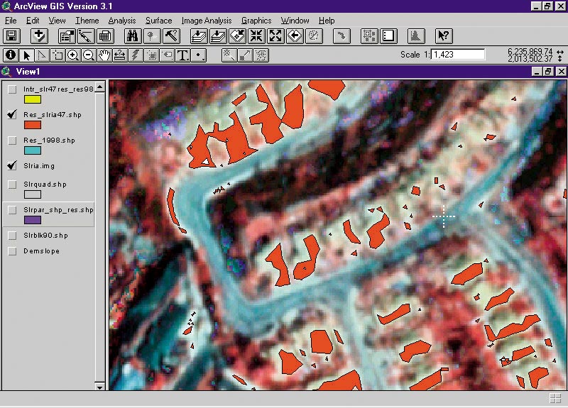
The Federal Highway Administration (FHWA) of the U.S. Department of Transportation (DOT) supports metropolitan planning organizations (MPOs) and state DOTs in their efforts to build and maintain our nation's highways. In 1997, FHWA initiated a research program to support MPOs and state DOTs in their use of aerial and satellite imagery in forecasting and modeling demands for new and upgraded roads. This presented a shift away from the use of historical imagery, which was used during the final design process of highway construction. While the research program pointed out the utility of the satellite data due to its broad regional coverage, its timeliness, and its multispectral content, it also showed the need for increased spatial resolution to enable identification of smaller features, thereby increasing the utility to transportation planning applications. As it happens, recently launched commercial imagery satellites provide that higher resolution data. This imagery data provides geometrically corrected aerial imagery with resolutions ranging from one meter to less than one foot and can be used in a number of transportation planning applications including
The full integration of high-resolution imagery data, however, will not occur overnight. FHWA believes that the growing availability of high-resolution imagery data in itself will not necessarily result in better DOT forecasts and models. In many cases, the availability of this new imagery data may place additional analytical stresses on MPO and state DOT staff, the result being that these new imagery sources could go unused. Some of the issues that prevent the widespread use and integration of this data by transportation planners include lack of understanding of the applications using these data, lack of land use classification guidelines, lack of technical staff to process the data into a form for use in planning activities, and data costs and funding issues. What was needed was additional training, increased user awareness, and support. FHWA issued a request for proposals in 1997 through its Small Business Innovation Research (SBIR) office to develop a program to further encourage the use of imagery and broaden the acceptance of imagery for transportation applications. Shenandoah Mountain Geographics, an Esri Business Partner, won the SBIR award. During the user requirements analysis stage of the SBIR program, Shenandoah Mountain Geographics determined that transportation planners need information to support demographics analysis and information to support change over time. Case studies were initiated to extract buildings from imagery and to identify change using multidate imagery. Esri software products were used throughout the program in conjunction with ERDAS IMAGINE. ArcGIS was used as a data manager to manage the image layers and map layers used in the analysis. ArcGIS templates were instrumental in managing the nearly 50 change areas identified in the analysis. ArcGIS was also used to produce publication quality graphical output. The ArcGrid extension proved especially helpful in conjunction with the Fragstats software package available from Pacific Meridian Resources (now Space Imaging Services, an Esri Business Partner) to support area change statistics and numerical analysis for the changes observed in the studies. The coDmpatibility of Esri products with ERDAS IMAGINE provided significant benefits in image analysis, integration with vector data products, analysis, and display. In addition to the case studies, training was implemented, heightening user awareness. These efforts satisfied the requirement and the mission of the U.S. DOT, and Shenandoah Mountain Geographics is currently implementing the Phase II SBIR, the documentation and analysis of the case studies. For more information, contact Bruce Kiracofe at Shenandoah Mountain Geographics, 5520 Connecticut Avenue NW, Suite 202, Washington, D.C. 20015 (e-mail: bkiracofe@shenandoahmountain.com, tel.: 202-237-8133, fax: 202-244-4951) or visit www.shenandoahmountain.com. |