 |
The number of interactive mapping sites has exploded as more organizations realize the power of online mapping. In each issue of ArcNews, we give readers a glimpse of some of the many new Internet locations powered by Esri software. Links to these and other Web sites powered by Esri technology are at www.esri.com/imssites. To have your site considered for mention in this column, send a description of the mapping site and the URL to www.esri.com/imsregistry.
Lewis and Clark Information System
www.lewisandclarkeducationcenter.com/map.htm
In preparation for the Lewis and Clark bicentennial celebration in 2004, the University of Montana Lewis and Clark Education Center maintains a Web site that offers spatial data related to the expedition. This ArcIMS site gives users the option of choosing maps at a continental or regional scale. Both scales offer a variety of map layers, and the regional maps feature campsites along the trail. Some of the campsites have the explorers' journal documents associated with them.
Map Milwaukee
www.gis.ci.mil.wi.us
Map Milwaukee garnered recognition last year from both Civic.com and the American Planning Association for its use for disseminating public information and as a city development tool. Built with ArcIMS, the application offers a comprehensive spatial database with layers of information about site location, zoning, parcel data, and property ownership. Businesses and developers use the site for planning and permitting of new and remodeled buildings in Milwaukee.
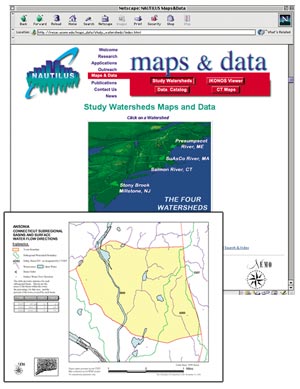 Nautilus Nautilus
resac.uconn.edu
The maps and data section of NASA's Northeast Regional Earth Science Applications Center at the University of Connecticut (see right) offers easy access to data and visualization tools for four watershed studies. Land use planners and decision makers who are concerned about urban sprawl in these areas from Maine to New Jersey will find the ArcIMS mapping capabilities available at the Web site critical to their work. The GIS data sets, such as estimates of impervious surfaces for water quality management, aquifer protection zones, soils, and aerial photos, have been typically unavailable to local officials and organizations. The site also serves IKONOS satellite imagery.
SacSites
www.sacsites.com
With the goal of attracting new Businesses to Sacramento and responding to existing Businesses' requests, the City of Sacramento's Economic Development Department has joined with several other City departments and the local utility district to develop an Internet application that provides immediate access to critical Business and development information. SacSites is a one-stop shop that combines data used by site selectors such as economic, planning, utility, geographic, and demographic information. Using ArcIMS, the Business development application also functions as a parcel viewer and planning tool. Users can find locations by address, intersection, parcel number, and point of interest, and tabs at the top of the screen organize the layers by department and topic. The application calculates demographics for three distances around a given point, and it calculates percentages on the fly. Users can edit the information about opportunity sites online, add new sites, and upload photos, PDF files, and word documents. There's also an extensive resource center, which links Business developers to important information such as land use plans, forms and applications, and loan and incentive programs.
South African Coastal Information Centre
sacoast.uwc.ac.za
This site promotes sustainable coastal management and protection in South Africa by enabling users to access resources within the Coastal Management Office and other offices of the Department of Environmental Affairs and Tourism. Built around ArcIMS, this neatly organized and visually appealing spatial library, which was voted Site of the Week by GIS.com last June, offers maps, audio interviews, three-dimensional flyovers, VRMLs, and digital videos.
Tampa Bay Pilot Study Interactive Mapping System
gulfsci.usgs.gov/ims/index.html
The Tampa Bay Integrated Science Pilot Study is a collaborative science effort between the U.S. Geological Survey and other federal, state, and local partners. It addresses some of the most pressing societal and ecological problems of the Tampa Bay estuary and will serve as a template for research projects in other estuaries of the Gulf of Mexico. Another ArcIMS site, the Tampa Bay application provides access to spatial data related to this Florida estuary. Visitors to the site can view, query, and analyze maps with a variety of themes such as habitats, land use, study areas, and jurisdictional boundaries.
|