Spring 2002
Spring 2002 |
|||||||
|
|
|||||||
Wonder Inevitably Follows
Teaming GIS Technology with Experience-Based Lessons |
|||||
|
By Kathleen M. Haskin, Curriculum Specialist, Frost Valley YMCA Environmental Education Center
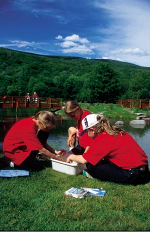
Typically, outdoor environmental education is an activity-based experience. Concepts and lessons about the natural world (primarily natural sciences) are brought to life through direct experience and movement metaphors, that is, elaborate role-playing activities that illustrate predator/prey relationships or complex natural systems. These place-based teaching techniques are well established in the environmental field, driven by the students' desire to investigate one specific natural location, such as a stand of trees. Unfortunately, these hands-on methods utilized in outdoor environmental education lack the capacity to investigate extensive natural communities, such as the forests of the Pacific Northwest. Therefore, exploring large geographic units has often been set aside for indoor classroom-based lessons, until now. Today, GIS technology is bringing new perspectives and views of the world into environmental education. Environmental scientists have long used computer-based technologies in their work visualizing and monitoring global environmental change, or as ecologist Paul Shepard phrases it, to "manage the tempo of alteration." As environmental education strives to incorporate in-depth project-based experiences with hands-on learning, GIS and other computer technologies are bridging the gap between indoor and outdoor classrooms. "GIS allows us to view the forests as well as the trees," notes Mark Becker, GIS project manager at the Center for International Earth Science Information Network at Columbia University. Becker also works with the Frost Valley, New York, YMCA, an environmental education center taking a lead in incorporating technology into outdoor environmental education. The Frost Valley YMCA Environmental Education Center took its first steps toward technology back in 1998 by creating a state-of-the-art technology lab at its 6,000-acre Catskill Mountain facility. The Luke Roehm Technology Lab, designed by Becker and Dave Scherf, Frost Valley's environmental sciences coordinator, includes PC workstations, plotters, digital cameras, GPS units, and Esri mapping software. "The lab, along with its software, have been valuable tools for us," comments Scherf. "It has enabled us to make the connection between environmental sciences and environmental education." In addition to hosting in-depth environmental research on-site by entities such as the United States Geological Survey, the Institute of Ecosystems Studies, and Cornell University, Frost Valley is working toward introducing more of these science technology tools into the teaching practices of environmental education.
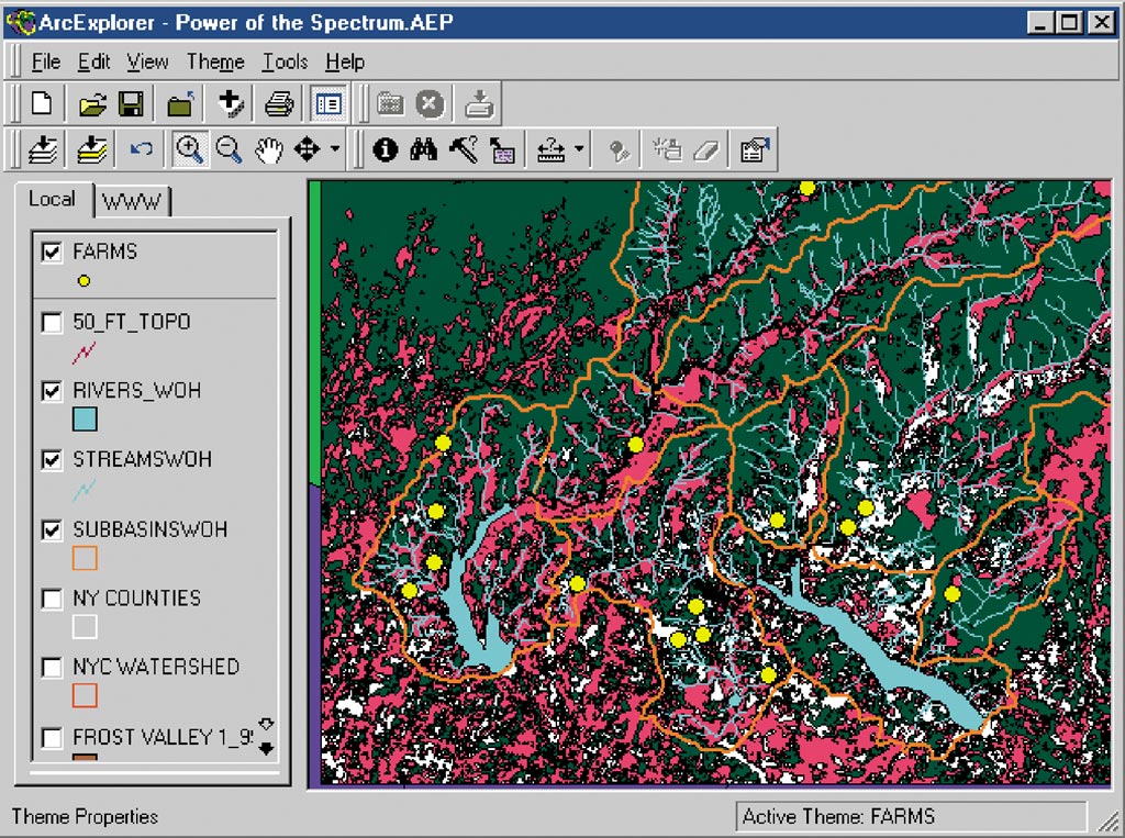
In April of 2001, Frost Valley released its most recent watershed education curriculum, More Ways of the Watersheds (coauthored by Mark Becker and Kathleen Haskin). This innovative curriculum incorporates hands-on/minds-on activities with technology-based learning experiences, exploring topics in forestry, agriculture, and wastewater issues. The technology lesson plans in More Ways of the Watersheds investigate the subjects through carefully designed GIS projects correlating natural and cultural systems. The projects and lesson plans presented in this teacher's guide utilize Esri's ArcExplorer software, investigating the areas of interest through both vector and raster images. "Computerized mapping coupled with experience-based lessons have given our students a full view of the forests, taking into account both time and space through comparative temporal GIS projects," comments Frost Valley's John Haskin, associate executive director of programming. To take a group of students from a natural area in which they just measured many of the trees to a technology lab in which they can then access a remote image of the entire Catskill Forest, makes that connection between what they experience and what they learn from a distance. In outdoor education, instructors give their students magnifying glasses in order to take a closer look at something, just as astronomers use telescopes to bring a view of the heavens closer. Today, technology education reverses that perspective, taking a closer look from afar. Far-off satellites bring images of vast areas into perspective, taking the knowledge of complex natural systems the student explored outdoors onto a screen in the computer lab. Utilizing the Roehm Lab and Esri's Data Automation Kit, ArcPress, ArcExplorer, and ArcView software, the Frost Valley educational staff have opened a world of images to students of all ages. Programs at the lab have included community-based youth projects and presentations as well as university, middle school, and high school educational opportunities. Adding to the Layers of Environmental EducationFrost Valley has also highlighted its GIS curriculum at its own international environmental education training, demonstrating that the sound of discovery "Ahh . . . !" crosses into other languages. Frost Valley's homeschooling and intergenerational elder hostel classes have adults side by side with their children at the monitors, teaming knowledge and experience with youth's comfort with technology. What a great feeling to instruct the group to open the map image and select the first layer from the table of contents. Wonder inevitably follows, despite cultural and generational boundaries. Environmental educators teach in the present, preparing students for the future. As Winston Churchill once noted, "The further away from something one gets, the further into the future one sees." Blending outdoor environmental lessons with GIS technology provides a mixture of education and science to challenge students' perspectives both locally and globally. Whether using a field guide or a database, the strength of the curricular tools is measured through the life actions of the students. The impact of Frost Valley's educational methodologies will come into focus soon, as today's students grow to become tomorrow's leaders. For more information, visit www.frostvalley.org or write to Frost Valley YMCA, 2000 Frost Valley Road, Claryville, New York 12725. |