Spring 2002
Spring 2002 |
|||||||
|
|
|||||||
Wisconsin's Historic Preservation Management Now Done Via the Web |
|||||
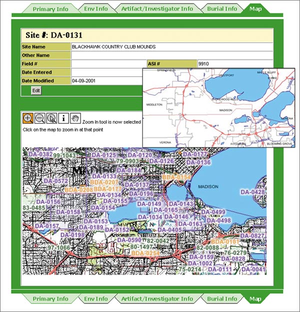
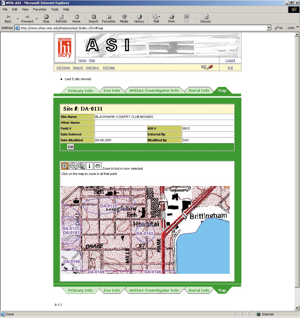
Every time a proposal for land development is made in the State of Wisconsin, the Division of Historic Preservation at the Wisconsin Historical Society (WHS) must examine it for possible impact on sensitive historical and natural resources. With more than 150 years of recorded land information to sift through each time a proposal is submitted, quick access to appropriate data is imperative. In the past, hard-copy maps and four independent databases of information using different database technologies (one each for archaeological sites, architectural sites, survey reports, and compliance tracking) had to be maneuvered each time a proposal was reviewed. While the staff could access some databases directly, they had to log onto a different system to access others. After years of interface development by different staff, students, and volunteers, the cobbled-together system started breaking down more frequently as new operating systems and networks were installed. With a grant from the Wisconsin Department of Transportation to implement technology advancements, the WHS enlisted Esri Business Partner GeoAnalytics, an information technology consulting and application development company, to build an integrated system where all applicable data could be viewed on the Web. "Utilizing the Internet for map viewing and data access and distribution will streamline our operations significantly," says Robert Birmingham, the State archaeologist. "Agencies will be able to enter into a secure site, view information their projects may impact, and more effectively communicate with us on how best to proceed with compliance reviews." Moving into the 21st CenturySince 1846, two years before statehood, the WHS has been recording historical information--first on paper, then to mainframes of the 1960s and desktop software systems of the 1990s, and now via a customized Web-enabled application based on Oracle 8.1.6, ColdFusion, Java programming, and ArcIMS. "We wanted to provide a technically robust, easy-to-use solution to speed up compliance time while maintaining accuracy," says Anita Temple, planning and GIS analyst at GeoAnalytics. "Making the process Web-based was the ideal solution." Technical SolutionsTo clean up the databases, the WHS purchased Oracle 8.1.6 into which all data has been converted or migrated. Significant effort went into cleaning up orphan records, duplications, and errors during the migration. Unifying the four databases into one allows staff members to access all relevant data via the same system. Read-and-write access is controlled through user login and encrypted password security.
Then the archaeological staff was trained in ArcView basics to learn how to transfer data from hard copy to digital form (heads-up digitizing) and establish quality assurance and control procedures. Learning new computer skills wasn't trivial. Archaeologist Diane Holliday comments, "Before the training, I was a techno-peasant. But in just a few short months, all of the more than 30,000 archaeological sites and several thousand survey and Euro-American burial sites were digitized in ArcView using USGS digital topographic quads as background reference." Finally, since each historic preservation group has its own Business function and data, each group has its own Web-based application. Each application has custom search capabilities based on what each group needs to find during their activities. For example, the architectural staff typically ran searches based on building addresses, while the archaeology staff searched via township, range, and section information. Each application has the functionality to add, update, or delete data or records and display a graphical map with buttons to pan, zoom, and query. The ArcIMS mapping capability provides users with a quick view of all mapped data to immediately determine whether protected archaeological or architectural sites are present. This helped the compliance office establish whether the project required internal review or not. Saving TimeNow, when agencies call or send in proposals, the WHS staff can respond in a fraction of the time they used to spend searching for information. For the first time, they can see their efforts graphically on a map for decision making, visual analyses, and reports. With everyone utilizing the same technology platform as a cohesive unit, the division can react as one entity, providing better services. Birmingham sums it up this way: "By implementing Web-based solutions, we've migrated to the current state of technology and can provide maximum service to agencies, staff, and consultants on sensitive protected archaeological and architectural sites in the State." For more information, contact David Prohaska, GeoAnalytics, Inc., 1716 Fordem Avenue, Madison, Wisconsin 53704 (tel.: 608-241-7100, fax: 608-241-7116, e-mail: dprohaska@geoanalytics.com). |