Spring 2003
Spring 2003 |
|||||||
|
|
|||||||
The City of Greenville, Texas, Approaches Brownfields With GIS |
|||||||||||
The city of Greenville, Texas, located 45 miles northeast of Dallas, Texas, was incorporated in 1850. With the arrival of railroads in 1880, access to agricultural markets opened up much of the area to farming. Greenville grew quickly from a town of a few hundred to several thousand. Cotton was the primary catalyst for this rapid expansion. Greenville's cotton compress became the largest inland press in the world and was so highly regarded by the spinners of Manchester, England, that growers soon shipped cotton from many miles away to the Greenville press to get the Greenville marking. For the past 50 years, however, much of the commercial, retail, and industrial development has shifted away from the central downtown areas toward Interstate 30. This shift has resulted in a steady abandonment of the downtown area, leaving many buildings vacant and in a state of disrepair.
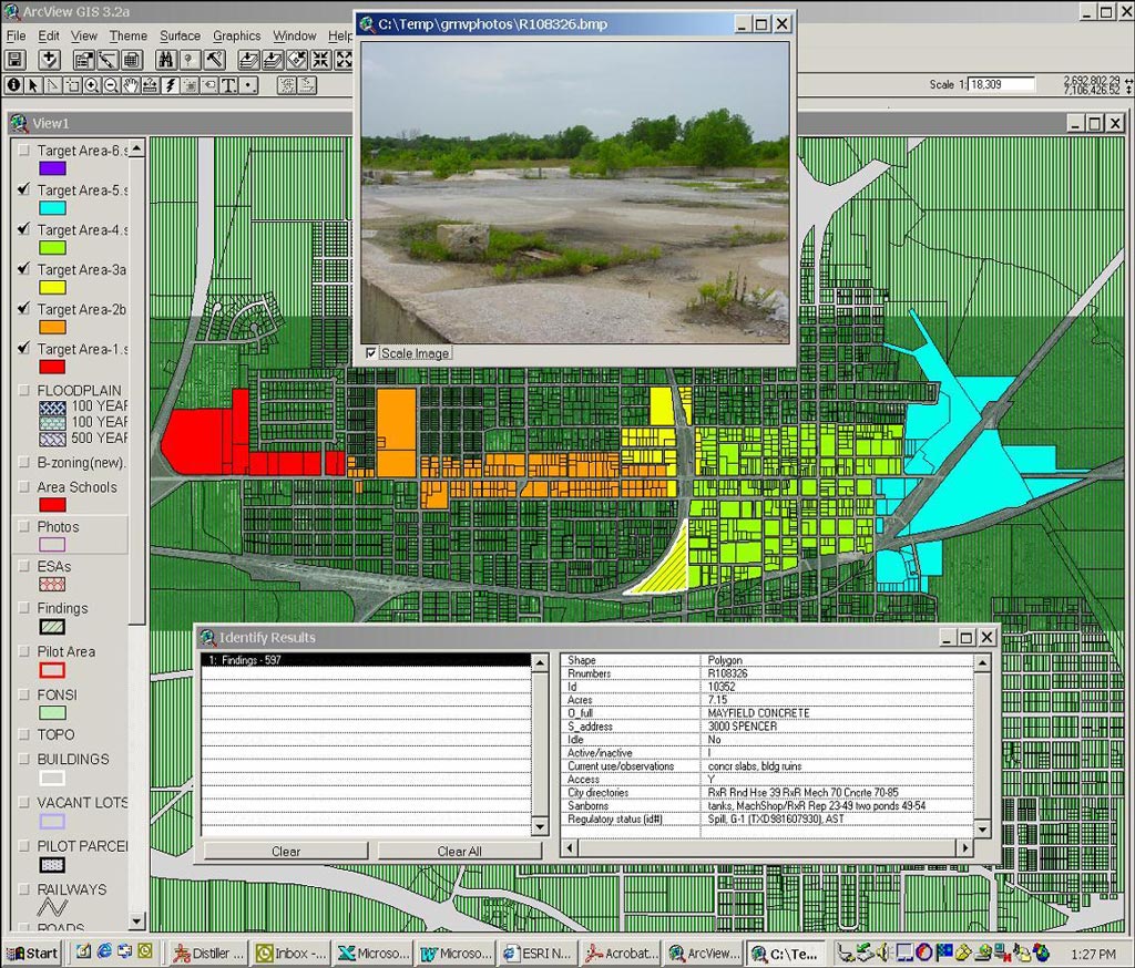
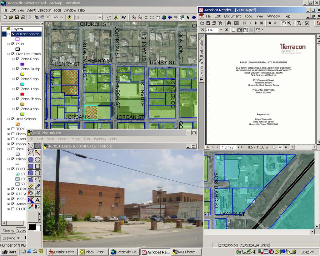
Philip Sanders, director of community development for Greenville, assembled an application for the city to the United States Environmental Protection Agency (EPA) Brownfields Program (see sidebar) in 2000 in the hopes of getting a brownfields grant to address some of the problems faced by the downtown area. On September 20, 2001, the city was awarded an EPA Brownfields Assessment Demonstration Pilot Grant. Because of the volume of environmental information to be collected and assembled, the first task was to create a system that could be simultaneously utilized for public outreach, redevelopment prioritization, and tracking the city's progress. In addition, it would not only need to catalog potential brownfields within the Brownfields Pilot Area but also be capable of Web-based interactive use by all interested parties and provide a smart growth tool for city planners. Terracon, Dallas, Texas. was awarded the contract to help in managing selected parts of the Brownfields Program in January 2002. According to Sanders, "The city chose Terracon based on its extensive experience with brownfields projects, environmental assessments, and remediation projects." In keeping with current city development tools, it should also be developed using GIS. Esri's ArcView and ArcGIS were the clear choices for the task. Compiling Existing InformationAs part of the pilot, the city is required to inventory the brownfields within target areas. Since the target areas were well defined (approximately 600 parcels), the effort was set up to obtain available information for the parcels that could potentially affect redevelopment efforts. Information was readily available from the Hunt County tax appraisal office, city of Greenville's GIS Department, and the North Central Texas Council of Governments (NCTCOG) that provided the general layers needed to represent the target areas. The information not available, however, included many of the things routinely collected during an environmental assessment of specific properties. This information was also the piece of the puzzle of most interest to potential lenders and redevelopers (i.e., site history). Unfortunately, the costs to conduct a full Phase I Environmental Site Assessment (ESA) for every parcel would be prohibitively expensive compared to the $200,000 from the initial Brownfields Pilot Grant. Therefore, the goal was to identify a plan to collect as much of the required data as possible without the extensive cost and to present it in a system that allowed the user to perform a query either for individual or collective needs. Building New Information
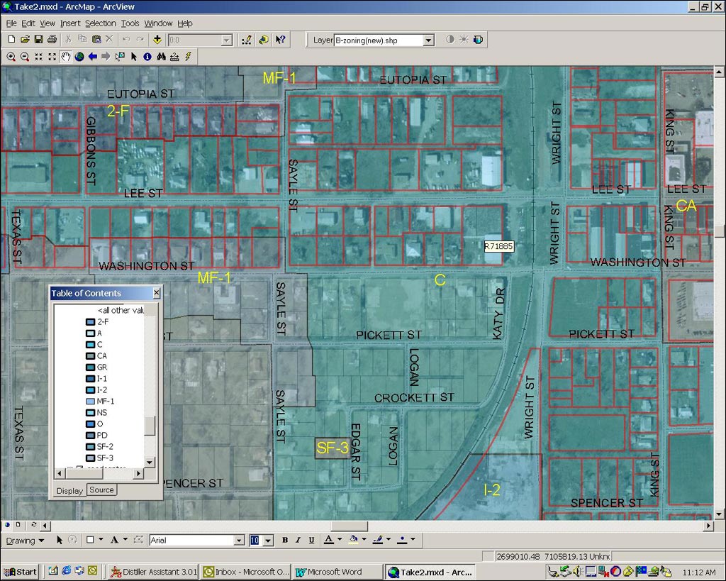
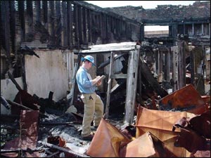
The GIS Department proceeded to create new layers to specifically address the issues of current and historic use as it pertained to potential sources of contamination. ArcView was chosen because of the program's flexibility for merging data sources, creating new shapefiles, and interfacing with existing systems used by the city. Principal shapefiles were created and augmented with their associated databases in ArcView. The new databases were then populated with selected information reflecting each parcel's history and other related concerns. Use of ArcView allowed for additional database editing in Microsoft Access. While the information collected for the new databases excluded a few portions of the standard ESA format, such as historical interviews, it did focus on available records concerning each of the individual parcels. The layers included selected environmental concerns as far back as 1885. Focusing on these areas maximized the useful information placed into the database and reduced the project costs significantly. By bringing together a team with more than 50 years of combined experience assessing environmental concerns, the data could now be evaluated efficiently as to its inclusion within the various databases. A follow-up review of selected records provided quality assurance/quality control for the process. Additional layers included current digital site photographs for each parcel and the ability to link the parcels to electronically stored documents for each site as the inventory system matures. The new information allows the user to identify environmental obstacles early on in the process of redevelopment.
The city formed a Brownfields Advisory Committee (BAC) in September 2002 consisting of community representatives, including members of the National Association for the Advancement of Colored People (NAACP), Clean Greenville, the Main Street Advisory Board, and other public associations, to provide input into the redevelopment effort utilizing the new inventory system. By harnessing the power of new and existing GIS data and community efforts for the revitalization of the pilot area, a new focused approach allows for redevelopment activities to proceed with more informed decisions. Kenneth Tramm, a senior project manager with Terracon, notes, "The hope of this system's approach is that it will reduce investigation expenditures and provide developers with relevant information that affects not only the cost of development, but more critically, the schedule of development. Only the interrelated Esri systems, such as ArcView, ArcIMS, and the newer ArcGIS software, would allow for the numerous objectives of this project to be effectively met." Dwayne Ford, EPA Brownfields project manager for the city, says, "The inventory system allows for real-time discussions of the potential environmental concerns facing redevelopment of a given site." Some of the benefits of the system include the following:
Work on the basic inventory system was completed within four months. In addition, four ESAs on 33 parcels have been completed. As redevelopment occurs within the target areas, the new information is tracked and updated for the city and EPA's databases accordingly. The next step is to begin wide-scale use of the Brownfields Target Area Inventory System with ArcView and ArcIMS via the Web for public outreach, future city planning, tracking proposed investigations and remediation, and attracting redevelopment partners. For more information, contact Kenneth S. Tramm (kstramm@terracon.com) or Michael E. Covert (mecovert@terracon.com) or Terracon (tel.: 214-630-1010, fax: 214-630-7070, Web: www.Terracon.com). For more information on brownfields, please visit the EPA at www.epa.gov. |