Spring 2003
Spring 2003 |
|||||||
|
|
|||||||
GIS Data ReViewer 4.2 Now Available |
|||
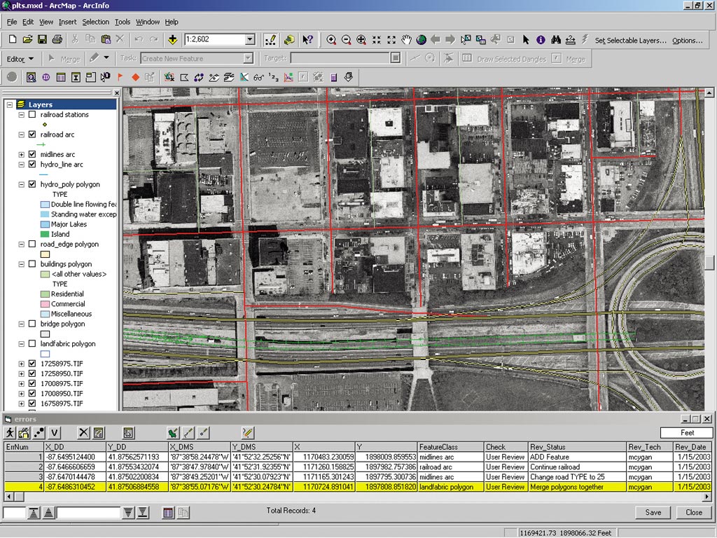
GIS Data ReViewer is a data quality control management application that simplifies many aspects of automated and visual spatial data quality control tasks, resulting in a more efficient and consistent review process. Composed of a series of buttons, tools, and context menus, GIS Data ReViewer is used to identify where corrections, additions, and deletions must be made to the spatial data and its attributes. GIS Data ReViewer extends the ArcMap application that is part of ArcView, ArcEditor, and ArcInfo. GIS Data ReViewer is a customizable product developed by Esri's Production Line Tool Set (PLTS) Group to support visual review and batch validation of data. GIS Data ReViewer eliminates the paper trail associated with traditional error tracking through the centralization of the error detection, correction, and verification cycle, thus improving and organizing the data review effort. In addition, it provides an integration framework for ArcGIS multiuser geodatabase environments. New functionality in GIS Data ReViewer 4.2 includes a sampling tool and a frequency tool in addition to a tool for zooming to an x,y location. The sampling tool is based on specifying either a percentage or a number of features to select from a coverage, shapefile, or feature class. The random sample is generated and saved to a sample table in the GIS Data ReViewer session. The new frequency tool in GIS Data ReViewer provides the ability to create a summary of values for an attribute in the data. In addition, spatial checks can be run on a selected set of features. GIS Data ReViewer also enables you to do the following:
GIS Data ReViewer requires ArcView, ArcEditor, or ArcInfo. For more information, visit www.esri.com/reviewer, call Esri at 1-800-447-9778, or call your Esri regional office (to locate your regional office, visit www.esri.com/usa). Outside the United States, contact your local Esri distributor; see www.esri.com/international. |