Spring 2003
Spring 2003 |
|||||||
|
|
|||||||
Massachusetts' Cape Cod Canal Data Maintained and Updated With GIS |
|||
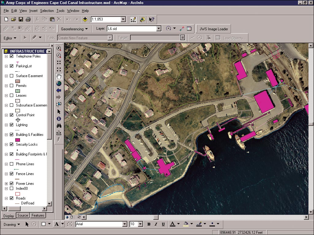
The U.S. Army Corps of Engineers is a worldwide organization that provides engineering services and construction support for a wide variety of military and civil projects. Since 1928, the New England District of the Corps has been responsible for the operation and maintenance of the Cape Cod Canal in Massachusetts. The canal, 17.4 miles long, is designed primarily to provide safe waterway navigation between Cape Cod Bay and Buzzards Bay, saving an average of 135 miles of coastwise travel around the cape's tip and outer shore. The canal is also operated as a federal recreation area available to the visiting public. The Army Corps of Engineers-Cape Cod Canal (CCC), a field office of the New England District, has utilized Esri products for the last 10 years to assist with the maintenance and operation of the canal. The existing ArcView 3.x system, comprised of a land base, digital orthophotography, and infrastructure mapping, has provided CCC personnel with a visual tool to monitor their facilities and assets. For better system management and tighter security, the CCC recently began a migration project from the existing system to ArcGIS Desktop. Canal personnel sought to utilize the new functionality of ArcGIS--the geodatabase structure, advanced ArcGIS editing tools with multiuser capabilities, wizard-driven menus, and high-quality cartography. On the foundation of the geodatabase, they planned to create a GIS model of the waterway system, developing a process and designing specific tools that would assist them in the dredging of the canal. Based on hydrographic surveys of the canal bottom, dredging is periodically necessary to eliminate sand and other excess material deposited due to the canal's swift current. The CCC currently uses manual processes to determine the amount and location of material to dredge. To accomplish these tasks, the CCC contracted Esri Business Partner James W. Sewall Company of Old Town, Maine, to assist with the geodatabase design; interface ArcSDE and Oracle configuration; data migration; and development of custom dredging, volumetric analysis, and estimation tools. Sewall's shared history with the CCC and experience with Esri products as an authorized Esri software developer were essential criteria for selection as a vendor. On previous projects, Sewall has provided the canal with digital orthophotography, digitally compiled photogrammetric and facility data in Esri coverage format, and a customized system using ArcView and ArcInfo. To upgrade the CCC's GIS, the Sewall project team utilized Oracle8i Release 3, ArcSDE 8.1.2, and ArcGIS 8.1 on a Sun Solaris 8 machine. The canal's geodatabase was designed in Visio 2000 Enterprise Edition. Custom dredging tools for the canal were programmed with ArcObjects, utilizing the viewing capabilities of the Esri extensions ArcGIS Spatial Analyst, ArcGIS 3D Analyst, and ArcScene for ArcGIS. Project DevelopmentTo exploit the advantages of the geodatabase over the coverage model and yet effect a smooth migration of data from one system to another, Sewall designed a geodatabase that was structured similarly to the CCC's current coverage model. Features, objects, relationships, and attributes were constructed to reflect the CCC's current schema. After completion of the geodatabase design and testing, the project team migrated the CCC data from the legacy system to the geodatabase. Data Migration--The process of data migration and ArcGIS configuration involved six essential steps:
With the completion of this process, the CCC now stores and manages critical data in a centrally located commercial off-the-shelf database management system. Multiple CCC users can view, query, and edit data over a long period of time. Further, they can manage and edit the geodatabase using standard ArcGIS tools (ArcCatalog, ArcMap, and ArcToolbox). Volumetric Analysis--In addition to designing the geodatabase, installing and configuring the software, and migrating the legacy data, the project team worked closely with the CCC to design a digitally automated dredging application for volumetric analysis. According to Project Manager Clarence Young, "The challenge of this phase of the project was finding the tools that would allow us to model the channel conditions and to analyze the current conditions against this baseline. We investigated several applications and found that the combination of Esri's ArcGIS 3D Analyst and ArcScene gave us the best tools for this solution." Application DevelopmentTo automate the current manual process of calculating dredge volumes, Sewall developed two custom tools, Fish Net Filter for creating canal bottom contours and Cut Volume for dredging estimation and analysis. The Fish Net Filter was originally written for the CCC in 1995 in Avenue. For the updated process, Sewall rewrote it in Visual Basic using Esri's ArcObjects. When utilized, the filter creates an even-spaced grid centered over the selected data set. Then it creates a new data set with the same fields as the original. The highest point in each grid cell is copied to the newly resampled data set. This smaller resampled data set makes some analysis functions more efficient without degrading the quality of the resulting information. The CCC uses these results to create canal bottom contours. The original depth sound points are spaced about one foot apart. For dredging estimation and analysis, the Cut Volume tool creates two triangular irregular networks (TINs)--digital terrain models based on a network of discrete triangles--then calculates the cut volume between them. Based on the canal design model, the first TIN is created from design elevation points at stations along the canal and from breaklines for changes in slope. These two data sets contain attribute elevations for both the design bottom and the regulated design overdepth (2 feet lower). As a result, the design model TIN is created at either depth. The second TIN is a sounding model created from collected depth soundings that have been converted to elevations. The last step is converting both TINs to raster images and calculating the difference. The intermediate TINs are saved and can be loaded into Esri's ArcScene for viewing. SummaryFor the CCC, maintenance and updating of canal data are part of an ongoing process. The enhanced functionality of the geodatabase model, ArcGIS Desktop, and custom dredging tools significantly increase the CCC's ability to optimize resources and manage navigation channel right-of-way operational activities. Francis Ciccone, CCC chief engineer for 30 years, says, "The ability to calculate shoal volumes and view underwater soundings within the ArcGIS Desktop application is the fulfillment of many years of effort in this area. The Sewall Company and its staff have done an outstanding piece of work and helped the canal staff to increase its utilization of Esri products." For more information, contact Thomas Marcotte, project manager (tel.: 207-827-4456, ext. 342; e-mail: mart@jws.com), or Clarence Young, project manager, James W. Sewall Company (tel.: 207-827-4456, ext. 215; e-mail: youc@jws.com), or visit www.jws.com. |