Spring 2004
Spring 2004 |
|||||||
|
|
|||||||
Announcing ArcGIS Data Interoperability |
|||
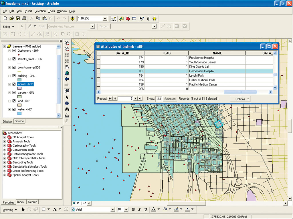
Jointly developed by Esri and Esri Canada Limited Business Partner Safe Software (Surrey, British Columbia, Canada), the Data Interoperability extension for ArcGIS 9 Desktop eliminates barriers for data sharing by providing state-of-the-art direct data access, data transformation, and export capabilities. This development will allow ArcGIS Desktop users to easily use and distribute data in many formats. Esri is committed to providing technologies that are based on open standards to serve customers and promote the sharing of geographic data. This new product enables true data interoperability between organizations regardless of industry, application, or format. Esri has worked with Safe Software, a provider of spatial data transformation solutions, to fully integrate its powerful tools within ArcGIS Desktop. The ArcGIS Data Interoperability extension works with ArcView, ArcEditor, and ArcInfo and provides
The ArcGIS Data Interoperability extension enables users to directly read, display, and analyze the data, utilizing all the available tools in ArcGIS Desktop. Using the Data Interoperability extension, users can also create custom data format readers that directly support data in nonstandard formats in ArcGIS. For example, a custom data source can be built that reads a GML file, selects and renames important attributes, splits data into multiple layers, and writes the data layers into a geodatabase. Once defined, this custom data source can be used over and over again in ArcGIS Desktop just like any other data source. ArcGIS Data Interoperability is an optional extension to ArcView, ArcEditor, and ArcInfo and will be available after the initial ArcGIS 9 release. |