Spring 2004
Spring 2004 |
|||||||
|
|
|||||||
Developing Custom Applications With ArcGIS Engine |
|||||
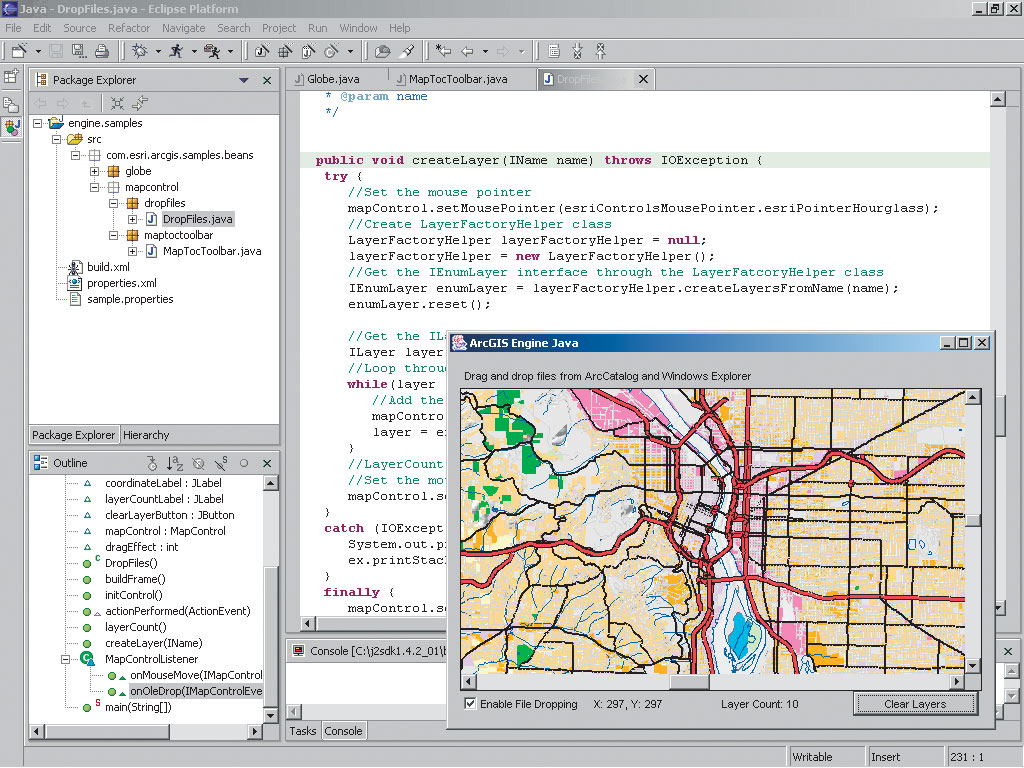
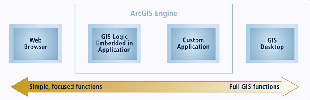
ArcGIS Engine is a set of embeddable cross platform ArcObjects, ArcGIS software's underlying components, used to build custom GIS and mapping desktop applications or add new functionality to existing applications. ArcGIS Engine applications can vary from simple map viewers to custom GIS editing and analysis programs. It is important to note that with ArcGIS Engine, the map displays can be either an incidental or central element in the application. This feature makes ArcGIS Engine particularly well suited to vertical market applications. This follow-on article provides an overview of developing applications with ArcGIS Engine. ArcGIS Engine Developer KitDevelopers build applications with the ArcGIS Engine Developer Kit and deliver those programs to end users via licensed ArcGIS Engine Runtime software. The ArcGIS Engine Developer Kit includes resources to support comprehensive development tasks. An integrated help system is provided for several application program interfaces (APIs) (common object model [COM], Java, .NET, and C++) along with object model diagrams and samples for each part of ArcGIS Engine. The ArcGIS Engine Developer Kit provides access to a large collection of ArcObjects components and includes visual developer controls for creating high-quality mapping user interfaces. These visual components are available as ActiveX controls, JavaBeans, and .NET Windows controls. The ArcGIS Engine Developer Kit controls can be combined with other controls and components to create customized user interfaces, displays, and reports. What Developers Can Do With ArcGIS EngineAs a developer, you can implement these and many other functions in programs built with the ArcGIS Engine Developer Kit:
Developing With ArcGIS EngineDevelopers build ArcGIS Engine applications in their chosen integrated development environment (IDE) such as
Developers register the ArcGIS Engine Developer components with their IDE and then create a forms-based application, adding in ArcGIS Engine components and writing code to build their application logic. For example, a developer can build a focused GIS mapping application by adding a map control, a table of contents control, and selected toolbars to their application. Although a simple application can be built with just the high-level controls, practical applications of the ArcGIS Engine require knowledge of the different object libraries that compose the ArcGIS Engine. Developer ToolsThe ArcGIS Developer Kit includes three key collections of GIS logic:
Deploying ArcGIS Engine ApplicationsOnce built, ArcGIS Engine applications can be installed on two types of ArcGIS seats:
An ArcGIS Runtime installation CD-ROM is included with the ArcGIS Engine media kit and can be installed and configured on many computers. A keycode file is required to enable ArcGIS Engine capabilities on each computer. Optional extensions to ArcGIS can also be enabled by adding a line to the keycode file. Visit www.esri.com/arcgisengine for more information including a comprehensive white paper detailing more development and deployment options for ArcGIS Engine. |