Spring 2005
Spring 2005 |
|||||||
|
|
|||||||
Offers New Account Administration Tools, Uploading of Polygons, Performance Enhancements, and More
ArcWeb Services Continue to Improve—A New Release Coming Summer 2005 |
|||
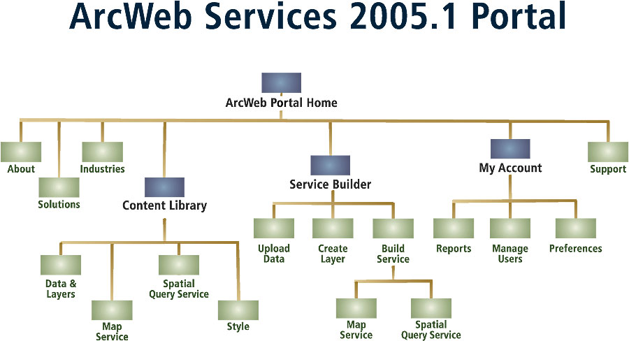
During the third quarter of 2005, Esri plans to release ArcWeb Services 2005.1—a significant update to ArcWeb Services. The new version is designed to give users more account administration capabilities that will help in the management of groups of users. Many new services will be offered, including the ability to upload points, lines, and polygons for hosting by Esri and then combine this data with ArcWeb Services data. ArcWeb Services are Esri's hosted GIS Web services. They offer a way to access GIS content and capabilities over the Web on demand. Because data storage, maintenance, and updates are handled by Esri, ArcWeb Services eliminate the overhead of purchasing and maintaining large data sets. The ArcWeb Services 2005.1 enhancements will be available via a new online portal. This portal will include an author tool for creating custom layers and services using a customer's own data or other ArcIMS services; a content library that will make it easy to discover available content; a service builder for creating, managing, customizing, and publishing ArcWeb Services; and account administration tools that allow group administrators to manage groups of users. Other highlights of the new release include the following:
In addition, as part of Esri's ongoing commitment to expanding the range of data available via ArcWeb Services, customers can expect several new data sources to become available soon. These data sources will include
For more information on ArcWeb Services or to get a 30-day evaluation, visit www.esri.com/arcweb or call Esri at 1-800-447-9778. Outside the United States, contact your local Esri distributor. |