Spring 2005
Spring 2005 |
|||||||
|
|
|||||||
Comisi�n Federal de Electricidad, Mexico's Public Electricity Corporation, Generates Electricity and Social Reform With GIS |
|||||
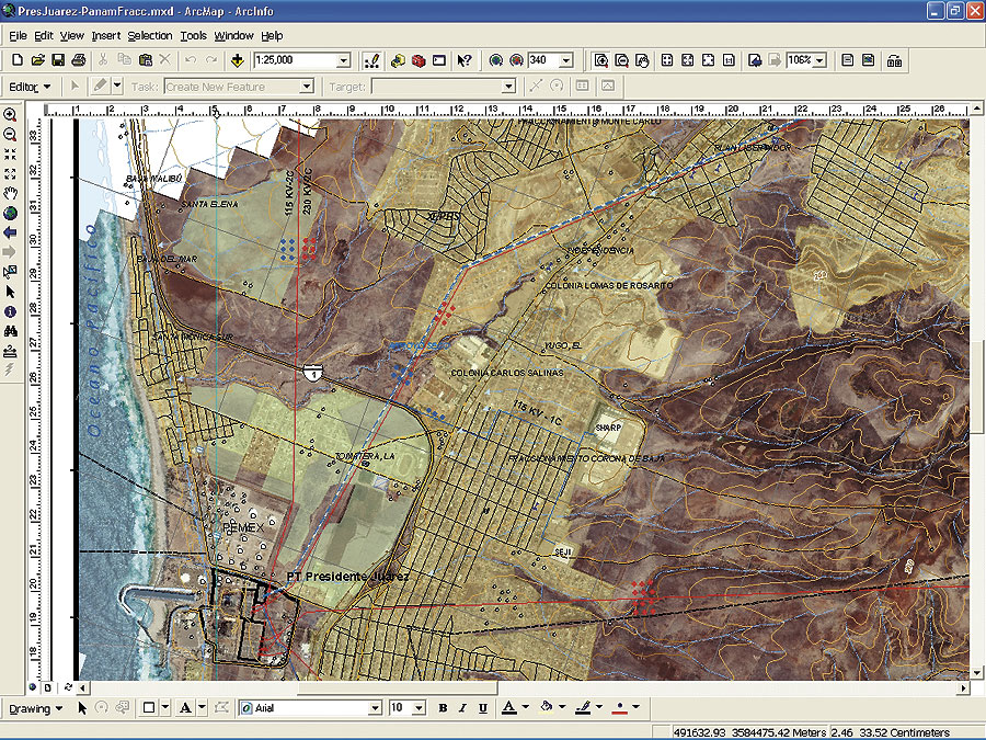
When C�sar Fuentes Estrada was a young boy, he remembers reading by the light of an oil lamp before electrical transmission lines reached his small village on the Gulf of Mexico. Now, as the Transmission and Transformation Project coordinator for the Comisi�n Federal de Electricidad (CFE), Mexico's public electricity corporation, Fuentes is determined to complete Mexico's long-term national electrification project. "Because CFE is run by the government," says Fuentes, "we don't have to manage by the profit motive that drives private industry. This is what allows us to continue until completion of our rural electrification project. It's not profitable from an economic point of view to achieve complete electrical coverage throughout the entire country; it's profitable from a social sense. Electricity can help raise the general standard of living throughout the country with the implementation in villages of common electrical appliances, such as refrigeration units for the storage of medical supplies and perishable foodstuffs. It can power pumps to aid in irrigating our crops and provide lighting for public safety. In general, electricity can help people achieve a better quality of life." In 1937, the Mexican government formed CFE to help expand the existing, and somewhat disjointed, electrical service provided by three separate companies. CFE's mandate was to build additional electrical generating facilities to meet, and hopefully exceed, the existing demand. While this strategy helped improve capacity, the government felt that its national electrification initiative was not expanding quickly enough to meet the country's growing needs. So in 1960, it nationalized the electrical industry in an attempt to reduce costs and accelerate the expansion of the electrical network throughout the country's rural areas. With nationalization, CFE became Mexico's governing entity for electrical power generation and transmission. At that point, the country began to integrate the various existing components of its domestic power system after establishing national technical standards for its transmission and distribution equipment and operating voltages. This standardization has also helped alleviate power outages and led to the development of its national electrical grid, known as the National Interconnected System (NIS).
Continues Fuentes, "The infrastructure developed for NIS allows us to easily balance the supply and demand of our electrical power by shifting it across the network to anywhere in the country, depending on capacity and need." In addition to the expansion of Mexico's electrical grid nationally, it is also linked to the United States at 11 points along the border. This cooperative relationship has been developed for both economic and reliability reasons. In the southern part of the country, CFE has interconnected its grid to Belize and Guatemala. The expansion has allowed CFE to grow into the sixth largest electrical generation and transmission company in the world. Key to the continued expansion of Mexico's NIS is the implementation of its comprehensive GIS based on the ArcGIS family of software (including ArcView, ArcEditor, and the ArcGIS 3D Analyst and ArcGIS Spatial Analyst extensions) and Leica's Image Analysis for ArcGIS, which is used throughout the regional offices, as well as ArcSDE and ArcIMS at CFE headquarters. The company began its GIS implementation three years ago and has been refining its basemap for the past year. Seventy CFE technicians have been trained in the use of GIS to aid in data collection and basemap development. The company has also developed applications for data management, transmission line site selection (the best path for each transmission line), vegetation analysis, and land profiles using the digital terrain model. The Next PhaseThe next phase includes data management and extended functionality for transmission line maintenance, since the company has more than 3,000 kilometers of lines to inspect annually. The system will also be used to determine the proper course for laying new lines. For new lines, the company must take into consideration a number of factors, including social, environmental, technical, and financial issues. All of this information will be included in the GIS. It will help CFE update its maintenance records and keep track of landownership in securing right-of-way permission as the company continues to expand the national grid. The data collection plan is to collect and manage regional data locally and then upload it to a central server for any CFE employee who needs access to it. The company is also converting its existing CAD drawings for use in its GIS using ArcGIS components. Concludes Fuentes, "In the future, we hope to implement an enterprise GIS that will be used throughout our company for all aspects of marketing, planning, and maintenance related to the generation and transmission of electricity. Much of the related data will, of course, be transmitted via the Internet, and we have already installed the most extensive fiber optic network in the country." For more information, contact Alfonso D�vila, Sistemas de Informaci�n Geogr�fica, S.A. (SIGSA) (e-mail: adavila@sigsa.info, Web: www.sigsa.info). |