Spring 2005
Spring 2005 |
|||||||
|
|
|||||||
Decreasing Site Selection Operation Costs by 75 Percent
Subaru of America Targets Specific Customer Groups With GIS |
|||
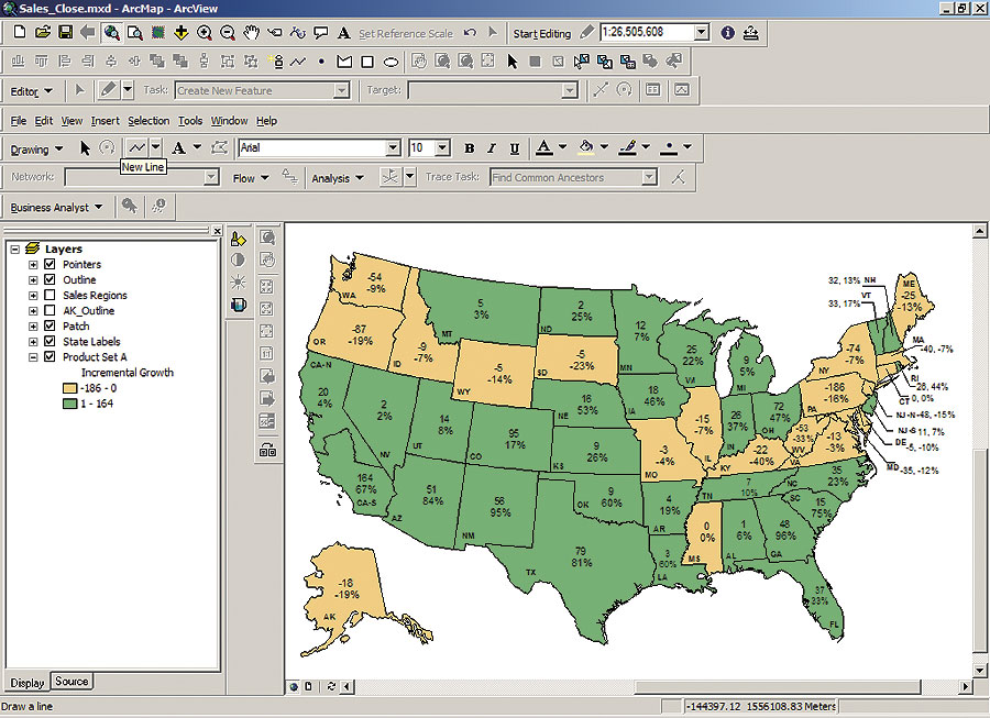
Making the wrong decision about the location of a business can be costly. Demographics, accessibility to the site, compatibility with neighboring storefronts, visibility to potential clients, competition, environmental assessment, architectural concerns, and other factors must be taken into consideration. Two of the biggest issues with site location research are using this information properly and communicating the results. Subaru of America, Inc., is one company that understands the importance of assessing this information accurately. Unlike its much larger competitors in the automotive industry, Subaru is a niche player that targets specific customer groups. Being able to see and analyze information to make decisions about where to place dealerships is paramount. Subaru is a wholly owned subsidiary of Fuji Heavy Industries Ltd. of Japan. Headquartered in Cherry Hill, New Jersey, the company markets and distributes all-wheel drive Subaru vehicles, parts, and accessories through a network of approximately 600 dealers across the United States. These dealerships employ approximately five to 50 people. In 2002, Subaru dealers sold 180,020 vehicles in the United States. Subaru stands out in the industry as the only automobile manufacturer to offer all-wheel drive as standard equipment on every vehicle it makes. This niche-focused product strategy requires Subaru to precisely target its customer groups. The company realizes the importance of developing an in-house process to produce timely and accurate market studies using its franchise territories to determine prime site locations. Using GIS software, it is possible to analyze the data and then present it in an easy-to-understand format. Sean O'Halloran, geographic decision support specialist at Subaru, explains, "Successful site selection analysis at Subaru combines the use of quality demographics and powerful GIS technology to locate our best dealer store sites." "The constant upgrading, finding new, or 'filling the holes' for dealer locations are integral parts of our everyday decision making," says O'Halloran, Subaru sought an alternate solution. O'Halloran was familiar with GIS and developed a short list of GIS vendors to review. After reviewing several software packages, O'Halloran selected ArcGIS Business Analyst software along with Esri geodemographic segmentation data for a number of reasons. He says, "I liked the products, especially the mapmaking aspects. It was easy to import data from a variety of sources, and the price was pretty competitive." In just two years since Subaru integrated mapping and GIS analysis into its market development, the data cost had dropped dramatically while the quality of the GIS software rose. O'Halloran spends a lot of time developing studies for different markets. He looks for areas of high and low potential for new dealerships throughout the United States. The maps he and his supervisor create are a culmination of data from many different sources: geodemographic data from Esri, sales information from their dealer franchisees, vehicle registration numbers at the ZIP Code level, and geographic information. Using ArcGIS Business Analyst with Esri segmentation data, Subaru analyzes current sales figures by targeted customer segments to decide on the best dealer locations. This combination of software and data enables Subaru to create custom "what if" scenarios and quality presentation maps, rank targeted customer groups, and define success levels for existing and potential locations. When O'Halloran is not analyzing markets or creating presentation maps, he is maintaining vast amounts of data. ArcGIS Business Analyst makes it easy to integrate data from all his sources, because it works directly with Microsoft Access, Subaru's database of choice. One of the biggest changes with this new GIS solution was the ability to take ownership of his data. Instead of outsourcing his sales data for geocoding and demographic profiling, he can perform these applications himself. Esri Community Coder 5 software allows him to assign latitude/longitude coordinates and FIPS codes to his customer files. He also integrates Esri Community Tapestry lifestyle segmentation data to further enhance his sales records for more comprehensive customer profiling. Tapestry data is divided into 65 segments describing U.S. residential areas based on demographic variables, such as age, income, home value, occupation, household type, education, and other consumer behavior characteristics. ArcGIS Business Analyst software and Esri data have allowed Subaru to dramatically decrease its site selection operation costs by 75 percent. The company has also improved the quality of its analysis, increased the efficiency and accuracy of its site selection process, and reduced the risk of erroneous site selection. "The biggest advantage of using GIS technology with Esri geodemographic data has been having the tools in hand before we make actual location decisions," says O'Halloran. "Using the mapping application in ArcGIS Business Analyst has become an everyday tool for our analysis process." For more information, contact Sean O'Halloran, Subaru (e-mail: soha@subaru.com), or Donna Fancher, Esri (e-mail: dfancher@esri.com). This article is derived from one that appeared in the February 9, 2005, edition of Directions magazine (used with permission). |