Spring 2006
Spring 2006 |
|||||||
|
|
|||||||
Upcoming Esri Press Title Covers GIS from A to Z |
|
|
With publication due later this spring, A to Z GIS will be a timely and invaluable resource for anyone who regularly encounters GIS terminology. With 400 color illustrations and clear, technically accurate definitions for more than 1,800 terms covering the entire GIS lexicon, it will be the most comprehensive GIS dictionary to date. In addition, two introductory essays will describe aspects of GIS vocabulary from linguistic and historical perspectives, and appendixes will list a top-level taxonomy of GIS and address particularly confusing terminology in more detail. A to Z GIS was created from a database of terms and definitions that is also the source for the GIS Dictionary on the Esri Support Center Web site (support.esri.com/gisdictionary). A to Z GIS: An Illustrated Dictionary of Geographic Information Systems is a must-have resource for managers, programmers, users, writers, editors, and students discovering the interdisciplinary nature of GIS. Visit www.esri.com/esripress/atoz to preorder your copy today. ISBN 1-58948-140-2, $24.95 |
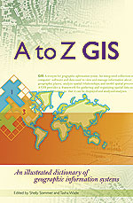 GIS vocabulary has changed over the last few years with the emergence of GIScience and the closer integration of GIS with spatial statistics and environmental modeling. To meet the need for clearly and accurately defined GIS terminology, Esri Press announces the upcoming publication of
A to Z GIS: An Illustrated Dictionary of Geographic Information Systems.
GIS vocabulary has changed over the last few years with the emergence of GIScience and the closer integration of GIS with spatial statistics and environmental modeling. To meet the need for clearly and accurately defined GIS terminology, Esri Press announces the upcoming publication of
A to Z GIS: An Illustrated Dictionary of Geographic Information Systems.