Spring 2006
Spring 2006 |
|||||||
|
|
|||||||
U.S. Bureau of Reclamation Administers Archaeological Sites with GIS |
|||||
|
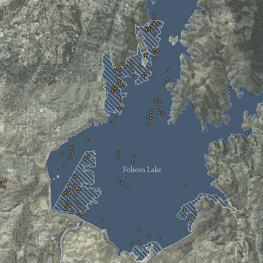
There are more than 2,000 archaeological and historic sites recorded on U.S. Bureau of Reclamation-administered
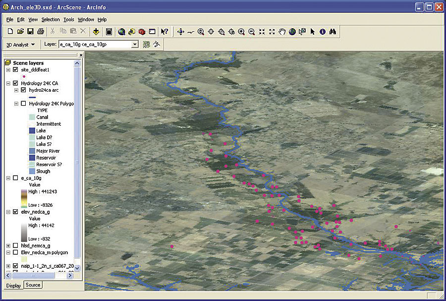
The U.S. Bureau of Reclamation's cultural resources management is a multifaceted program that encompasses responsibilities for (1) identification, evaluation, and management of cultural resources under the bureau's jurisdiction or control; (2) the curation of artifacts and museum property; (3) Native American concerns about human remains and associated cultural items; (4) the issuance of permits for cultural resources work on the bureau's lands; and (5) public education and outreach. For more than 10 years, the Mid-Pacific Regional Office has been in the process of digitally capturing archaeological site data. A significant portion of archaeological site information for the region is in a GIS. This information has been collected from a variety of sources for different projects. Site information is considered to be sensitive data, so regional staff archaeologists must review and approve access to cultural resource information. Managing the digital data became increasingly difficult. The spatial data was stored under different project folders, and site attributes were stored in different tables in a variety of formats. For better control of the existing digital records and to avoid duplication of records, the data is being centralized into a geodatabase. The geodatabase offers advantages in identifying potential duplicate site locations. It has common table definitions and structures. It permits the application and use of a controlled vocabulary and assists in reporting and tracking the status of site designations by the appropriate authority. The geodatabase also identifies the location of full site records and survey reports or links directly to any available digital copies.
The geodatabase was constructed as a personal geodatabase with the ArcGIS Desktop (ArcEditor) application ArcCatalog. As a management database, a site is represented only once. The geodatabase model assists in preventing duplicate loading of a site multiple times from separate project databases. It also prevents reporting of the same site with different site designations by multiple investigators. Sites and site features are represented as points, lines, and polygons. Sites that are in close proximity are identified and reviewed in ArcEditor, which is also used for verification and validation of proper location and site name. As the geodatabase develops, ArcEditor provides the opportunity to set topological rules to assist in ensuring that the sites and site features are appropriately represented for the different feature types. The geodatabase model has allowed the development of definitions and domains of valid codes that are consistent with the federal cultural resources management program. Definitions and the domain of valid codes led to lively discussions among the archaeologists. This included the application and meaning of terms such as Poor, Fair, and Good. These discussions also assisted in identifying components of the geodatabase that the archaeologists needed in performing their tasks. Domains assist in standardizing information associated with the sites and provide a controlled vocabulary for the geodatabase. These domains cover the time period associated with the site, the organization that has surface jurisdiction for the site, site condition, and collection status. This assists the staff archaeologists in completing surveys and reports for consultation and site designations. The ArcMap application within ArcEditor makes it easy for the archaeologists to craft maps that meet the needs of the various offices of historic preservation. A major issue for the archaeologists has been the assignment of the proper site identifier or name. The geodatabase and ArcEditor have simplified their task in selecting and formatting the name to meet their needs. It also assists in tracking the status of sites that are currently part of consultations required under sections of the NHPA. A major task for the archaeologists is tracking areas covered by any cultural resource surveys. This is a component of the geodatabase. Access to the actual site record can assist in categorizing sites for analysis and in refining the domain of site types. Viewing the site record is often preferred by the archaeologists when selecting subsets of sites for analysis. At this time, only a portion of the site records is in digital form. The staff members have direct access to these records for review and analysis by linking to the full site record via the geodatabase. Other records only have major characteristics or features identified as historic or prehistoric attributes in the geodatabase. Both methods are used in the GIS by the archaeologists for selecting subsets of sites with spatial or attribute queries. For more information, contact Barbara Simpson or David Hansen, GIS specialists, U.S. Bureau of Reclamation (tel.: 916-978-5031 or 916-978-5268, e-mail: bsimpson@mp.usbr.gov or dhansen@mp.usbr.gov). A paper on this geodatabase was originally presented at the 2005 Esri International User Conference in the Archaeology track. The paper title is "Geospatial Data Model for Archaeology Site Data" by Barbara Simpson, Lorri Peltz-Lewis, Anastasia Leigh, David Hansen, and Patrick Welch. |