Spring 2007
Spring 2007 |
|||||||
|
|
|||||||
Bureau of Land Management's Cultural Resource Database Goes Digital |
|||
|
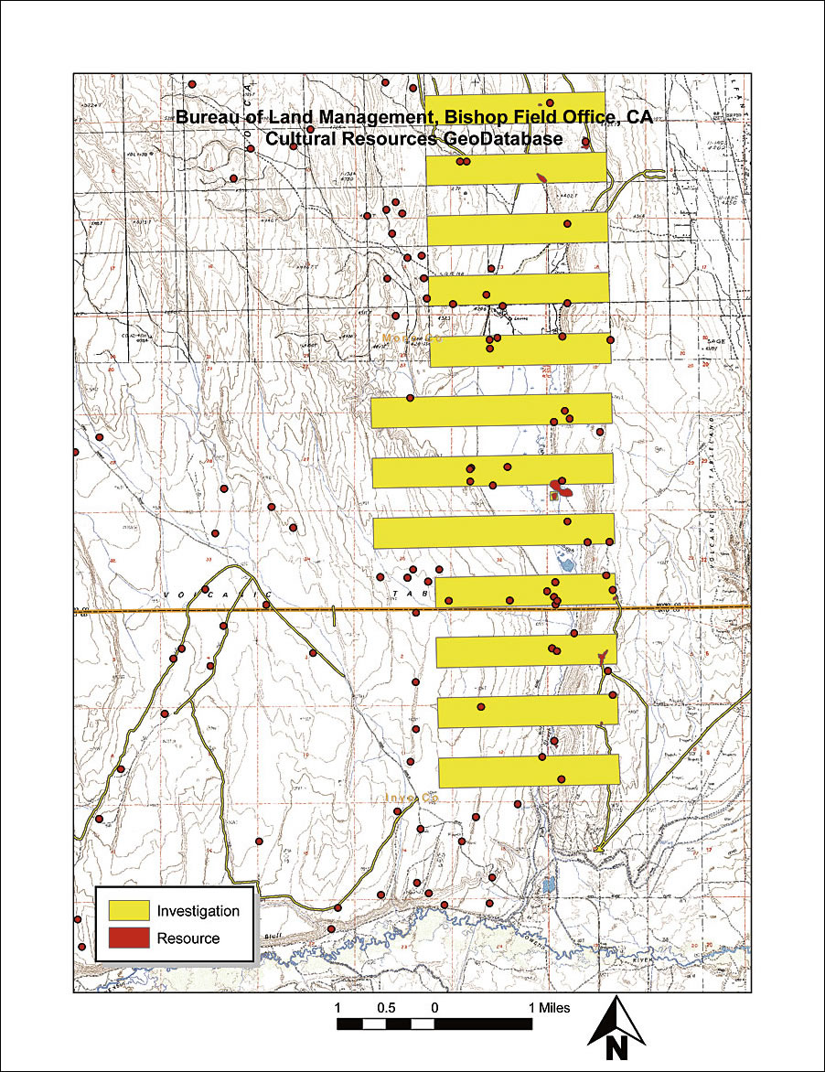
By Bradley L. Garrett Recording cultural resources on federal lands has always been a tedious enterprise. Cultural sites have been recorded for some time on hand-drawn maps using x,y coordinates from GPS data. In most offices, detailed site records were stored in one place and location maps in another. Often, data was lost in the process of report research when files were put back in the wrong place. Even worse, when snap decisions had to be made, such as in the case of fire emergencies, it took far too long to look up the pertinent data. What was needed was to get all of this data in one place for easy reference.
That time has arrived. The United States Bureau of Land Management (BLM) cultural resource database has gone digital. Kirk Halford at the Bishop, California, field office, in collaboration with Gnomon International, has developed a cultural GIS database tool for use within ArcGIS Desktop. The tool enables cultural resource managers to easily digitize hand-plotted survey and site locations for cultural resources. The tool also lets users copy previously existing GIS data into the resource database. Finally, the software allows for the attachment of metadata collected from site records and field-recorded information. The software has been implemented across the state of California. BLM field offices have been uploading their site and survey data into a central database with the guidance of Halford. The Alturas, California, field office recently digitized data on cultural resources for integration into the state database. More than 7,000 sites were digitized in the course of 30 days, including some site information metadata. The new working database will assist archaeologists at BLM in two very important ways. First, the ability to statistically analyze large amounts of data may lead to new research possibilities and interpretation of land use in history. Geospatial data also allows broad cultural patterns to emerge, as population dynamics, temporal use patterns, and habitation centers begin to "pop off" the map. Second, the construction of the database facilitates quick reference when creating reports on area impacts, such as environmental assessments, or when making quick decisions on potential resource impacts, such as in the case of fire-line bulldozing in areas of potential cultural sensitivity. In short, data layering using ArcGIS Desktop allows complex corollaries to be drawn between datasets. For example, when land jurisdiction is in dispute over a located cultural resource, transparent land allocation maps overlaid on site data easily solve disputes. These seemingly simple ways of working with data will do nothing short of revolutionize the way archaeologists work with cultural data. Currently, the resource database has seen limited use within BLM due to reluctance to shift to digital formats. The California Desert District and Surprise field office were the first to get 100 percent of their data uploaded. The Alturas field office has digitized the majority of its site information but still has some work to do filling out attribute tables for the information. Alturas may be able to finish up in another season. Hopefully, 2007 will be the year the rest of the BLM archaeology program goes digital! About the AuthorBradley L. Garrett was an archaeological technician for the United States Bureau of Land Management, Alturas field office, for the summers of 2005 and 2006. He now works in Hawaii for the International Centre for Archaeology Underwater and can be contacted at brad@archaeologyunderwater.com. More InformationFor more information, contact Cheryl Foster-Curley, United States Bureau of Land Management, Alturas field office (tel.: 530-233-4666, Web: www.blm.gov/ca/alturas). |