Spring 2007
Spring 2007 |
|||||||
|
|
|||||||
GPS-GAP Changes the Way We View the Earth |
|||
|
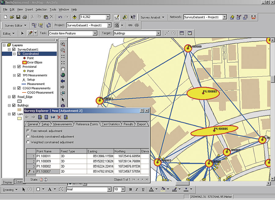
By Alfred Leick GPS technology has demonstrated stellar performance ever since its inception. The uses and applications have grown at an incredibly rapid rate. From navigation to recreational uses, from mapping to precision surveying and GIS, the ubiquitous nature of GPS is impacting our lives in a positive manner. Many of these applications provide precise positions, some in real time. Delivered with this precision is an implied understanding of some fundamental concepts that are often overlooked. The GPS, Geodesy, and Application Program (GPS-GAP) is an online educational initiative by the University of Maine that offers in-depth knowledge about this fantastic system to help GPS and GIS users understand all the parameters necessary for precise positioning, including the geodetic foundation.
GPS is changing the way GIS users collect and manage geographic data. The high accuracy that GPS provides has GIS professionals storing and managing their data in new ways. GIS now supports a double precision database, and GIS users are developing new methods for improving the spatial quality of the existing data in their systems. GPS provides a key component for this, but there are many considerations when using GPS to obtain and understand accurate positions. Geodesy—the science that determines the size and shape of the earth and measures its gravitational field—always looms in the background when positioning, regardless of accuracy, whether one applies reductions or transformations that allow plane computations, or whether one applies three-dimensional models recognizing the fact that the earth is round after all. Geodetic methodology provides products such as the NAD83 datum, the ITRF2000 reference frame, earth orientation parameters with respect to inertial space, the geoid, deflection of the vertical, station motions on a deformable earth, and spatial variation of gravity. All these products are available and continually refined, but an understanding of the fundamentals is important to properly employ them. Examples of primary geodetic measurement tools are laser ranging to satellites and the moon; Very Long Baseline Interferometry (VLBI); and, last but not least, GPS. Whereas VLBI has allowed us to reference the earth rotation to the direction of stable extragalactic radio sources with unbelievable accuracy, GPS has advanced geodetic capability by leaps and bounds in a variety of ways. New capabilities that come to mind are the accurate monitoring of plate tectonic motions, mapping of spatial variations of the troposphere and ionosphere (which introduce the majority of errors in GPS measurements), and ultraprecise positioning of near-earth satellites (which carry the sensors that supply important GIS input data streams). Ever since Eratosthenes of Cyrene's (276–194 BC) determination of "the size of the earth," geodetic science has been driven by the cycle of discovery and increased measurement accuracy, accompanied by mathematical refinement. As discovery generated new questions, the desire for better measurements followed. This cycle is still continuing and also applies to GIS applications. In step with today's trends in electronics, computers, and the Internet, the tools of GPS and GIS, mixed with geodetic capability, are being placed into the hands of more people than ever. The recent CNN broadcast on the top 25 nonmedical innovations of the last 25 years hinted at the broadening of the user base. It ranked GPS in position six, just after e-mail and above portable computers. The list was assembled by the Lemelson-Massachusetts Institute of Technology (MIT) Program in cooperation with CNN. Of course, the Internet occupied position one on the list. Emerging local real-time differential networks accelerate the integration of GPS and GIS. Differential networks allow the mitigation of systematic errors in GPS positioning and thereby increase the positional accuracy that is available to users. To be sure, regional differential networks are already widely in use. For example, the Wide Area Augmentation System (WAAS) is a U.S. government-operated real-time network that supports navigation for civil aviation. Another well-known network is the Continuously Operating Reference Stations (CORS) network of more than 1,000 stations operated by the National Geodetic Survey (NGS). These and similar regional networks throughout the world serve their mission well; however, their impact on the data collector in the field pales compared to what is still to come. The goal of local real-time differential networks with closely spaced GPS tracking stations is to enable ambiguity fixed solutions. Avoiding the details, let it be simply stated that this type of solution somehow manages to estimate the integer number of wavelength ambiguities, as opposed to merely estimating rational values (called ambiguity float solutions). It is the kind of solution that provides centimeter-accurate positioning in real time. The closeness of the stations is dictated by the network's ability to most economically make real-time ambiguity fixed solutions possible. Such networks could, of course, be connected to form regional networks of closely spaced stations. The network stations typically transport their observations via the Internet to a server at some central location and move data from the server to the user's GPS receiver. Ambiguity fixed solutions are the best that GPS has to offer. This fact does not change even as the modernization of GPS continues; the Russian global orbiting navigation satellite system (GLONASS) regains strength; the satellites of the European Galileo system come on line; or the planned Chinese Compass satellite system completes the fourth leg of the global navigation satellite system (GNSS) of independent global navigation systems, each one featuring some 30 or so satellites. The physics that led to a closely-spaced network of stations to achieve integer ambiguity resolution remains valid, although the reliability of real-time ambiguity fixing will increase with such an abundance of satellites available. Another development needs to be pointed out. GPS satellites originally (and most of them still do) transmitted one civil code and two encrypted military codes on two different frequencies. Again, without going into detail, ambiguity fixing works better if there are at least two different frequencies (carriers of the codes) available. Receiver manufacturers have developed patented solutions that allow them to use the encrypted codes. A consequence of these patented solutions is that dual-frequency receivers are still very expensive. The trend these days is to make at least two public codes available on the satellites, thus avoiding the need for patented solutions and "naturally" separating the civil and military access points to the satellites. This, together with the pressure of the mass market, should result in a major drop in price for dual-frequency receivers and consequently result in a broader user base for such devices. Having ambiguity fixed solutions available in real time—the discovery that emerges from the GPS-GIS intersection, supported by a solid geodetic foundation—can only be described as huge. GPS users will be logging their precise GPS positions in GIS servers in real time. The move of GPS/GIS capability with a geodetic foundation into many hands carries with it risks and pitfalls. After all, GPS still has limitations, mostly dictated by the laws of physics, as mentioned above. Such limitations may cause misinterpretation of results or lead to false conclusions and decision making. Since demanding GPS applications require more than merely pushing receiver buttons, there remains a need for objective quality control of data and an understanding of the mathematics and physics of the observables. Similarly, the ease with which GIS software can display and manipulate data requires a deep understanding of the nature of the data on the part of the serious user. Because of the inquisitive nature of users, it is inevitable that existing techniques and software capabilities will be pushed to the limit, if not over the limit, to advance discovery. Hence, there is the need for an educational service that seeks to address the GPS-GIS intersection and the geodetic foundation in a unified manner. My enthusiasm for GPS began during the summer of 1982 at MIT when I tested an experimental GPS receiver, called the macrometer, over a 30 km baseline from Woburn, Massachusetts, to Mount Wachusett. The satellite visibility ranged from about 6:00 p.m. to midnight in New England. Many of the sunset watchers at the summit were puzzled by my activities and impressed by the huge piece of equipment in the back of the station wagon, the abundance of cables, and the strange-looking antenna (so they thought). Their puzzlement about what I was up to was reflected in some of their comments, such as "Is this thing taking off?" or "Are you on our side?" Of course, there was plenty of time until midnight to be entertained by Fourier transforms and such on the computer screen and to ponder the unlimited potential of GPS. Those long evening hours on top of Mount Wachusett allowed me not only to double-check the amazing repeatability of the observed baseline vector night after night but also to marvel at the science behind all of that. There was the prospect that GPS could revolutionize my field of specialization, geodesy, and that we could gain a better understanding of the variations of the atmosphere. There certainly was curiosity as to what signals the satellites actually transmitted. I was told that it was so weak that it was below the background noise. And yes, there were questions: Why was this antenna so large that onlookers thought it might take off? Why was the computer crunching all night? What precisely were those carrier phases we used to compute the baseline? How did observations from a global network of tracking stations arrive at the control center? The latter certainly caught my attention since I was using the BITNET, the forerunner of the Internet, to supervise a graduate student in Maine, thus gathering my first experience with distance education. My amazement with the science underlying GPS satellite surveying made me rush to establish a graduate course in GPS that fall at the University of Maine. The urge to tell the GPS story propagated into three editions of my book GPS Satellite Surveying and into the series of GPS-GAP Internet courses. As a faculty member, I have been wondering for a long time when we should stop recommending astronomy to our students to fulfill science requirements and alternatively recommend GPS, which is much "closer to home" and has such an abundance of science to offer. Of course, we no longer need the station wagon and midnight observations. GPS-GAP has been designed as a cost-effective approach to education that takes advantage of the Internet. The courses are offered asynchronously, the class size is one (i.e., individualized instruction), and a course can start anytime. The time constraints of the traditional semester calendar do not apply. The courses can be taken in the workplace, at times convenient for the student, and at a pace that fits the needs of the individual. Details about GPS-GAP are found at www.gnss.umaine.edu. The courses have been designed as one credit hour units, allowing the students flexibility in navigating the sequence of the courses and taking advantage of prior knowledge of the subject. The content of the GPS-GAP courses is closely tied to the textbook GPS Satellite Surveying. The material is presented with sufficient depth as needed for understanding all geospatial positioning accuracy levels, ranging from 100 meter to millimeter, in either real time or postprocess. Of course, such topics as ambiguity fixing, conventional and network real-time kinematic (RTK), Virtual Reference Station (VRS) networks, geometry-free solutions, and precise point positioning are included. The current collection of GPS-GAP courses provides in-depth knowledge about GPS and the geodetic foundation. A new receiver antenna course and a tailored mathematics refresher course were recently added, and other courses are under development. An Internet browser is all that is necessary to take the courses. Computer-graded exams are available for assessment. The quiz questions play an important and integral part in the iterative learning strategy. The asynchronous delivery of the material, iterative learning strategy, location independency of student and instructor, and focus on the individual student make GPS-GAP an exciting and scalable opportunity for students and professionals in surveying as well as GIS. About the AuthorDr. Alfred Leick is a senior faculty member at the University of Maine, Department of Spatial Information Science and Engineering, Orono. He has been teaching satellite geodesy, including GPS, and adjustments since 1978. In 1996, he investigated procedures to combine GPS and GLONASS observations. That research is continuing and now also includes Galileo (the forthcoming European system). In 1990, he published the first edition of GPS Satellite Surveying (publisher: J. Wiley), with the second and third editions following in 1995 and 2004. He is editor-in-chief of GPS Solutions, a peer-reviewed quarterly journal published by Springer-Verlag, and he is a Fellow of the American Congress on Surveying and Mapping. More InformationFor more information, contact Alfred Leick, Ph.D., University of Maine (e-mail: Leick@maine.edu, tel.: 207-581-2179, Web: gnss.umaine.edu). |