Spring 2007
Spring 2007 |
|||||||
|
|
|||||||
Service at Sea to Deliver Conservation Technology Globally
Putting Adventure into Service |
|||||
Highlights
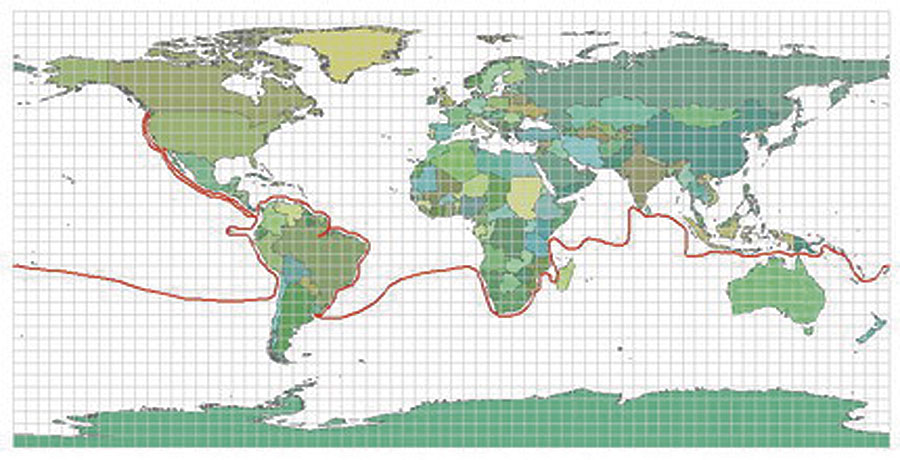
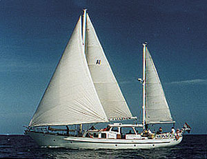
The promise of adventure is one of the main reasons conservation educators love their work. Most teachers know that lasting and meaningful learning often comes from firsthand experience. To Drew Stephens and the crew of Service at Sea, a nonprofit, ship-based GIS education program, adventure-based education is the catalyst for generating awareness; excitement; and, ultimately, sustained interest in global conservation issues. Stephens, founder and director of Service at Sea, knows that many conservation groups around the world could be more effective if they only had the right GIS tools and knowledge. So last year, with funding from Chevron and Esri, Stephens set out on a six-week journey to equip conservationist groups throughout Africa with GIS technology and training. Although Stephens knew these organizations could benefit from more comprehensive GIS training, what he found exceeded his expectations. After Stephens arrived, word about his GIS training quickly spread via members of the Society for Conservation GIS Web site. Before long, other local organizations began collaborating with these groups to enroll in the training that Stephens delivered, producing an unexpected networking opportunity for people from different organizations. In all, Stephens ended up helping 20 conservation organizations in five African countries: Botswana, Kenya, Nigeria, South Africa, and Uganda. Moreover, the pilot project laid important groundwork for Stephens' more ambitious Service at Sea venture. The Next StepService at Sea will launch this year and include a crew of GIS experts, scientists, and teachers, as well as a videographer. They will circumnavigate the globe with an environmentally friendly sailboat and offer free training and mapping services to conservation organizations throughout their four-year expedition. To assist teachers in teaching GIS, the journey will be chronicled and shared with K–12 teachers worldwide as downloadable teaching units and live webcasts to augment social studies, geography, conservation, and technology curricula. The teaching units and lessons will be in accordance with National Science Standards.
Although a large number of conservationist groups across the globe already use GIS, many lack the skills to obtain the maximum possible benefit from this technology. According to Stephens, the effective use of spatial technology is essential for conservation workers to deal with environmental issues properly. "Using GIS to its full potential is critical to enabling people, communities, and governments to make solid, informed decisions about resource consumption and other environmental and conservation issues," Stephens says. "One of the primary goals of Service at Sea is to help conservation organizations maximize whatever existing spatial technology they have to meet the goals of their communities by training them hands-on and in the field." Service at Sea will also offer GIS software grants for conservation organizations that are just getting started with GIS technology. Service at Sea has a growing partner base to help fund its journey. Newman's Own Organics has contributed seed funding, allowing Service at Sea to accomplish its strategic planning needs. In addition, Esri will continue to collaborate with Service at Sea to support many of its technical, education, conservation, and volunteer needs. The Service at Sea experience will give students and teachers the opportunity to virtually step into each of the world's ecosystems, analyze GIS-based data with scientists and consultants, and go on virtual field trips via satellite teleconferencing. This will help students visualize conservation issues and find working solutions with the use of GIS. During this time, Service at Sea aims to assist more than 800 organizations and thousands of individuals around the world. More InformationFor more information, contact Drew Stephens (tel.: 303-881-1595, e-mail: drew@serviceatsea.org, Web: serviceatsea.org). |