Spring 2009
Spring 2009 |
|||||||
|
|
|||||||
Tools for Complete Data Quality Control Management
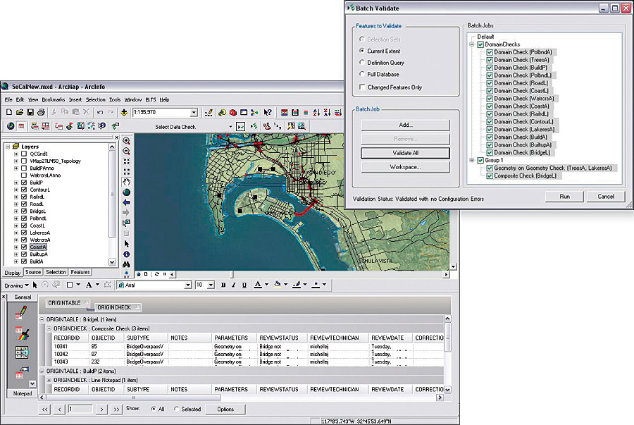
Enhance Data Quality with GIS Data ReViewer |
|||
GIS Data ReViewer, an extension to ArcGIS Desktop, is a complete data quality control (QC) management application that provides tools to assess, document, correct, and verify the overall quality of spatial data. It simplifies many aspects of automated and visual data QC tasks. GIS Data ReViewer supports an organization's QC efforts through 39 different automated checks. Data checks, which can be easily configured to meet specific requirements, can be run individually or as a group in a batch job. GIS Data ReViewer is also equipped with tools that aid in improving the visual review of spatial data to find features that are missing or not digitized accurately. Once erroneous data has been uncovered, it can be collected and managed in a central table that stores the error properties and correction status of the features. This framework also provides a simplified workflow for error correction across the enterprise. Additional tools allow for scheduling regular, automated data validation that can run at set intervals. With GIS Data ReViewer, users can greatly simplify and better manage tasks, such as identifying geometry and attribute corrections, missing features, data anomalies, and extraneous features. People use GIS Data ReViewer to implement a consistent data review process across their organizations, increase confidence in their data, make reliable business decisions, and eliminate the paper trail associated with traditional error tracking. More InformationFor more information, visit www.esri.com/datareviewer or contact Esri (e-mail: plts@esri.com). To request a free evaluation, visit www.esri.com/pltseval. |