Better Street Sweeping Management
By Kusi Odomse Akuoko, GIS Analyst, Maricopa County Public Works, Arizona
Highlights
- ArcGIS and GPS work together to process street sweeping data, as well as analyze and monitor the project.
- GPS units are mounted on each truck, with the resultant data processed in the GIS Division.
- Maricopa County GIS staff generate plots on a daily basis using ArcGIS to illustrate the routes.
Maricopa County is located in the southern-central part of the state of Arizona and has a population of more than four million. With its arid climate featuring dust and gravel soils, the county's Department of Transportation faces multiple challenges when it comes to the maintenance of unincorporated roads. To lower costs and improve business processes, the county decided to install GPS units on sweeper trucks that broadcast data when brooms are lowered for sweeping.

Maricopa County Public Works GIS Division used a simple application to track speed compliance of its sweeper trucks.
Sweeper trucks are large trucks with rotating brushes and a vacuum on the underside. As the sweeper truck drives down the street, the rotating brushes sweep road debris into the vacuum and off the street. Information is transmitted at 30-second intervals, providing the speed and location of the sweeper. The automated process replaces manual inspection and provides verification of work completed against work invoiced, ensures that speed limits are enforced, and provides support in litigation.
The county is responsible for sweeping more than 650 miles of roads. The roads are divided into distinct area units and swept every two or eight weeks depending on the designated cycle. To make sure that the roads are clean after they have been swept, county staff perform random field inspections. The visual inspection takes time, and it is cost prohibitive to perform 100 percent field verification given the large number of roads under contract. Field trips add cost in terms of staff time, wear and tear of vehicles, and fuel consumption. Therefore, the county needed to lower inspection costs while improving compliance with contract specifications. It was determined that ArcGIS and GPS working in concert could process this information, analyze and monitor the project, and publish the results.
Fulfillment of county specifications includes sweeping speeds not to exceed eight miles per hour, invoicing of swept roads per established cycles, and complying with predetermined schedules. With the installation of the GPS units, the county obtains information regarding compliance with schedules and speed limits, as well as a cross-reference of invoices against work performed 100 percent of the time while minimizing field inspections. With up-to-the-minute information, the county can also readily answer citizens' inquiries regarding the date and time when a particular street was swept. This information has been useful to the Department of Risk Management that now has the date and location of the sweepers at all times in case of claims regarding chipped windshields.
The objective of this program is to provide the tools necessary to effectively manage the sweeping contract with 100 percent accountability while reducing inspection costs. To that effect, the sweeping contract was amended to include an automated vehicle location (AVL) system that monitors the location and speed of each sweeper truck assigned to Maricopa County.
The AVL system consists of GPS units mounted on each of the sweeper trucks. Each unit receives information from satellites via radio waves using cellular networks, such as General Packet Radio Service or Code Division Multiple Access. Some roads within the county are outside the cellular coverage area of the GPS unit. This, however, is not a problem because the GPS units are capable of storing several thousand historical points when vehicles are outside the covered area. As soon as the vehicle enters an area that has coverage, the stored points are uploaded and transmitted to the main server.
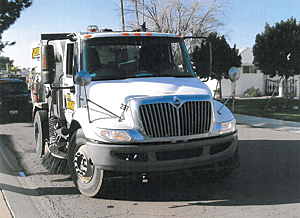
Maricopa County sweeper truck.
During the pilot project, the GPS units were transmitting continuously every 2 minutes. This process generated a large amount of data but did not provide distinct information when the brooms were lowered to sweep the streets. The 2-minute interval was too long, and small areas, such as cul-de-sacs, were completely missed. In addition to missing small areas, other information, such as driving time to and from job locations, stops during breaks, and detours, was being collected, which the county had no interest in. The process was modified to only transmit data when the broom was lowered for sweeping, and the interval was reduced from 2 minutes to 30 seconds. Under this improved scenario, the county was able to track the speed of the vehicles while sweeping. Currently, the contract allows a maximum speed of eight miles per hour while in sweeping mode. This is a reasonable speed to ensure efficient sweeping and maintenance of neat roads.
After the data is collected by the GPS units, the information is then transmitted via DBF and comma-delimited files directly to the Maricopa County Department of Transportation GIS Division for processing in ArcGIS. This data includes the date and time of data collection, truck name, ignition status, current speed, average speed, odometer reading, total distance traveled, and latitude and longitude, as well as the VIN number of the sweeper truck. The data that is processed in ArcGIS is then converted into streaming data into shapefiles.
GIS staff generate plots on a daily basis using ArcGIS to illustrate the routes. This allows field inspectors to determine the following information at a glance:
- Identification of vehicles assigned to the units on each particular day
- Identification of the driver assigned to each sweeper
- Determination of the speed threshold of each sweeper truck
- Virtual inspection of the roads swept in each sweep circle
- Comparison of areas billed with actual areas swept
Programs created using Visual Basic programming import the GPS data and the invoices submitted by the vendor and convert them into Esri shapefiles. These custom programs extract the data from the vendor's Excel invoices. GIS staff developed automated programs for the generation of the maps, the creation of the database, and the management of the process.
Acknowledgments
Generous contributions to this article were made by Marta Dent, GIO, Maricopa County Public Works GIS Division; Larry Wolfson, supervisor; Jim Smith, supervisor; and Eric Feldman, GIS analyst.
For more information, contact Marta Dent, GIO, Maricopa County (e-mail: mld@mail.maricopa.gov), or Kusi Odomse Akuoko, GIS analyst, Maricopa County Public Works (e-mail: Kusiakuoko@mail.maricopa.gov).