GIS and The City 2.0
By Jack Dangermond
Seven billion. That number has received a lot of attention recently as the global population has grown past this mark. But lost in the media coverage of this milestone was another, perhaps even more fascinating, global statistic: more than 50 percent of those 7 billion people now live in cities, a number projected to grow to more than 75 percent during this century. In fact, there will be at least 19 cities in the world with a population greater than 20 million people by the end of the 21st century. Cities are human destiny.
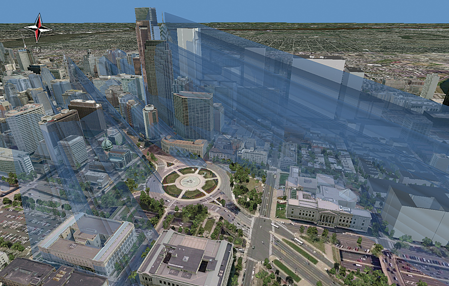
Tall structures can have a huge shadow impact on a city, as modeled here in CityEngine.
This growing recognition of cities as the center of the human world was further highlighted when The City 2.0 was awarded the 2012 TED Prize. "For the first time in the history of the prize, it is being awarded not to an individual but to an idea," the Technology/Entertainment/Design (TED) committee stated. "It is an idea upon which our planet's future depends."
Clearly, cities will play an increasingly important role in our survival. Cities offer easier access to services, and urban dwellers are more efficient consumers of limited resources. But as our cities become more populated and more numerous, how do we best manage this complexity?
We need to start thinking about cities in a different way.
Reimagining the Canvas
Fundamental to changing the way we think about cities is a reimagining of the way we abstract them. Maps are abstractions of geography and have proved to be particularly useful throughout our history. But traditional maps have limited our ability to manage and design in a holistic, comprehensive manner.
GIS technology has given us a powerful new context for extending our traditional methods of abstracting geography—a new canvas that includes everything that lies below, on, above, and around the city, including what exists inside and outside buildings, as well as how things connect to the city and how all these things change through time.
Cities as Ecosystems
Cities are the places where most of us now spend the vast majority of our lives. They have in fact become man-made ecosystems—vast assemblages of interdependent living and nonliving components—the primary habitat for the human species.
The recognition of cities as a habitat for modern man is leading to new approaches to their management and design. GIS technology has long been used to map, study, analyze, and manage natural ecosystems. It only seems logical to manage, model, and design our new man-made ecosystem with the same tried-and-true tools used for traditional ecosystems.
Buildings as Microcities
As our cities are growing in size and complexity, so too are the buildings that compose much of the fabric of the city. In effect, many buildings and facilities are becoming small cities themselves, and they need to be designed and managed as such.
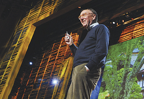
Jack Dangermond at TED2010 in Long Beach, California (Credit: TED/James Duncan Davidson).
GIS tools, used successfully for many years in fields such as environmental analysis and landscape planning, also support a broad range of applications inside and outside buildings and facilities. In fact, GIS can be used throughout the life cycle of a facility—from siting, design, and construction through ongoing use, maintenance, and adaptation, ultimately through closing, repurposing, and reclamation.
An Engaged Citizenry
Smart cities of the future will be those where the citizenry is engaged in city design and evolution, where we fully leverage the collective intelligence of the masses and allow everyone to actively participate in shaping our communities. Today, social media and mobile citizen engagement applications are enhancing a variety of government-citizen interactions involving public information, requests for service, public reporting, citizens as sensors, unsolicited public comment, and even volunteerism.
Geospatial technologies have already proved to be effective tools in supporting citizen engagement. Intelligent web maps are acknowledged as a catalyst for solving key challenges in creating a dialog through informed citizens. As web- and cloud-based GIS continues to evolve and social media and mobile devices become more pervasive, governments will continue to deliver innovative forums through interactive information and participatory citizen applications.
Designing The City 2.0
Geography is constantly changing—from wind and water erosion, natural climate shifts, tectonic and volcanic activity, and the dominance and extinction of species and ecosystems. But recent changes to geography as a direct result of human activities are threatening the survival of many species, including our own. And while the actions causing these monumental changes are often deliberate, much of the change to geography has been an unintentional by-product of poor planning and unsustainable actions—change that I call accidental geography.
In my talk at TED 2010, I introduced the idea of geodesign—a concept that enables architects, urban planners, and others, to harness the power of GIS to design with nature and geography in mind. Geodesign results in more open participation through visualization, better evaluation of proposed scenarios, and a deeper understanding of the implications of one design over another. Combining the strengths of data management and analysis with a strong design and automation component is fundamental to designing The City 2.0.
A New Direction
Cities are intricate collections of materials, infrastructure, machinery, and people, with countless spatial and temporal relationships and dependencies, and require progressively more sophisticated tools to help us design and manage them. They are complex systems where we humans spend an increasing amount of our lives.
"This idea is capable of inspiring millions of people around the world to contribute to one of the biggest challenges and opportunities humanity faces," the TED committee stated when announcing the award of the 2012 TED Prize. "The City 2.0 is not a sterile utopian dream but a real-world upgrade tapping into humanity's collective wisdom."
Our challenge is to design our man-made ecosystems to achieve the maximum benefit to society while minimizing short- and long-term impacts on the natural environment. As an integrative platform for management and analysis of all things spatial, I believe that GIS technology can help meet this challenge.
Cities are our new man-made ecosystems, and it's time we start to think about them, manage them, and design them as such.