Quo Vadimus?
By Brian J. L. Berry, University of Texas, Dallas
Where are we going?
 I doubt that the young "quantitative revolutionaries" who, 50 years ago, were working to trick line printers to reproduce boundary files and produce choropleth maps would have been able to answer that question. Although we were full of hope, as Neils Bohr said, prediction is very difficult, especially if it is about the future. What we used to call computer graphics was held at bay by manual cartography aided and abetted by hardware limitations during the 1960s and 1970s, when the spatial analytic paradigm reshaped human geography, and by the ideological predispositions of Marxist geographers and critical social theorists in the 1980s and early 1990s. It was not until the IT revolution brought new hardware and software, removing earlier constraints, that hopes could begin to be realized and modern GIS could take shape. And take shape it has, creating the extraordinary new interdisciplinary area of geospatial information science, now firmly established as the leading edge of scientific geography and critical to many applied arenas, among them urban and regional planning and environmental analysis and regulation.
But the full potential of the revolution has yet to be realized. The majority of Americans are geographically illiterate, and as a downside of the IT revolution, the widespread availability of GPS devices makes it even less likely that they will engage in even the most rudimentary road map reading. Few schools provide any preuniversity GIS experience, and few universities provide even "driver ed" introductions to GIS software.
Is there a path to a different future? I believe the answer is yes and that it resides in the millennial generation, born in the 1980s and 1990s and now entering young adulthood. The Pew Research Center has undertaken detailed survey work on the millennials in the United States. It concludes that they are history's first always-connected generation, steeped in digital technology, social media, and handheld gadgets. Via texting, Twitter, Facebook, YouTube, Google, and Wikipedia, they are in instant communication with each other and with sources of information, although not always with the means to evaluate the validity of that information. More ethnically and racially diverse than previous generations, less religious and more educated, they are more culturally liberal than their generation X parents and embrace multiple modes of self-expression using the new media, valuing a wide range of lifestyle choices.
Importantly, they are among the one-fourth of US Internet users who play games on social networks (a segment that is growing). The potential of online social gaming has, I believe, yet to be realized by geospatial analysts. Observers of the "serious gaming" industry argue that new generations of games, particularly what they call "life-and-style" games, "games-for-change," and "behavior change" games, have the potential to attract participants to work on real-world problems and craft potential solutions. Tens of millions of players have been attracted to Zynga's Cityville and Farmville games, managing small cities or virtual farms, proceeding from level to level via collaborative development activities. The fun is in the gaming; the opportunity comes in focusing on real problems in real places rather than on virtual worlds. It is the real place component that carries with it the means to counter geographic illiteracy.
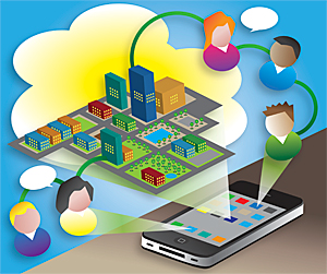
How might this be accomplished? I revert to designer-planner lingo as I envisage new types of "charrettes" that marry GIS via cloud computing with gaming on social networks, providing the opportunity for the broadest array of participants both to compete and to participate in developing collaborative solutions to problems requiring structured solutions in which conflicting goals are resolved via the gaming process. The real excitement for the millennial generation comes from being plugged into gaming and is likely to be enhanced if the problem is real, not virtual, and the solution is of consequence. GIS, if it is equal to the task—and I believe it can be—can provide that reality. I envisage some games that are national in scope, even global, but many more that substitute new online charrettes for the classical limited stakeholder confrontation. In an earlier article, Harvey Miller talked of "meeting grand challenges with GIScience." I believe one path to meet such challenges and enhance both geographic education and planning practice is to take advantage of the passions of the online gaming generation by adding dynamic reality to new forms of social network charrettes.
About the Author
Brian J. L. Berry is the Lloyd Viel Berker Regental Professor in the School of Economic, Political and Policy Sciences at the University of Texas, Dallas (UTD). One of geography's earliest mid-1950s quantitative revolutionaries, he has been an active participant in the development of spatial analysis and GIScience ever since. A member of the National Academy of Sciences and a fellow of the American Institute of Certified Planners, he headed Harvard's Laboratory for Computer Graphics and Spatial Analysis from 1976 to 1981. Recently, he helped craft UTD's pioneering PhD program in geospatial information science.
For more information, contact Brian J. L. Berry (e-mail: brian.berry@utdallas.edu).
Read other articles in this series.