Summer 2003
Summer 2003 |
|||||||
|
|
|||||||
GIS Tools for the Defense and Intelligence Communities
ArcGIS Military Analyst Available |
|||
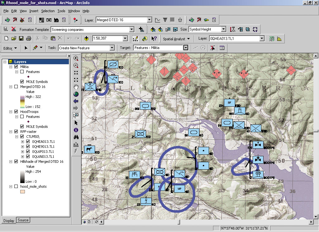
The ArcGIS Military Analyst extension incorporates a suite of tools tailored to meet the special needs of the defense user and significantly enhances the effectiveness of core ArcGIS as a tool set foundation for the military planner and intelligence analyst. "By providing easier access and usability for military raster, vector, and elevation data, ArcGIS Military Analyst allows the defense analyst to focus on data analysis rather than on managing data files," says Clark Swinehart, ArcGIS Military Analyst product manager, Esri. ArcGIS Military Analyst maximizes the use of the standard suite of the National Imagery and Mapping Agency (NIMA) and international data products by allowing direct use and rendering of NIMA's vector and raster products, line-of-sight assessments, Military Grid Reference System conversion, and Digital Terrain Elevation Data (DTED) analysis. ArcGIS Military Analyst also includes the Military Overlay Editor (MOLE), which supports MIL-STD 2525B and custom war fighting symbologies. Features of ArcGIS Military AnalystArcGIS Military Analyst offers full customization using Component Object Model (COM) interfaces, on-the-fly projection of raster and vector data, and a suite of tools that include
ArcGIS Military Analyst can be used with any of the data sources supported by ArcGIS Desktop products (ArcInfo, ArcEditor, and ArcView). ArcGIS Military Analyst tools can be accessed through Microsoft Visual Basic for Applications (VBA), which is included with ArcGIS Desktop. Customized with any COM-compliant language, ArcGIS Military Analyst lets you build new applications that deliver highly sophisticated military solutions, especially when combined with the ArcGIS Spatial Analyst and ArcGIS 3D Analyst extensions. ArcGIS users in the defense and intelligence industries who are current on their maintenance automatically received ArcGIS Military Analyst in April 2003. Other interested users with a current ArcGIS maintenance agreement should contact their customer service representative to request this extension. ArcGIS Military Analyst is available for Windows NT 4.0, Windows 2000, and Windows XP (Home Edition and Professional) operating systems. ArcGIS Military Analyst requires ArcInfo, ArcEditor, or ArcView. Users interested in the full capabilities provided by ArcGIS Military Analyst tools also need ArcGIS Spatial Analyst and ArcGIS 3D Analyst. For more information, visit www.esri.com/militaryanalyst, contact your Esri regional office, or call Esri at 1-800-447-9778. Outside the United States, please contact your local Esri distributor. |