Summer 2003
Summer 2003 |
|||||||
|
|
|||||||
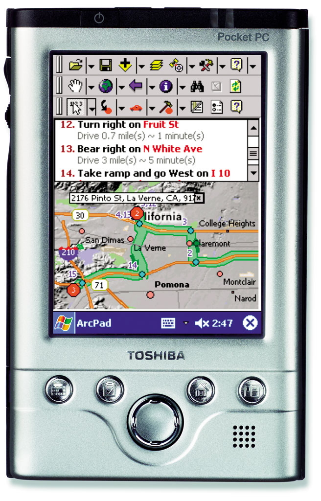
ArcPad StreetMap Now Available |
|||
The ArcPad StreetMap extension provides high-quality street mapping, geocoding, and routing capabilities to GIS users in the field. ArcPad 6.0.1 users will immediately benefit from a street-level database integrated with their existing field data. With ArcPad StreetMap, You Can
About ArcPad StreetMap DataAt the initial release, ArcPad StreetMap includes high-quality data for the entire United States from Geographic Data Technology, Inc. (GDT) (Dynamap/Transportation). Data from Tele Atlas/TomTom (MultiNet) will also be available in the near future. Both GDT and Tele Atlas/TomTom provide detailed data that is optimized for routing. The data is compressed and includes predefined symbology and scale-dependent layers, making it easy for users to get started. Data sets for other geographics are also planned. RequirementsArcPad StreetMap requires ArcPad 6.0.1 and is only supported on Pocket PC and Pocket PC 2002 handheld devices. ArcPad StreetMap is not available for use on Windows Desktop computers. For more information about ArcPad StreetMap and ArcPad, visit www.esri.com/arcpad. To purchase ArcPad StreetMap in the United States, visit www.esri.com/shop, call Esri at 1-800-447-9778, call your Esri regional office, or contact your local reseller. Outside the United States, please contact your local Esri distributor. |