Summer 2003
Summer 2003 |
|||||||
|
|
|||||||
Detecting Areas With Different Land Use Potential
In Egypt, Sudan, and Namibia, GIS Helps Compare Human Strategies of Coping With Arid Habitats |
|||||
|
By Olaf Bubenzer and Andreas Bolten, University of Cologne, Germany
The historical development of the arid zones of the northeastern and southwestern African continent and its people during the last 12,000 years, in light of the complex interrelationship between man and changing climatic and environmental conditions, is the central topic of the Arid Climate, Adaptation and Cultural Innovation in Africa (ACACIA) multidisciplinary collaborative research center (www.uni-koeln.de/sfb389). This includes the study of processes such as aridization and desertification. ACACIA focuses its research activities on the countries of Egypt, Sudan, and Namibia, aiming at a transcontinental comparison of human strategies of coping with arid habitats. ACACIA was established by the German Research Foundation (DFG) at the University of Cologne in 1995 and combines the efforts of more than 70 scholars of various natural, cultural, and social sciences: African studies, botany, Egyptology, geography, history, linguistics, prehistory, and social and cultural anthropology. The subproject, GIS-based Atlas of Holocene Land Use Potential for Selected Research Areas, in which all data was processed in ArcGIS, began in 2002 and has the following objectives:
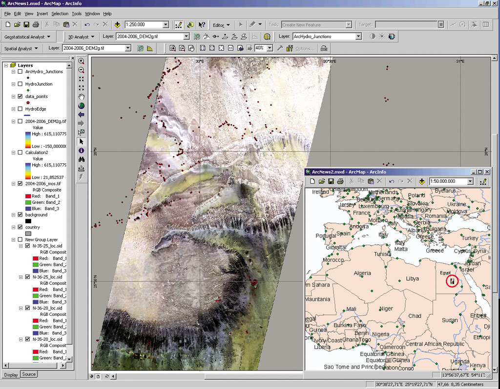
In the time frame between 9,000 and 5,000 years B.C., the Neolithic people in the western desert of Egypt benefited from a humid climatic phase. They were able to survive by hunting, gathering and, later on, by pastoralism. Whereas the present-day climate in this region is hyperarid (in the area of the Dakhla Oasis no measurable rain has been registered over the last 20 years), the precipitation amounts in the early to mid-Holocene humid phase reached maximum rates of approximately 100 mm per year. Outside of the oasis, with its fossil groundwater and the Nile valley, these amounts did not allow widespread land use of the desert. Archaeological and geomorphological investigations evince that only by living in the vicinity of morphological depressions, ephemeral or seasonal water accumulations enabled people to survive. It is obvious that detailed relief data, elevation models, and hydrological parameters are fundamental to finding favorable areas and to reconstruct their land use potential. Due to a lack of topographic maps in these areas, remote sensing data has been used. Advanced Spaceborne Thermal Emission and Reflection Radiometer (ASTER) data from the National Aeronautics and Space Administration (NASA) satellite TERRA, which was launched in December 1999, fulfills the quality and specification required. This data has a ground resolution of 15 meters and allows the production of digital terrain models (DTMs). Because the data is obtained via FTP, a powerful and fast Internet connection is a basic requirement. The rate of transmission from the Earth Observing System Data Gateway via the high-speed university network is up to 4 Mbit/s. As of January 2003, 1,400 scenes, each 120 MB (168 GB total), are available.
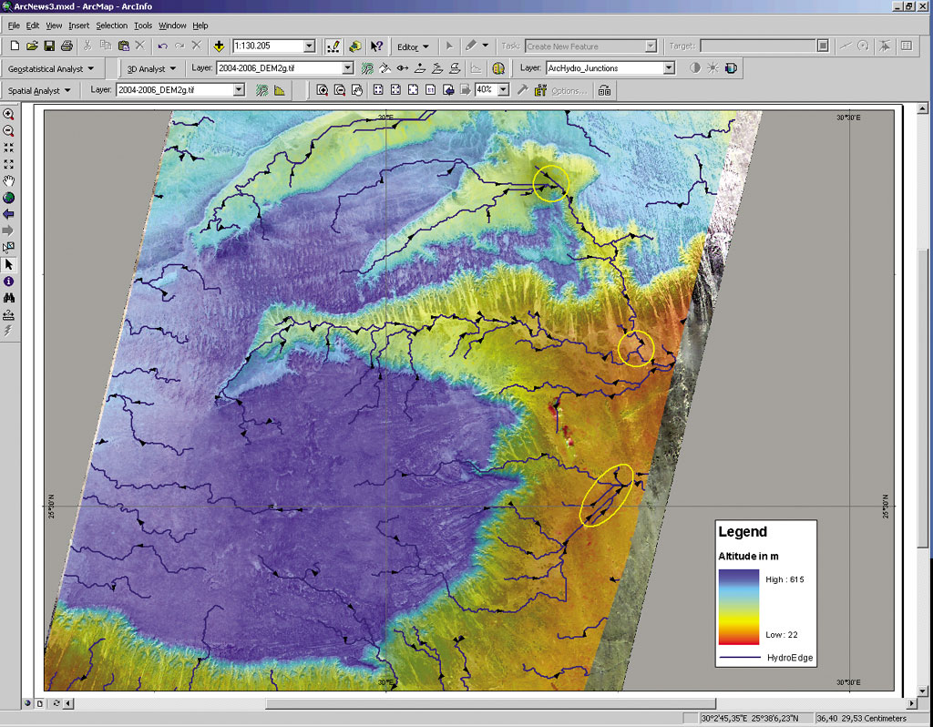
As an example, a view from the western desert of Egypt demonstrates the extraction and processing of geomorphological and hydrological parameters. The Egyptian Limestone Plateau reaches between the oasis belt in the west and the Nile Valley in the east and rises approximately 400-500 meters above sea level. In the northeast a few dunes of the Abu Muhariq dune belt appear, which crosses the plateau and has a total length of approximately 500 km including its extension into the Kharga-Toshka depression. By using the remote sensing software Geomatica (PCI Geomatics), it is possible to process the raw data, create orthoreferenced scenes, and extract DTM with a ground resolution of 30 meters. The pure computing time for one scene (~60 to 60 km) is about 30 minutes on a high-speed PC. The terrain model files and the discolored images can be directly imported into ArcGIS. In several ACACIA subprojects the satellite images replace absent topographic maps, facilitate fieldwork, and allow ground control of the GPS data. The next step is the data analysis in ArcGIS. By communication with other subprojects, different vector and raster data sets are merged to obtain new, comprehensive information. One example is the correlation of geomorphological values such as aspect or slope with other geo- and archaeoparameters. In another example, with the aid of the ArcGIS data model Arc Hydro, a model of a hypothetical drainage system has been deduced from the digital terrain model. If a runoff is adopted, the marked plains are areas where high amounts of water would accumulate. The detection of area units with different land use potential is possible in combination with the relief data mentioned and landscape parameters such as climatic condition, vegetation cover, and surface substrate. For more information, contact Olaf Bubenzer or Andreas Bolten, Department of Geography, University of Cologne, Albertus-Magnus-Platz, D-50923 Cologne, Germany (tel.: 49-0-221-470-7019, fax: 49-0-221-470-5124, e-mail: olaf.bubenzer@uni-koeln.de or andreas.bolten@uni-koeln.de, Web: www.geographie.uni-koeln.de). For information about the NASA satellite TERRA, visit terra.nasa.gov. |