Summer 2005
Summer 2005 |
|||||||
|
|
|||||||
Each Spring, Migratory Wading Birds and GIS Converge on the Northwest Coast of Australia |
|||||||
|
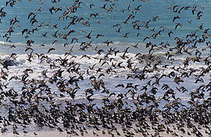
Each spring, hundreds of thousands of migratory wading birds arrive from Siberia at their critical nonbreeding habitat on the tropical northwest Australian coast. A team of scientists led by the Australian Department of Conservation and Land Management (CALM) is examining the ecology of these birds on two very large mudflats in this region, Eighty-Mile Beach and Roebuck Bay. In 1990, these locations were both nominated as Ramsar sites under the Convention on Wetlands signed in Ramsar, Iran, in 1971 (www.deh.gov.au/water/wetlands/publications/index.html). The convention's mission is "the conservation and wise use of wetlands by national action and international cooperation as a means to achieving sustainable development throughout the world." The town of Broome (population 14,000), located on the northwest corner of Roebuck Bay, is an important tourist location with more than one million visitors per year. Eighty-Mile Beach is a four-hour drive southeast of Broome. With little infrastructure, it is more isolated and is surrounded by large cattle stations. These areas have unique concerns from a conservation viewpoint. The obvious impact at Roebuck Bay is human activity, including increased tourism and beach use, a port, and Broome's airport. At Eighty-Mile Beach, the birds tend to roost inland, an area that coincides with the location of the cattle stations and potentially expanding agriculture. Bob Hickey, associate professor in the Department of Geography and Land Studies at Central Washington University (Ellensburg, Washington), explains, "We are examining the ecology of the birds for input into local and regional planning by CALM. Because these mudflats are relatively isolated, we still have an opportunity for pure scientific study in relatively undisturbed areas and the application of our findings to planning for sustainable development in this region. Identifying mudflat land management issues prior to degradation will help ensure species survival."
The use of GIS and remote sensing technology was an integral part of the work from project conception to field mapping to reporting. Hickey and his graduate and undergraduate students used ArcGIS Desktop software (ArcInfo) and Esri Business Partner Leica Geosystems GIS & Mapping's ERDAS IMAGINE software running on PCs. Central Washington University has maintained long-term site licenses of both ArcGIS and ERDAS IMAGINE, and Hickey found the technologies to be compatible and suitable for their study. The project work was conceptualized in the early 1990s. The big field sampling projects were completed in the late 1990s and early 2000s. "Our teams lived on the mudflats during the field studies," says Hickey. "One of the local cattle station owners at Eighty-Mile Beach kindly allowed us to camp on his land, use his water, and find respite from the sun under his shade trees. At Roebuck Bay, we camped at the Broome Bird Observatory. Our field sampling time was spent entirely in the mud. There was mud, mud, and more mud as far as we could see." Using ArcInfo, Hickey created basemaps for the study with Landsat imagery and government agency roads and coastline data. He wrote a small program to generate regularly spaced (x,y) coordinates on a grid of the study area. He used ArcInfo to map and print these points as custom sampling site maps for each field team each day. There were approximately 10 teams with three people per team collecting a sediment sample and a benthic invertebrate sample for each point. "Benthic invertebrates, the preferred food of the migratory birds, are small animals that live in mud, such as crabs, clams, snails, and tube worms," explains Hickey. "The birds migrate to the mudflats to feed and replenish their energy supply for their journey back to Siberia." Using GPS units, more than 80 people helped collect samples at approximately 900 points along a 120 km section of Eighty-Mile Beach. The mudflats varied between 0.5 and 3 kilometers wide. Each night, using ArcInfo, Hickey or a student would quickly produce progress maps and occasional species maps that the biologists found significant. "It was quite thrilling to us all when we learned that we discovered some new species living in the mud," says Hickey.
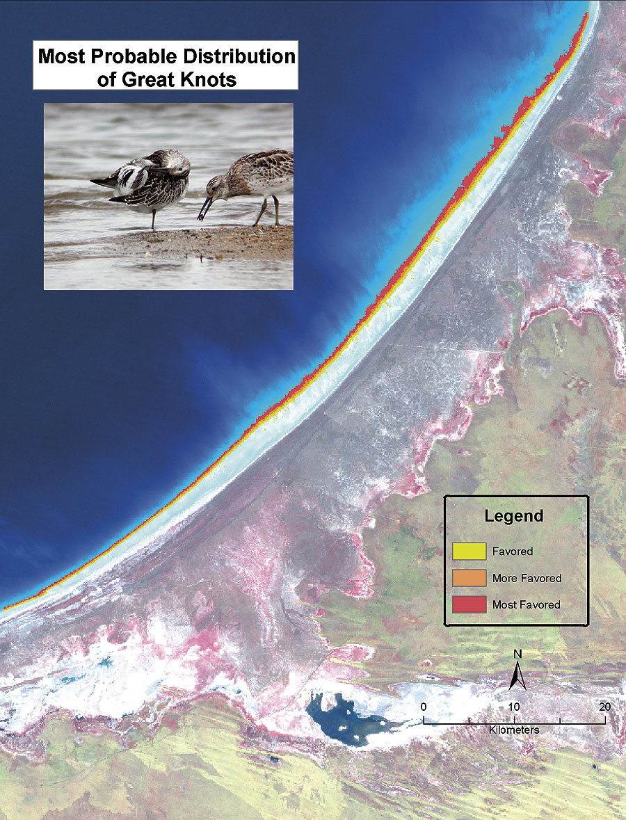
With Hickey's support in 2004, Suzanne Wade, then a graduate student at Central Washington University, analyzed the field sample data from Eighty-Mile Beach. "We were interested in mapping zones along the mudflats where certain benthic invertebrates are likely to live, which in turn would likely predict where the birds feed," explains Hickey. Because the mud is relatively featureless to the naked eye, they needed to perform an unsupervised classification on the Landsat imagery using ERDAS IMAGINE to analyze potential spatial distribution patterns. "Initially we didn't know if there was a relationship between the field data (sediments and benthics) and the imagery reflectance data," explains Hickey. "We performed a number of unsupervised classifications using ERDAS IMAGINE. Similar classes were collapsed so we weren't creating classes that didn't appear to exist. To our surprise, we found a remarkable linear pattern ranging from the sand dunes down to the water based on sedimentology and water retention. We really got good results." The classified imagery was exported from ERDAS IMAGINE as a GRID and merged with the field data in ArcInfo. Using the GRIDSPOT command in ArcInfo, they extracted the spectral category below each sample point. Each point included sample field data and the spectral unsupervised classification class number. Next they ran chi-square and Kramer's V statistical tests using Statistix (www.statistix.com) and demonstrated that there are significant relationships between the spectral classes and both grain size and the benthic invertebrates that are known to be excellent food for certain migratory bird species. Once they knew the spectral classes that contained favorable bird food, they could highlight them as areas used for feeding by particular species of birds. "No one has ever done this before," says Hickey. "Remote-sensing studies on mudflats are few and not on this scale."
Most large mudflats have very intense tides that churn the sediment so nothing can live in the mud. The mudflats at Eighty-Mile Beach and Roebuck Bay have gentle tides that provide an ideal environment for the benthic invertebrates on which the wading migratory birds feed. These are among the most biodiverse mudflats in the world. CALM is responsible for managing the mudflats and will use the study data as input into its planning processes. "This analysis can lead to further study of where migratory birds should or should not be found on Eighty-Mile Beach," continues Hickey, "which is very important for their preservation and land planning considerations. Our team is involved in local planning and has participated in community education and awareness conferences. We have also had some support and involvement from the local aboriginal people. This is a wonderful example of international cooperation, pure scientific study, and the application of science for planning a sustainable future." For more information, contact Bob Hickey, Ph.D., Central Washington University (e-mail: rhickey@cwu.edu, Web: www.yogibob.com). Suzanne Wade's M.S. thesis can be found at www.yogibob.com/80mile/index.html. The gridmaker software can be downloaded from www.yogibob.com/gridmaker/gridmaker.html. For more information on Leica Geosystems geospatial solutions, contact Leica Geosystems GIS & Mapping (toll free in the United States: 1-877-463-7327, outside the United States: 404-248-9000, Web: gis.leica-geosystems.com). |