Summer 2005
Summer 2005 |
|||||||
|
|
|||||||
National Geographic Maps Division Helps Organizations Create Their Cartography |
|||
|
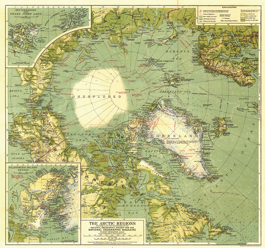
Ninety years ago, in the waning days of the Age of Exploration, the National Geographic Society gathered a staff of cartographers to begin the job of mapping the world. One of the group's early efforts, a map of the North Polar region, featured a large blank area marked "unexplored." (See map below.)
Although the last bits of terra incognita have long since disappeared, National Geographic continues to celebrate the spirit of exploration through expeditions to remote locations, grants for scientific and conservation research, and education initiatives that encourage schoolchildren to discover and explore the world for themselves. Meanwhile, GIS users around the world are doing their own exploring, and in the process, they are fueling an explosion in geographic knowledge. It has been a quiet explosion, though, in part because vast amounts of geographic information serve small, specialized communities. Yet much of that new knowledge is of enormous potential value for public information and education. National Geographic Maps can help organizations "liberate" this valuable spatial data. The society's tradition of superb cartography, editorial and design excellence, and map-driven storytelling is now available to governments, nonprofit organizations, and private-sector companies with their own stories to tell. After 90 years of producing maps for National Geographic magazines and books, National Geographic Maps is now partnering with organizations to create exciting new maps and map-driven Web sites. The basic idea is this: An organization that has GIS data or other spatial information and wants to reach a broad audience with an important message can work with National Geographic to turn that data into a compelling story. Because of its international reach into millions of homes and schools, National Geographic can help partner organizations distribute the resulting products. Example 1: The Appalachian Regional Commission (ARC) wanted to promote tourism to an area that enjoys vast cultural and scenic riches yet lags behind much of the country economically. ARC partnered with National Geographic to produce a Geotourism MapGuide that encourages vacationers to come to the region and explore its riches in ways that are both sustainable and support the local economy. Other Geotourism MapGuides will soon be produced with new partners. Example 2: The World Wildlife Fund (WWF) spent many years developing highly detailed maps delineating the world's terrestrial ecoregions. WWF also created a Global 200 list of the ecoregions that are of the most critical importance to the earth's biodiversity. With support from Ford Motor Company, National Geographic and WWF created a printed map and sent it to every K-12 school in the United States. In partnership with Esri, WWF also created a Web site (www.wwfus.org/wildworld) that brings these ecoregions to life on the Web with interactive maps, text, and photographs. (See our National Geographic Society poster for more examples. [PDF-42.7 MB, 1 page]) This summer, National Geographic and Esri are launching a Web service for media organizations. National Geographic MapMaker allows subscribers to create custom, publishable maps utilizing the vast data resources of Esri's Geography Network. The service will be enhanced in the coming months with additional content and resources from the National Geographic Society. GIS realizes a goal articulated by the society's founders in 1888 when they established National Geographic to "increase and diffuse geographic knowledge." National Geographic Maps is excited to inherit this quest at a time when new technologies and new partnerships make it possible to pursue the society's mission in ways that couldn't be imagined back in the days of terra incognita. If individuals and organizations are interested in National Geographic's cartographic services, they can contact Allen Carroll, chief cartographer (acarroll@ngs.org), or Eric Riback, sales director (eriback@ngs.org). |